

Weather Alert Night: Frigid temps, ice, snow and a biting wind chill
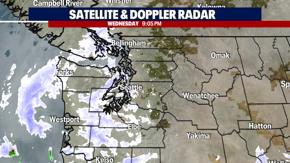
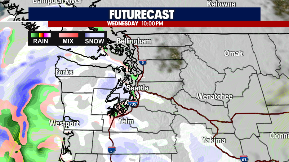
Seattle - It has been a blustery night! Snow continues to fall for those across Western Washington. Light-moderate snow continues to accumulate for some, and others are dry or experiencing light flurries. Either way, expect cold and icy roadways tonight/tomorrow morning. Here is a look at the 9pm radar:
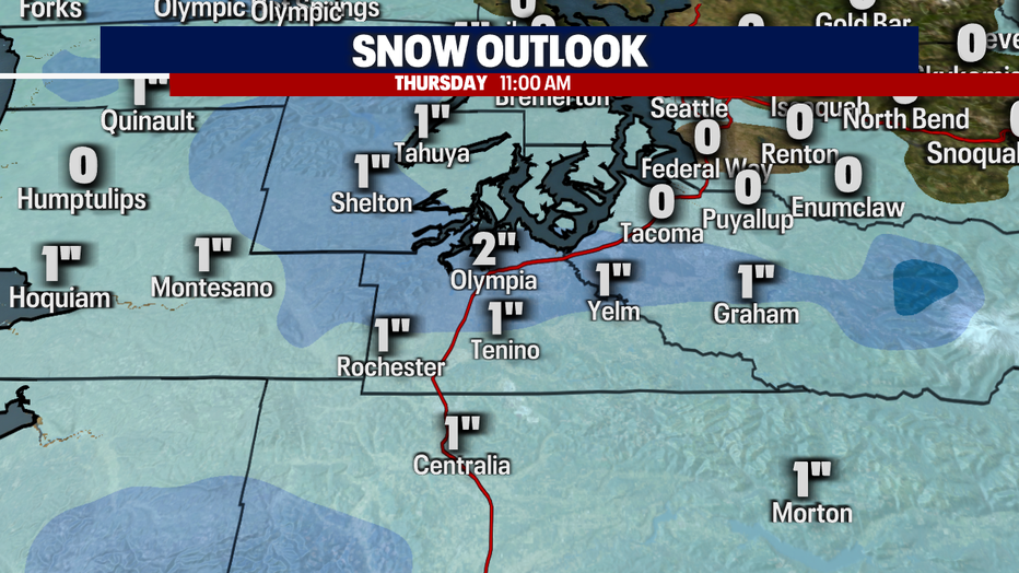
My biggest concern lies with those in the South Sound. This is where we can easily expect between 1-2" of snow by tomorrow morning. Beware of ice on the roadways because temperatures are already at or below freezing in the area.
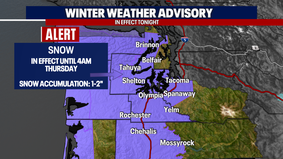
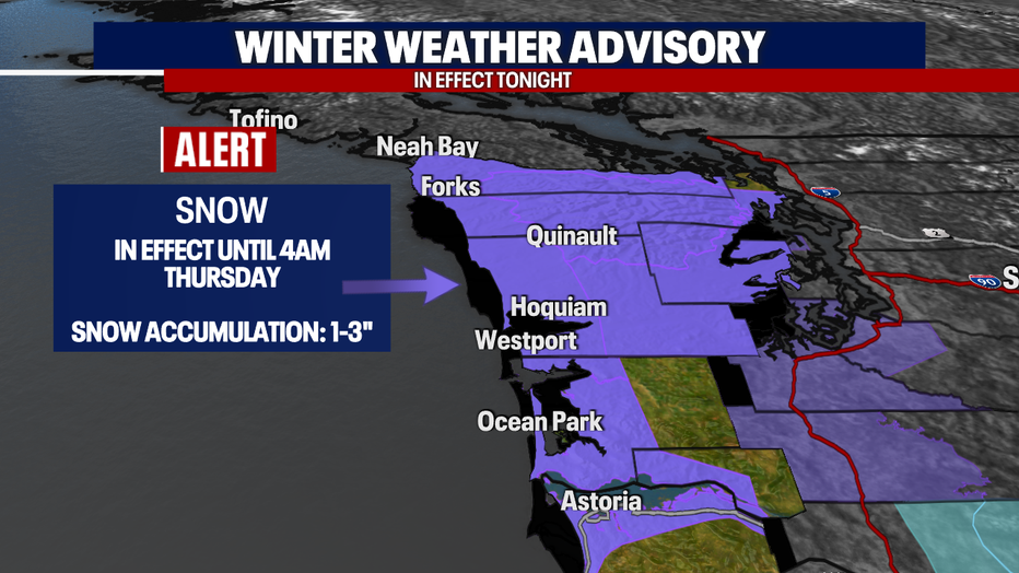
A *Winter Weather Advisory* has been issued for those in the Hood Canal, South Sound, and the Chehalis Valley because of the accumulation expected. Here is a detailed look at the alert:
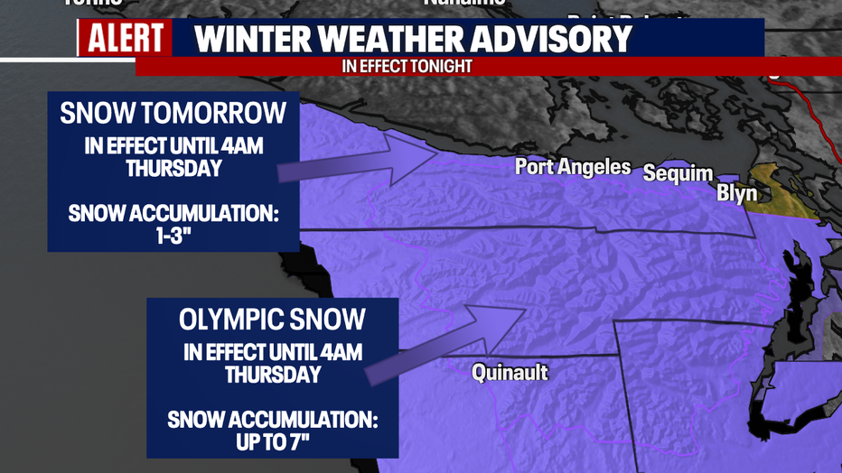
The Olympic Peninsula, Strait, and Coast remain under Winter Weather Advisories until early tomorrow morning. Here is a look at the alerts:
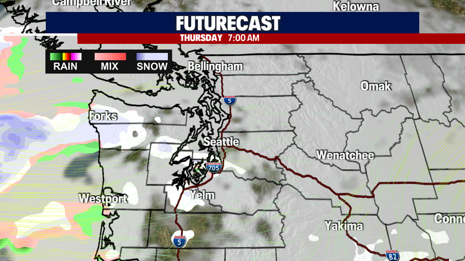
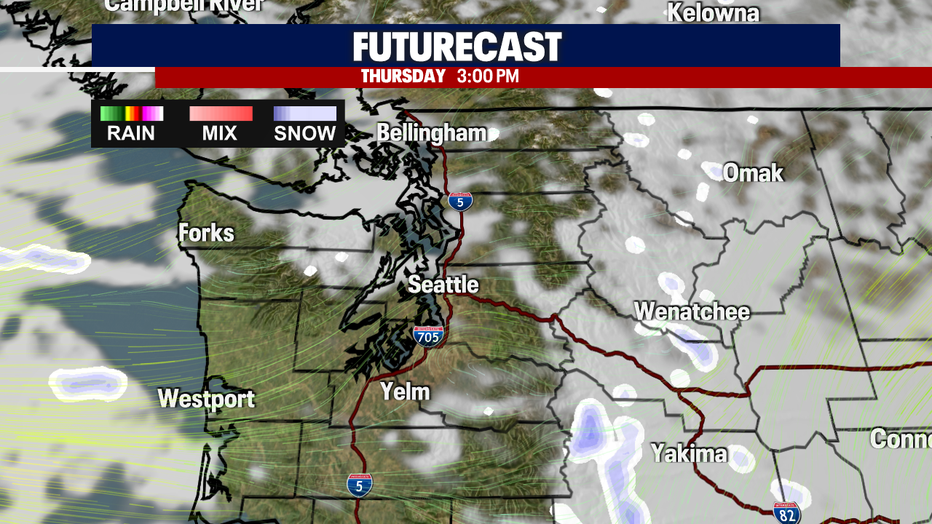
Now, lets time this out. Most of the accumulation will take place early in the night. When we wake up tomorrow, a few light flakes will be possible, but most of the snow will fizzle out, and we'll begin to clear! Expect more sunshine tomorrow afternoon.
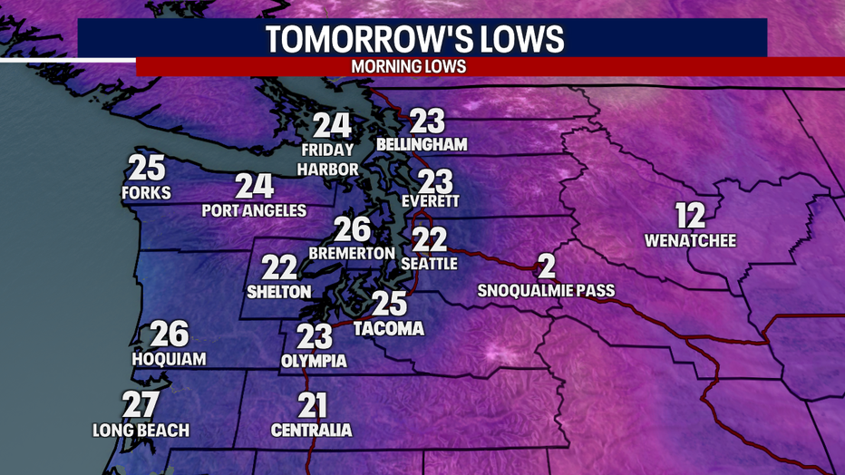
Let's talk temperatures now! Record-breaking temperatures are expected - and not the kind that we look forward to this time of year. The record overnight low is 23 degrees, so we'll be close! Here is a look at your morning lows and wind chills:
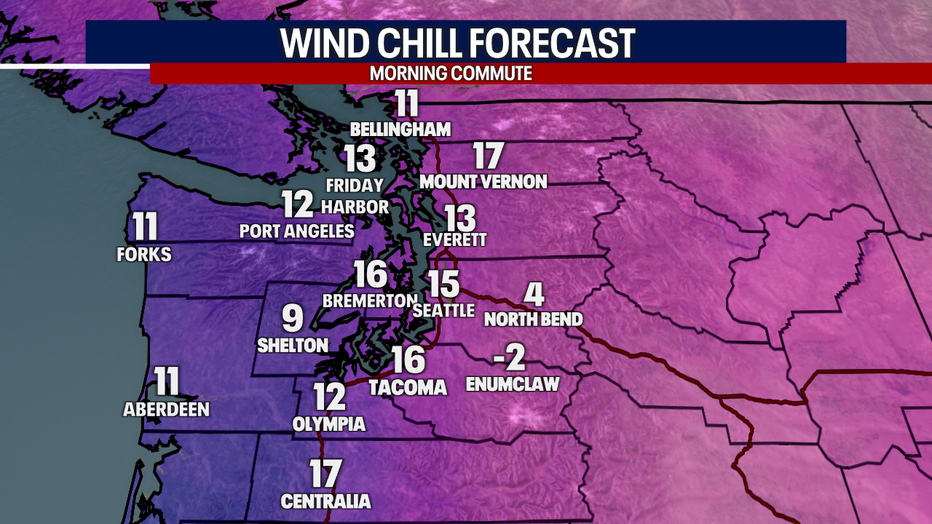
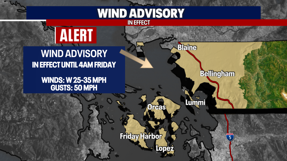
The wind chills are going to be brutal! This is because the winds will remain breezy at times (10-20 mph). In fact, they'll be even stronger across the North Sound. Earlier today I saw reports of gusts up to 58 mph in the area. It makes sense why we have a Wind Advisory in place through Friday morning.
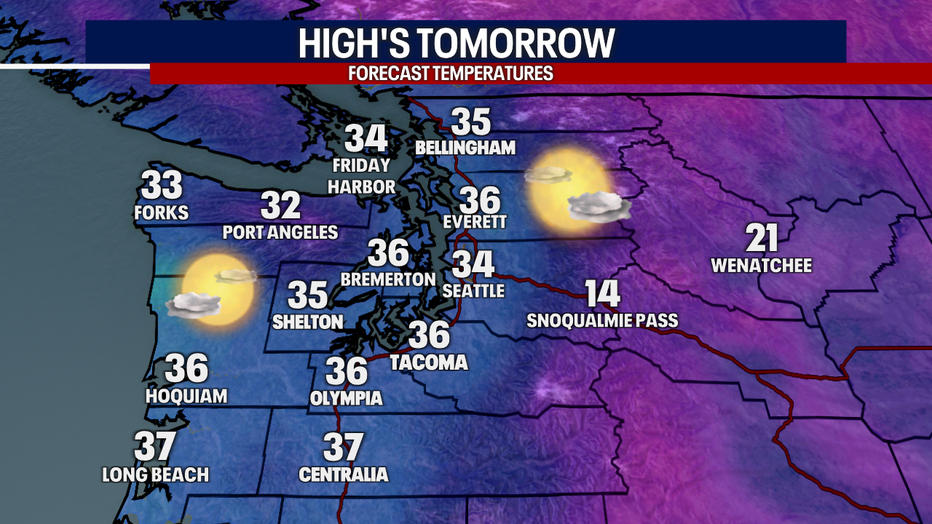
It's hard to look at this next graphic. Afternoon highs will peak in the mid-30s for most of us tomorrow afternoon. This too will be record setting, so we'll see what we top out at!
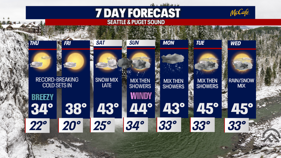
Frigid temperatures will continue through Saturday morning. By the weekend, we'll get SOME relief with afternoon highs returning into the 40s. However, this is when we'll get ready for our next system (Saturday evening - Sunday morning). Here is a look at your 7-day forecast:
Have a good one!