

Weather Alert Day: Soggy Sunday and thunderstorms possible in the Cascades
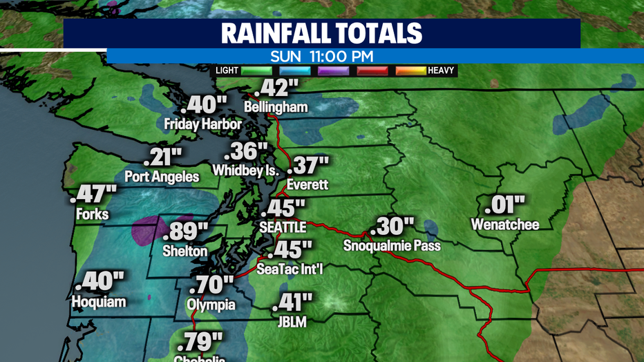
SEATTLE - Seattle's yearly rain total is back to above normal since May 8 thanks to an atmospheric river that will continue to pump moisture in from the South. It will continue to feel muggy as well! The rain has intensify this afternoon/evening across Western WA and could bring thunderstorms to the Cascades and east due to a frontal system
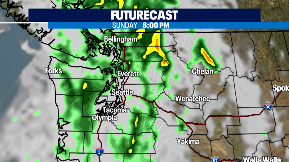
Most locations will pick up 0.25"-0.55" of rain today. The heaviest rain will be in the SW Interior, Cascades and the Olympics.
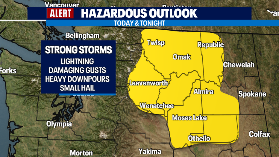
There is a threat for scattered thunderstorms in the Cascades and portions of Eastern Washington. Storms can be strong and produce frequent lightning, damaging wind gusts, heavy downpours and small hail. If you're headed that way, use caution!
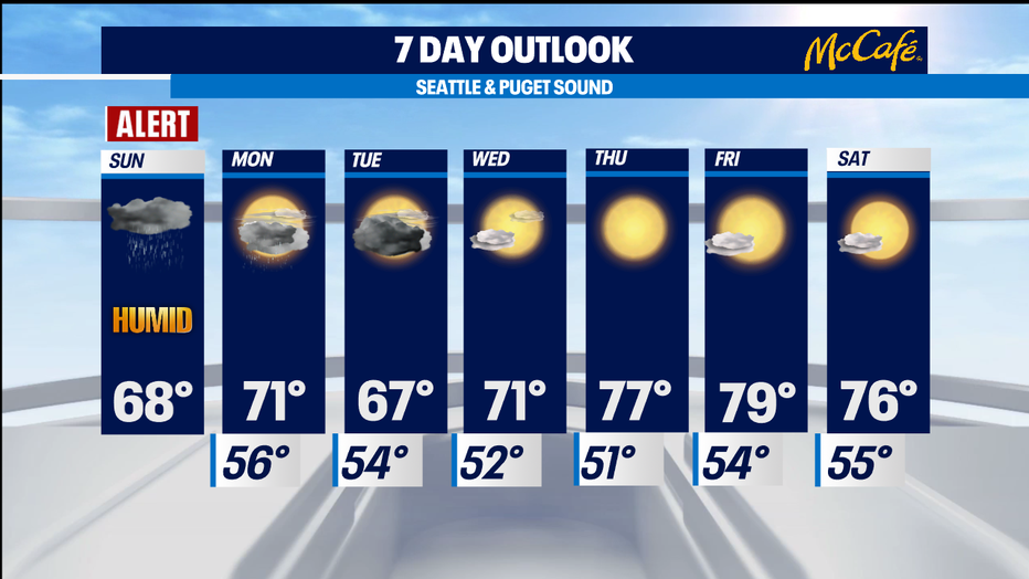
Rain will taper off Sunday night and into early Monday but southerly flow will keep a few lingering showers in the area on Monday. Tuesday right now looks stormy and may be another day to watch as widespread thunderstorms are possible! After that, we've got sunshine and warmer temperatures Wednesday through next weekend.
Have a great day!
-Q13 Meteorologist Grace Lim