

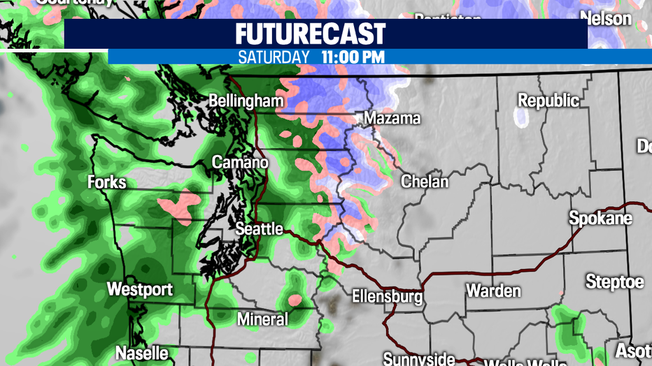
Weak system tonight through Sunday morning
SEATTLE - Morning fog in the South Sound will lift by noon but clouds will hang around ahead of our next rainmaker sitting offshore. This will be a weak system and will bring a shot of light rain tonight through Sunday morning.
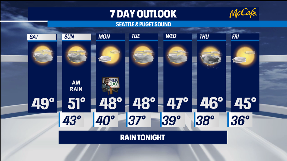
Highs will be near 49. High pressure will build Sunday, clearing the clouds and making way for sunshine and milder temps in the lower 50s! Enjoy it!
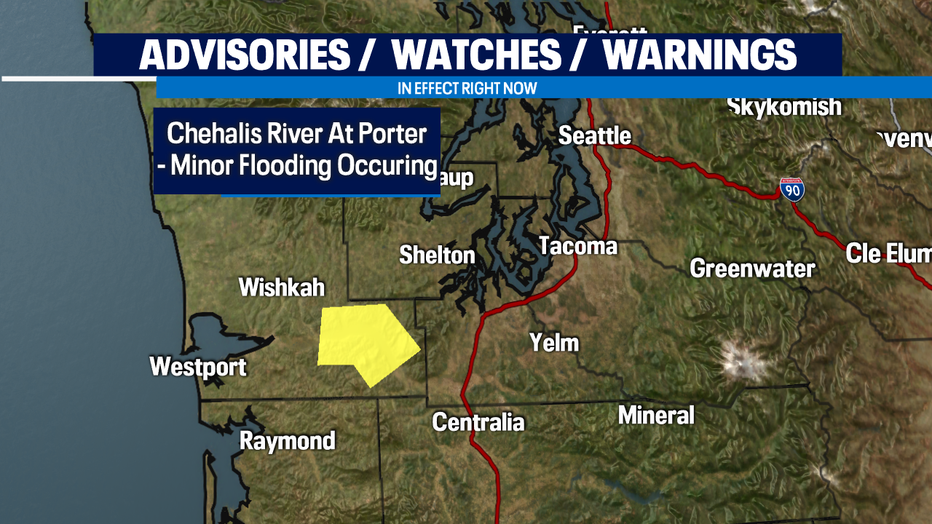
Given the weak nature of tonight's front, the Chehalis River at Porter in Grays Harbor County will recede, falling below flood stage this afternoon and remaining below flood stage tomorrow.
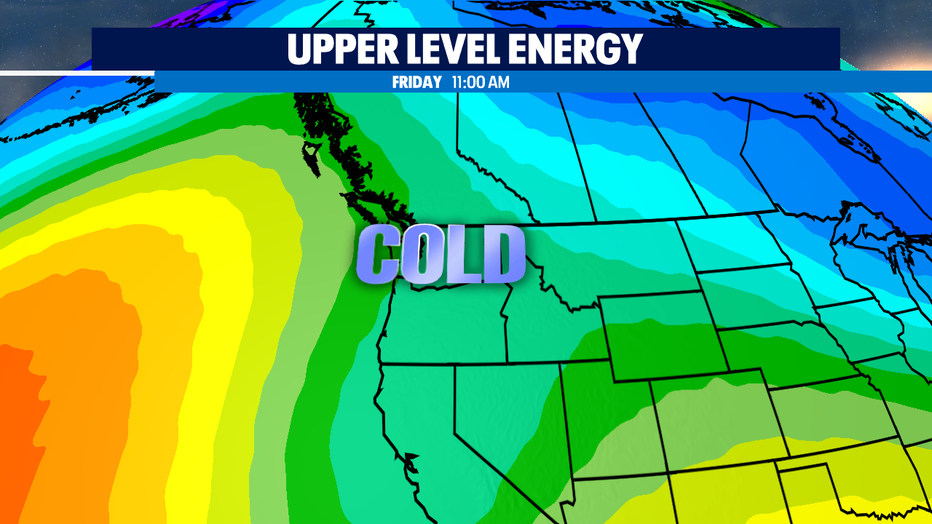
There are rumblings of lowland snow Thursday/Friday. Cold air will drop in, dropping our snow levels to 200ft Friday. Here's the thing- will there be moisture leftover with the trough to transition into snow? It is all dependent on the timing of snow levels, temperatures and precipitation. With that said, for now, there is a lot of uncertainty and chances at this time look very low. If it does happen, amounts will be light if anything.
High pressure and offshore flow will bring on a cooling trend next week. Highs will be in the mid to upper 40s and overnight lows in the mid to upper 30s.
Have a great day!
-Q13 Meteorologist Grace Lim