Seattle weather: Temps warming up with just a few passing showers to end the work week
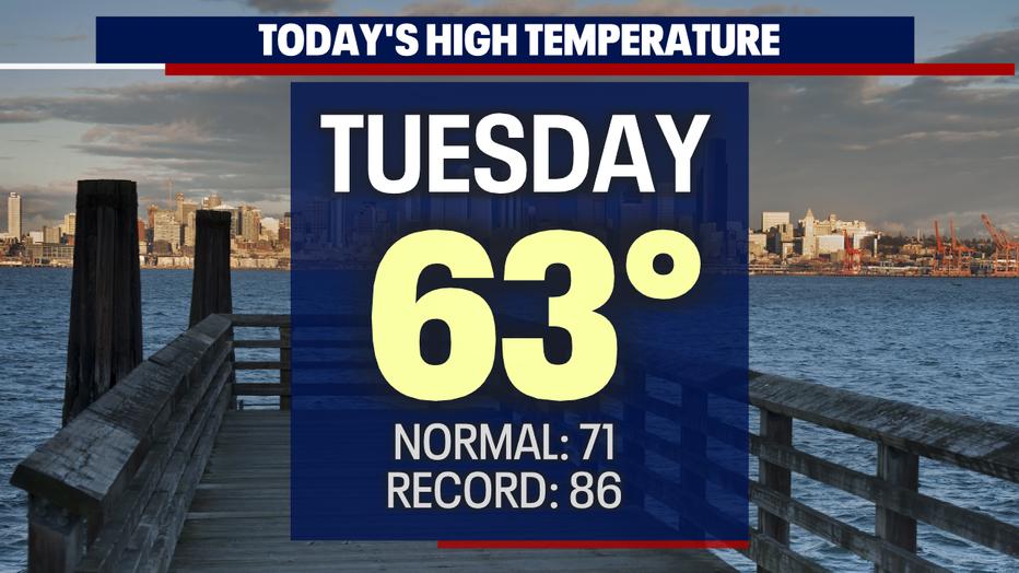
SEATTLE - Our slow warming trend continues as we push through the work week. Highs Tuesday landed in the low 60s for many including Seattle. That's warmer than Monday, but still about eight degrees below average for this time of year.
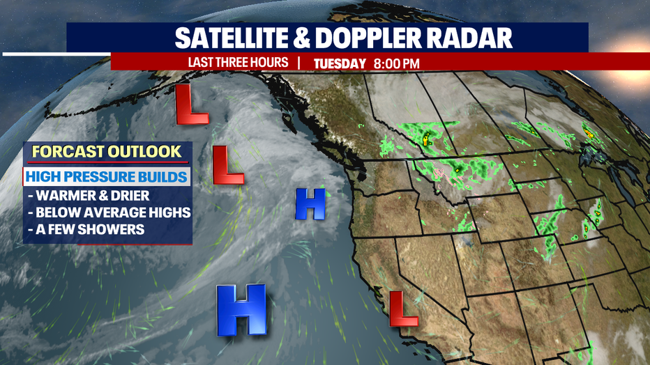
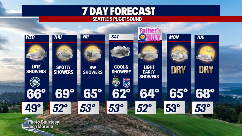
We'll continue the trend of warming up along with seeing less shower activity as high pressure builds. This will help keep stronger systems out of the Northwest, although we can't rule out a few light showers moving through late Wednesday through Thursday.
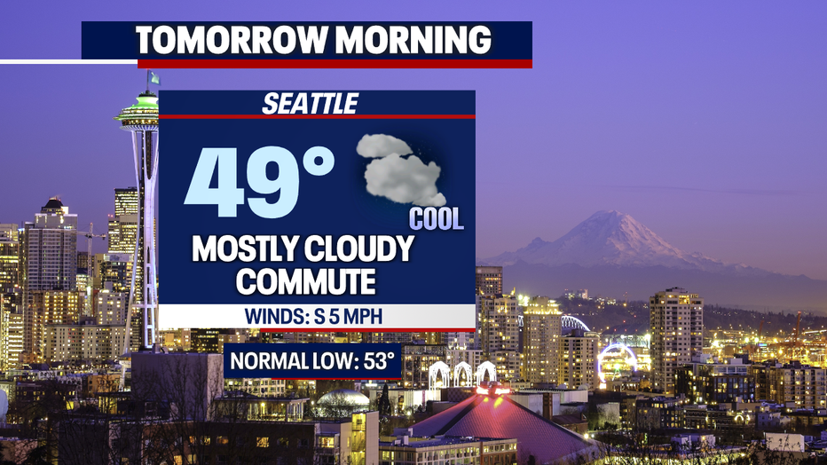
Getting out the door Wednesday will feel cool again as overnight temps fall into the upper 40s to low 50s with mostly cloudy skies.
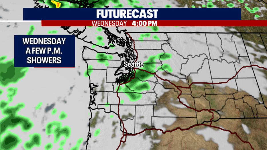
By Wednesday evening a few showers will move up from the south and slide north during the commute with a few pockets of showers sticking around the coast and Strait.
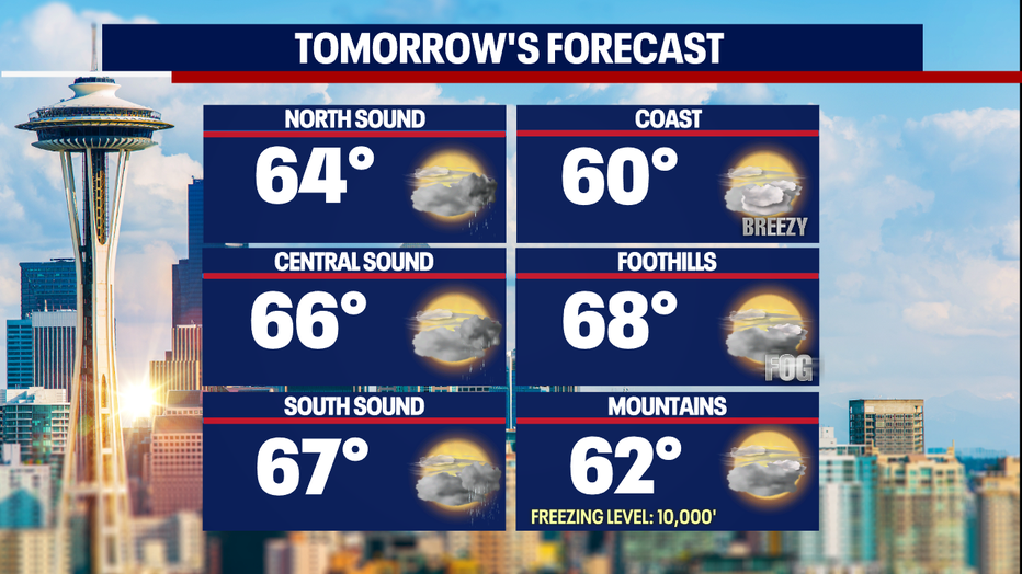
Metro area and South Sound highs climb into the upper 60s with the North Sound slightly cooler in the low to mid 60s. The foothills start the day with areas of patchy fog.
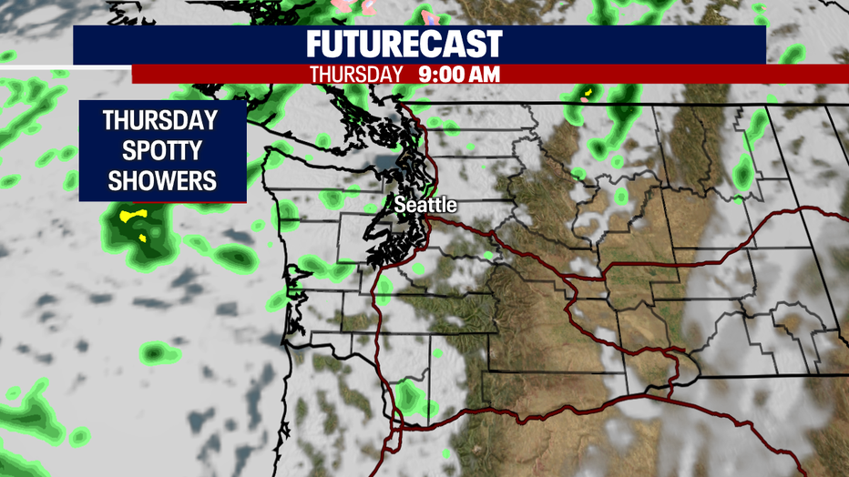
Look for sunbreaks and pockets of showers on tap Thursday with highs falling just shy of 70.
Friday starts out dry, but showers will start falling again just after midnight and continue into Saturday as skies cloud up even more. Highs cool into the low to mid 60s.
Father's Day 2022 features cloudy skies with a few early, light showers, otherwise a dry day for Dad! Enjoy!
And at this point dry conditions are forecast for Monday and Tuesday as well! Highs sit in the mid to upper 60s.
Have a great night all! ~Erin Mayovsky, FOX 13 Forecaster
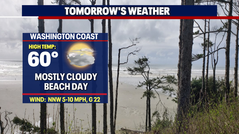
*Beach Forecast
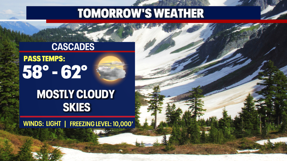
*Mountain Forecast
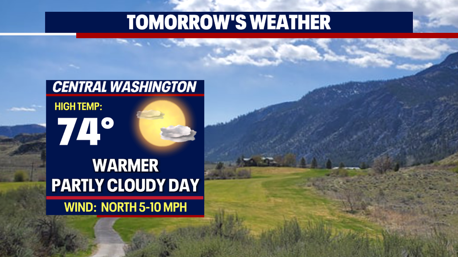
*Central WA Forecast