Seattle weather: Warmer and drier Thursday with showers into the weekend
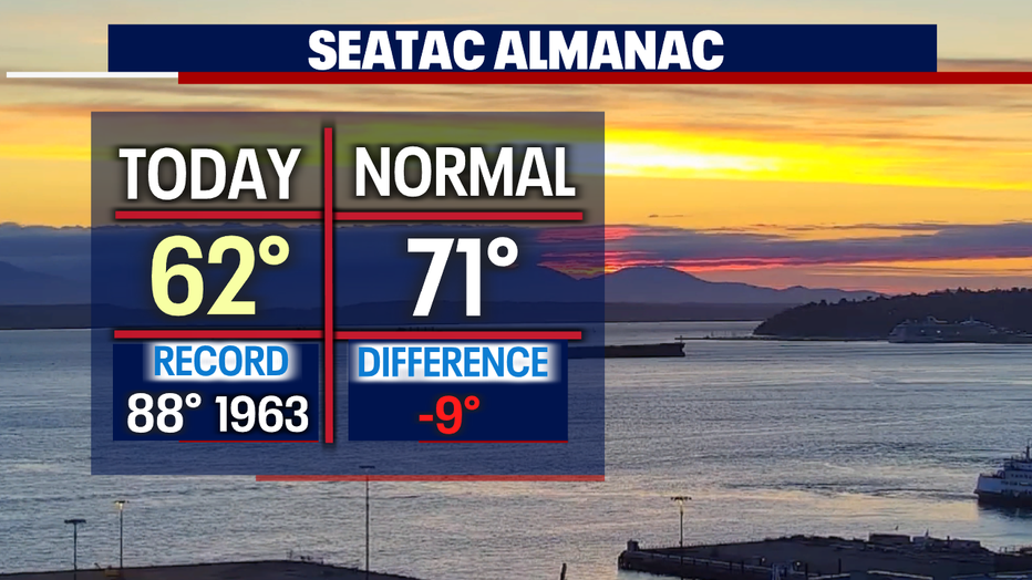
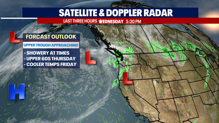
SEATTLE - We saw cooler highs with scattered, pockets of showers across much of our region Wednesday with Seattle landing in the low 60s.
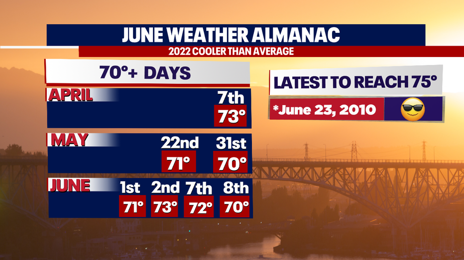
We certainly are under a cool trend spell so far this year. Normally by this point in the season, we'd experience more 70-degree days, but so far this year, we've only seen seven days in the 70s. Usually, the month of May averages seven of those days with double that amount for June.
And another fun weather stat for us here…. The record for the latest day to reach 75 is June 23, 2010. And with our temperatures running, cool we're likely to break that record too.
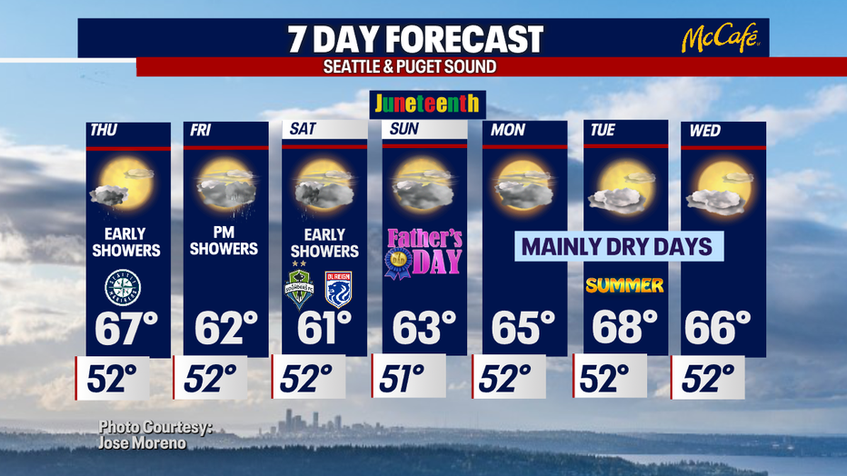
Overnight, look for spotty showers with temps falling off into the low 50s for the metro area.
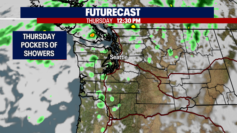
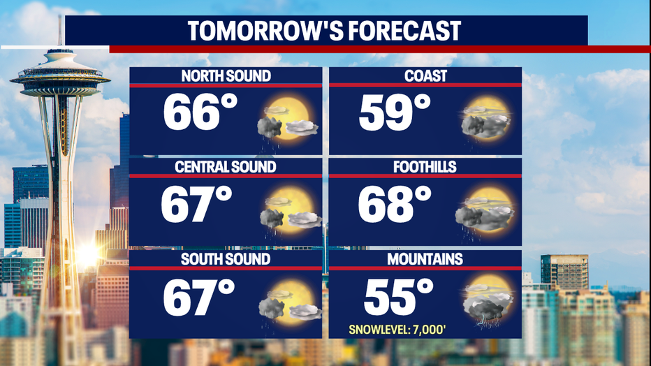
Skies will start to clear by lunchtime Thursday leaving us with a nice afternoon. Highs up and down the I-5 corridor will warm into the mid-60s, still below average, but we'll take it.
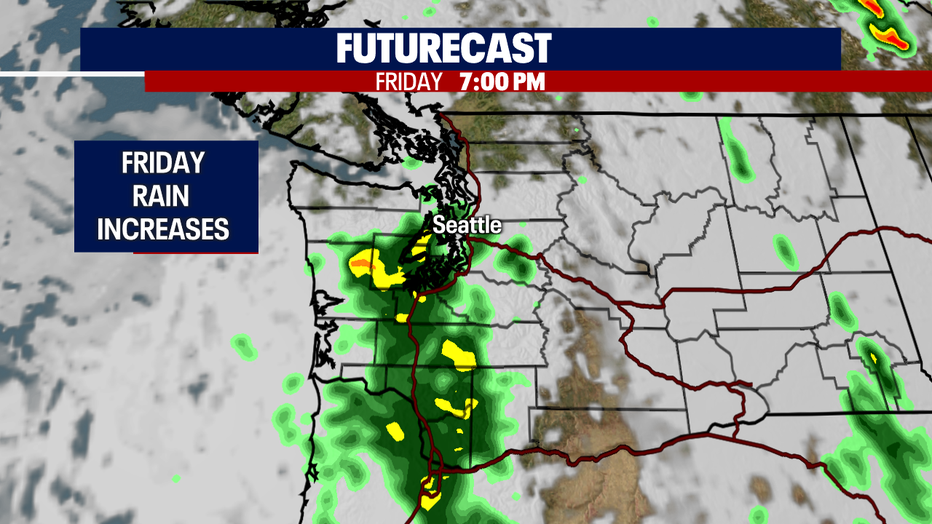
Looking ahead as we push into the weekend, we'll see a mixed situation as an upper trough stays with us sending cool and showery weather our way.
Rain will increase late on Friday and hang with us through early Saturday, otherwise the afternoon features mostly cloudy skies. Highs fall into the low 60s both days.
High pressure will build back in early next week giving us drier conditions with highs finding their way back into the mid to upper 60s. Enjoy!
Have a great night all! ~ Erin Mayovsky, FOX 13 Forecaster