

Tracking our next rainmaker
SEATTLE - Happy Monday!
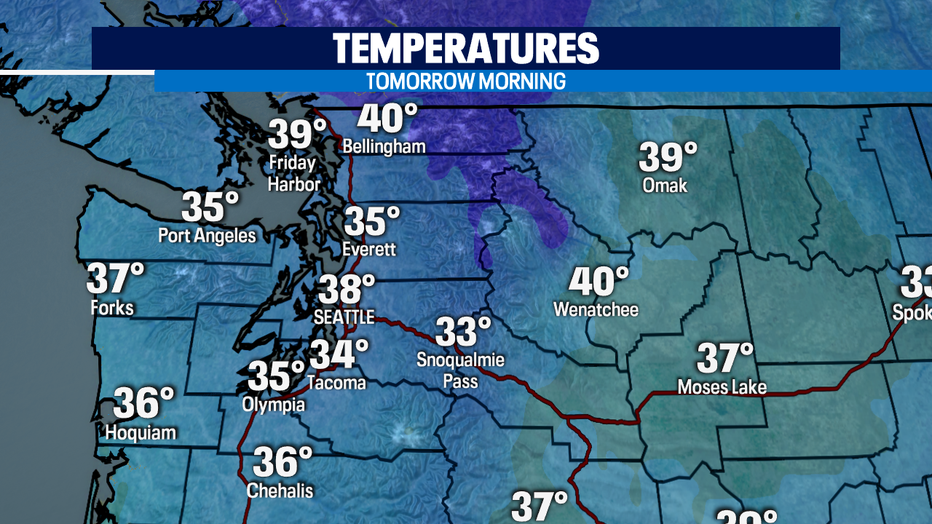
I hope you have been able to enjoy the day. Temperatures will gradually drop this evening and the winds will calm down. We just have to be prepared for those chilly morning temperatures in the mid-upper 30s.
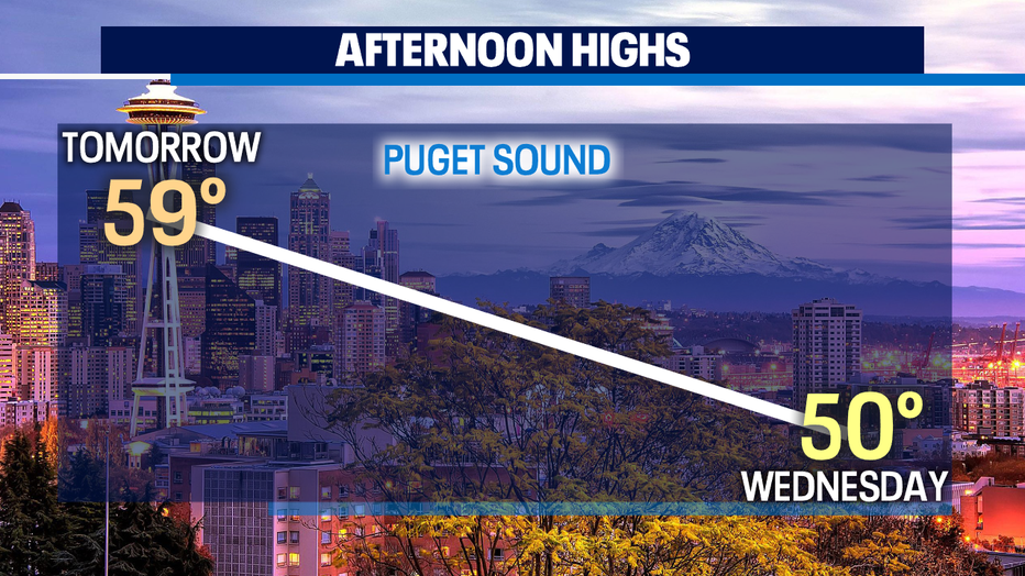
The dry weather pattern will continue tomorrow. You'll notice those clouds working their way in, but we'll continue with a bright and warmer day.
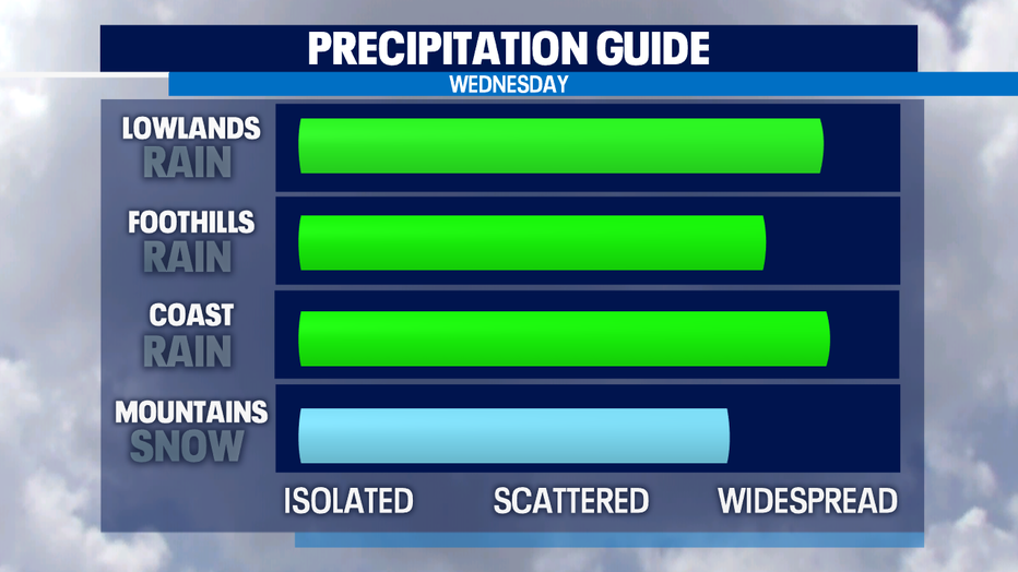
Our next rainmaker will hit on Wednesday. A frontal system with trigger lowland showers and mountain snow. Most of the precipitation will be light but we'll have times of moderate rain hitting the area. Expect .10-.50" of accumulation.
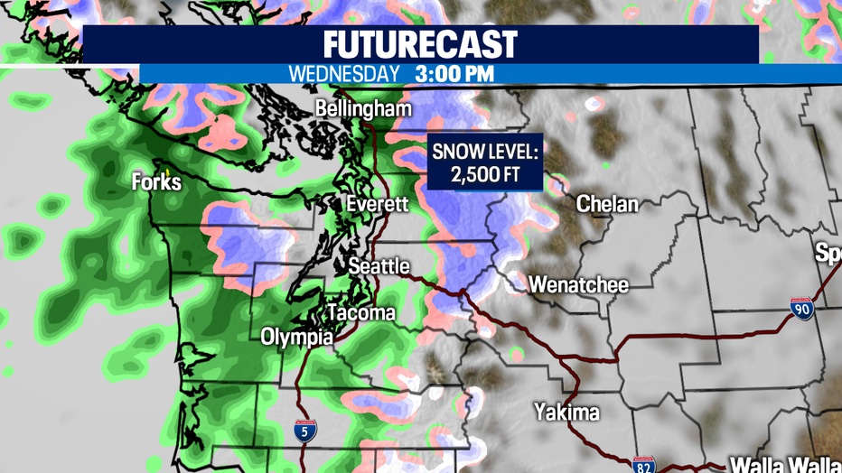
Here is a look at the futercast showing the widespread rain in the afternoon. The snow level will drop to 2,500' so this will impact our passes. Please, check in on the road conditions if you're planning on travel through the Cascades.
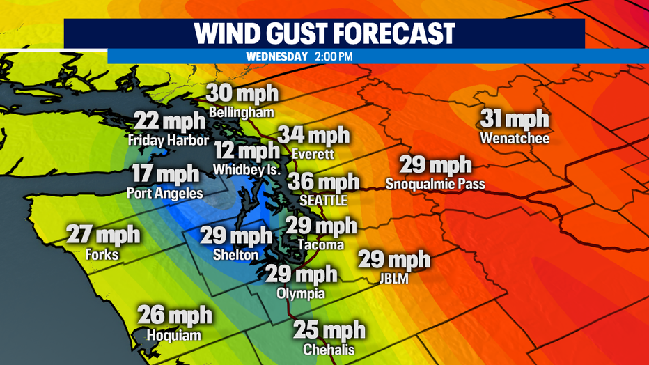
The winds will increase as well. The winds will crank up to 30-35 mph at times. Most of the day will have sustained winds between 10-15 mph.
Have a good one!
Q13 WEATHER RESOURCES:
DOWNLOAD: Q13 Weather and News Apps
WATCH: Forecast and Radar
READ: Closures and Delays
CHECK: Latest Weather Alerts and Live Traffic Map
INTERACT: Submit your Weather Photo
FOLLOW: Lisa Villegas, MJ McDermott, Tim Joyce, Erin Mayovsky and Grace Lim