

Spotty thunderstorms return to the forecast
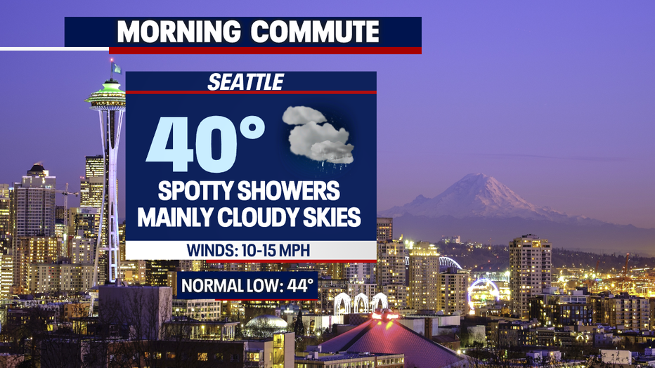
Seattle - Spotty showers will continue overnight! The temperatures will continue to drop into the upper 30s and lower 40s - so it'll be cooler tomorrow morning. The winds have also kicked up this evening. Expect gusts between 20-30 mph out of the South.
The Winter Weather Advisory will remain in effect for the following location:
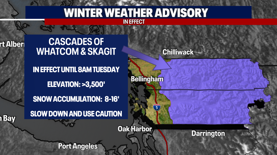
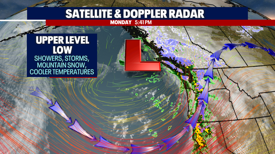
Snow will continue to collect across our passes so continue to check in on those conditions. We can expect a mix of snow, showers and even thunderstorms as we roll over into the day across the Cascades.
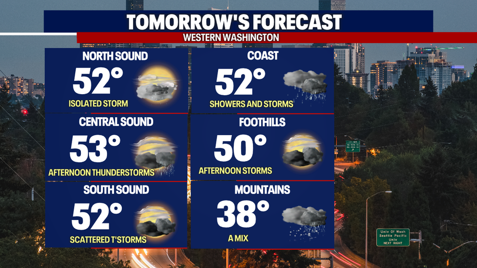
Tomorrow afternoon we'll see more clearing and sunshine. The spotty showers will remain along with some thunderstorms. Here is a look at what we can expect across Western Washington:
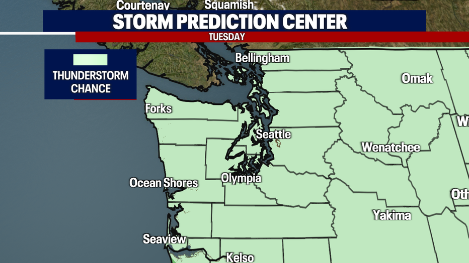
The Storm Prediction Center has issued a thunderstorm chance across the region. Use caution and be aware of the forecast tomorrow.
The reason for the changes in our weather pattern, again, is due to another upper-level low pressure system.
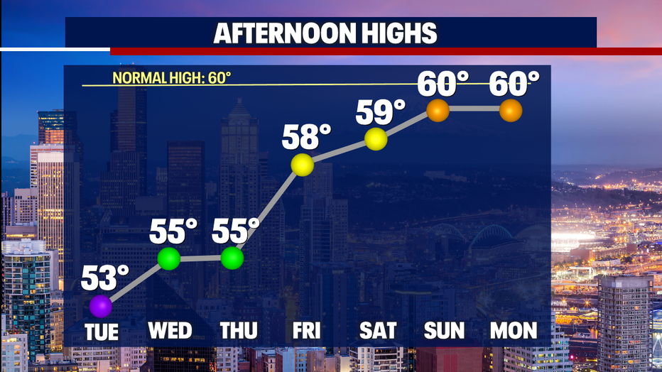
Don't worry! We'll see some improvements in our forecast by the end of the 7-day. A gradual warming trend will take place.
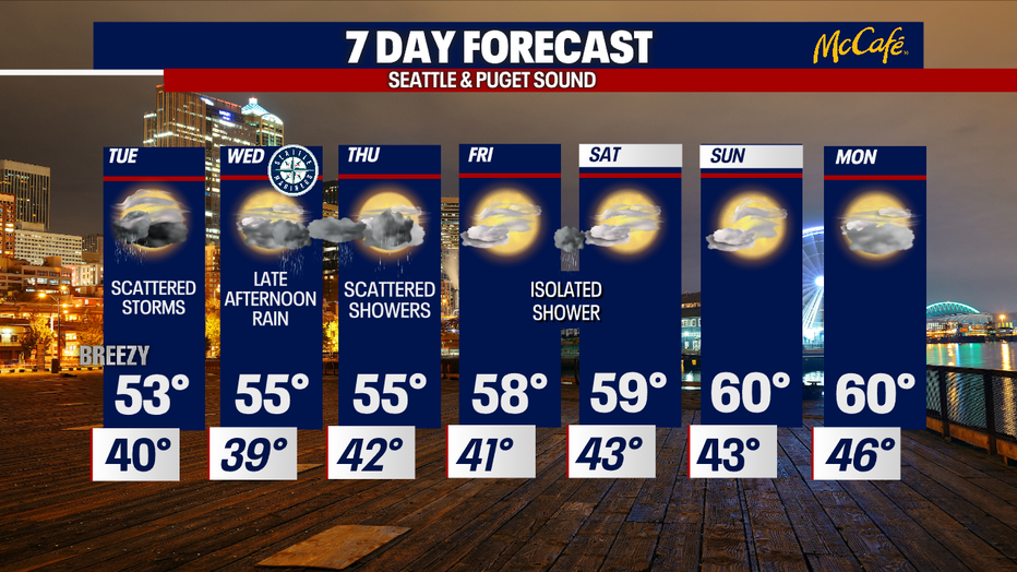
Here is a look at your 7-da7 forecast:
Enjoy and have a good one!