Seattle weather: Rain and snow wrap up, giving way to a dry Saturday
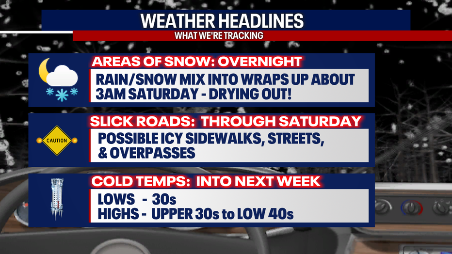
SEATTLE - Rain and snow will wrap up overnight into early Saturday, but cold temperatures hang with us through next week.
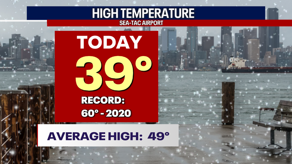
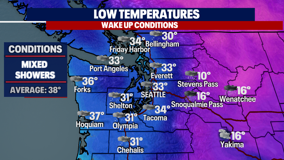
Friday's highs were colder than average again! The airport only warmed to 39, which is 10 degrees below our seasonal average.
Overnight, temps will sit near freezing for many with a few areas even colder into the upper 20s to low 30s.
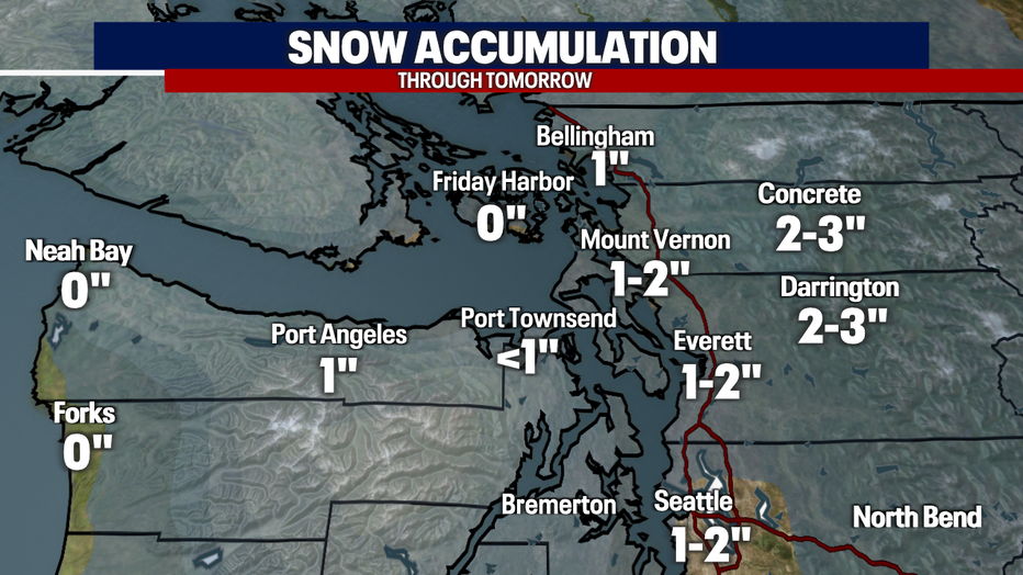
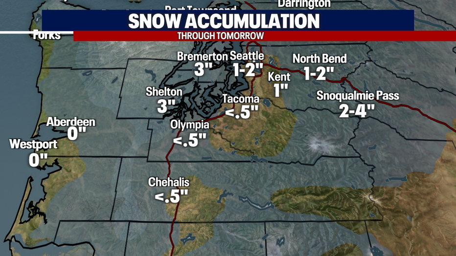
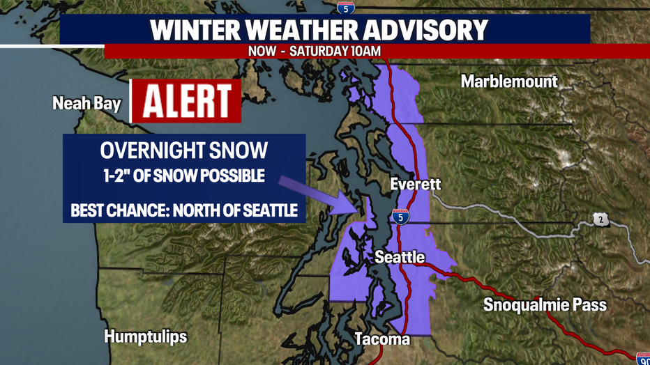
As showers wrap up in the middle of the night many locations will have a dusting of snow—possibly even a couple of inches. This will create slick roads tomorrow morning.
Here's a look at potential snow totals for early Saturday morning. The North Sound and foothills have the best chance to see a couple of inches. Otherwise, just a dusting to an inch around the rest of the region.
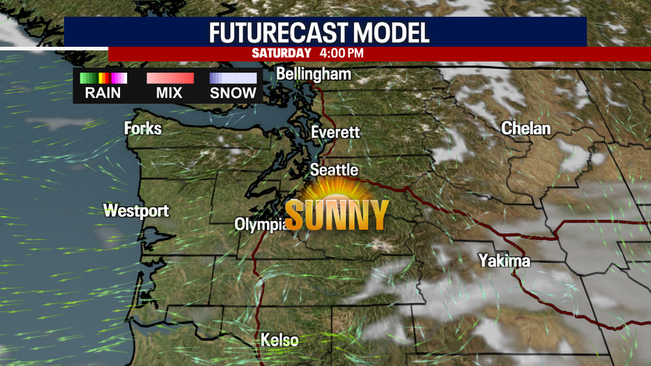
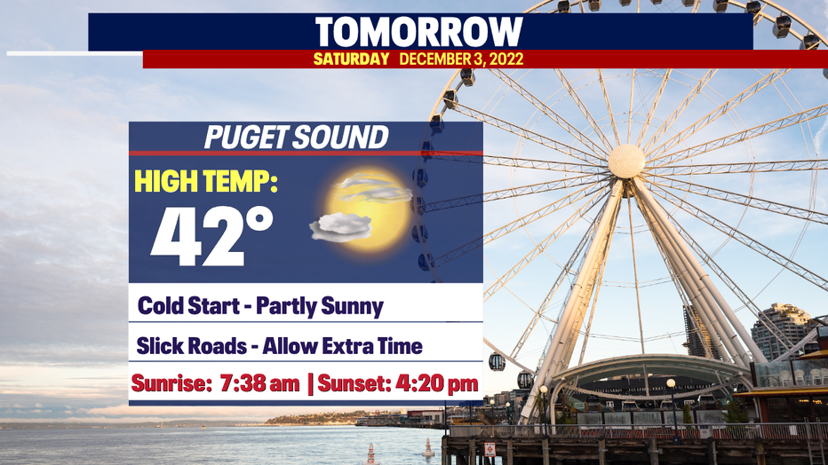
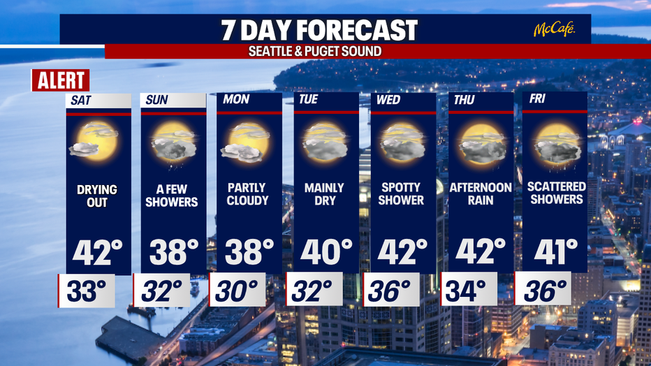
Skies will continue to clear out as we move through Saturday, giving us a partly to mostly sunny day. Highs will only warm into the low 40s.
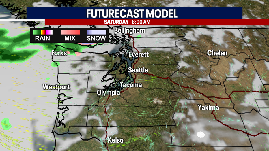
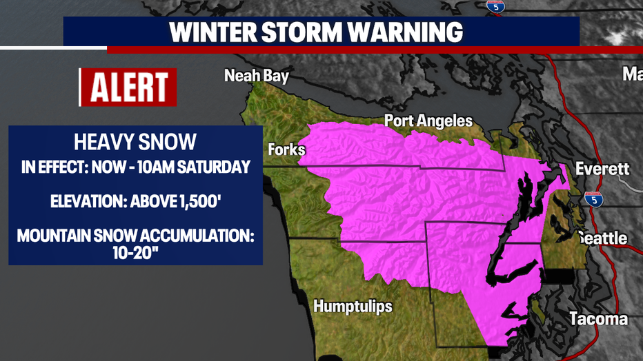
By 10 a.m., the "Winter Weather Advisory" for the lowlands of Puget Sound will expire along with the "Winter Storm Warning" for the Olympics.
Futurecast models have Western WA enjoying fall sunshine through sunset before clouds start to increase some.
Highs will run cool, below the norm of 48 for this time of year. In fact, temperatures will continue to be cool through next week.
Sunday looks mostly dry, but there is a chance of a few showers to spin into the area dropping mostly rain for the Central Sound with the chance for snow near Chehalis south. Highs only land in the upper 30s.
We start the week on a dry note, with spotty showers Wednesday with the best shot for rain to return Thursday afternoon as a cold front rides into Puget Sound.
Have a great weekend all! ~Erin Mayovsky, FOX
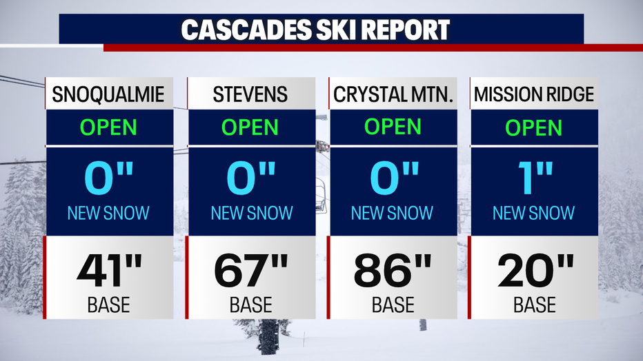
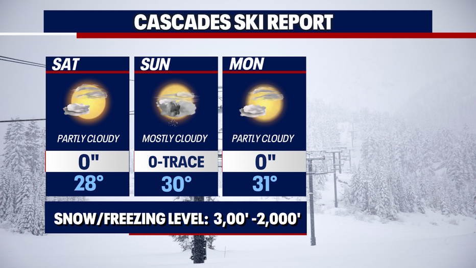
*Mountain Snow Report: