More Fall sunshine on tap for the next couple of days, then rain returns!
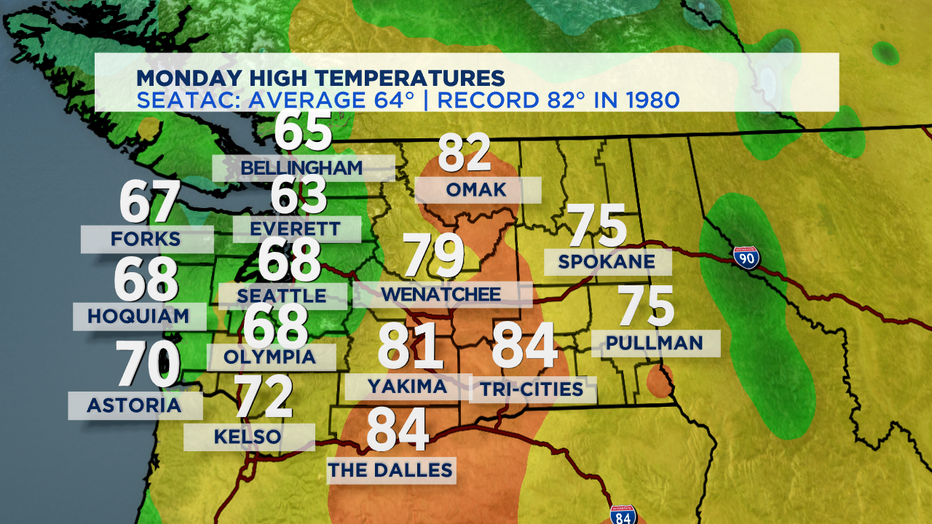
seattle - The sun certainly took some time to appear today after morning clouds and fog. Most of us saw beautiful blues skies this Monday afternoon with temps warmer than our average seasonal high of 64. Here's a peek at how we did today:
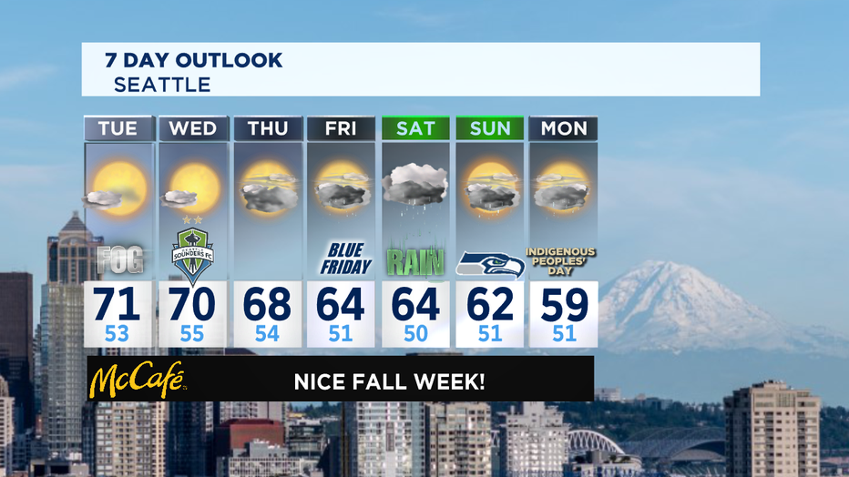
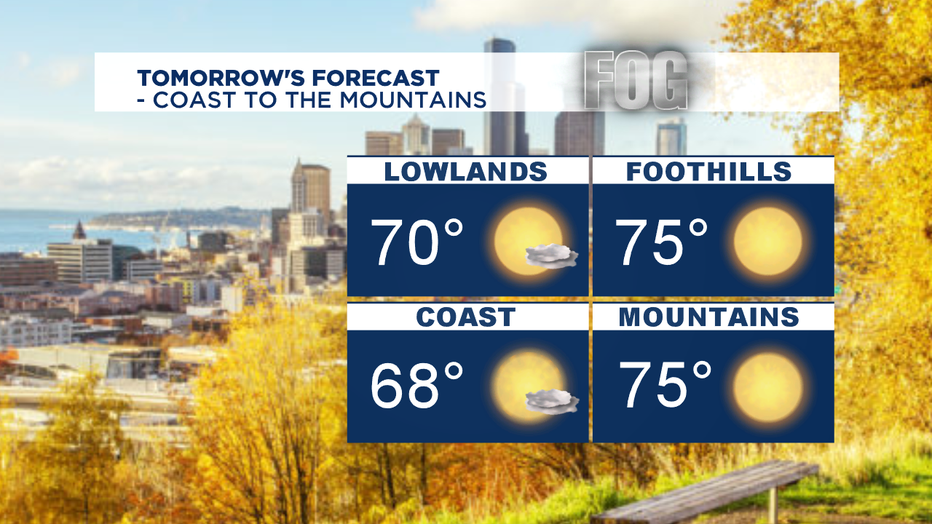
"FogTober" will live up to the name for the next couple of days, delivering more fog inland through the morning hours before lifting to beautiful blue skies by the afternoon. Highs will push near 70 and this could be the last time we see temperatures that warm until spring time! Yikes! Always hard to transition from the tail end of summer like conditions to the true fall season. Our pretty Autumn sunshine courtesy of a strong upper level ridge that will continue to hang out through Wednesday.
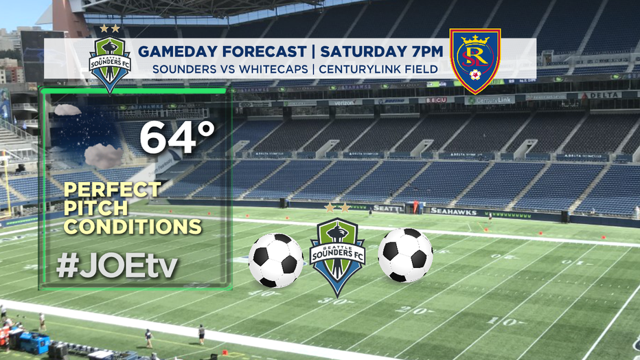
Conditions on the pitch at CenturyLink Field Wednesday night for the Sounders FC should be ideal. We expect a dry night with temps in the mid 60s as the Rave Green take on Real Salt Lake. Kick off set for 7pm on JOEtv. #GoSounders
As our ridge breaks down and shifts east, we'll start to introduce more cloud cover. Thursday look for a mostly cloudy day, mainly dry, but there is a chance of a few sprinkles as a trough drops down from the Gulf of Alaska. As the trough splits some of you in the North Sound might see light showers. Highs will cool back into the mid 60s.
A more organized system is waiting for us in the Pacific and will start to approach the NW Coast Friday morning. Showers will start to fall through the overnight hours from the NW Coast, through the Stait and North Sound, falling as far south as Seattle. By late afternoon we'll see a brief break before the heavy rain gets going just after dinner. We expect widespread showers with some gusty wind possible at the coast, less windy inland, but still breezy. Highs land in the mid 60s.
Rain will continue to be the theme Saturday too, in fact showers look heaving at times... a soggy day for sure. Temperatures will cool even more dropping into the low 60s. Heavy rain will slow down and turn to just showers by Saturday night.
Sunday will start off with a few lingering showers, but by lunchtime we should dry out for a brief break. Highs will sit near 60, below the seasonal norm.
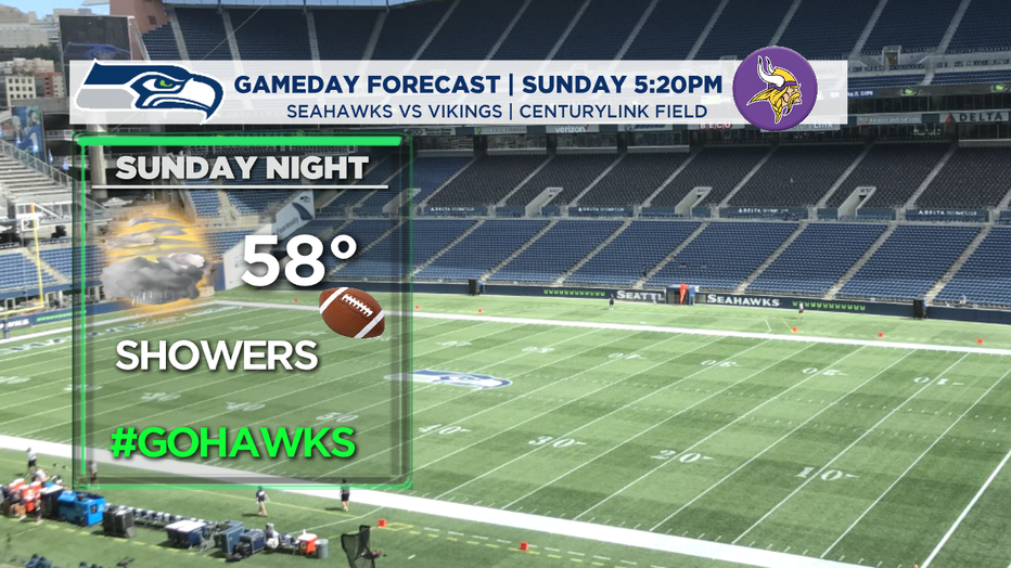
So, what does it look like for Sunday night football from CenturyLink Field? Seahawks kick off at 5:20pm against the Vikings and just as the ball starts to fly we'll see another round of showers getting ready to drop. By about 8pm most of the area will deal with more rain. There is a slight chance that Seattle could sit in the rain shadow, keeping the metro area dry, but we'll have to wait and see. This might be a game that you're happy to watch from home. Highs are cool in the upper 50s to near 60.
Monday, also "Indigenous Peoples' Day" brings more sloppy weather! Widespread rain with cool highs will keep us wet through the week. Welcome to true Fall in the Pacific Northwest! Enjoy!
Have a great night! ~Erin
_______________________________________
- Erin Mayovsky, Q13 Forecaster
Twitter: @ErinMayovsky
FaceBook: /ErinMayovsky
Instagram: @ErinMayovsky
_______________________________________