

Hottest day of 2021 (so far)
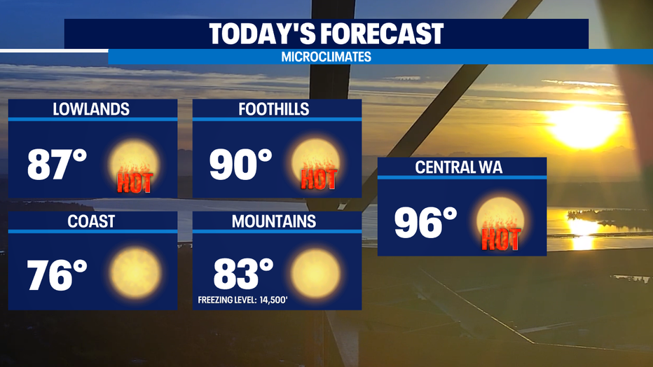
SEATTLE - Monday is the first full day of summer and it will sure feel like it! Highs warmer than yesterday’s 81 at SeaTac by 5-6 degrees. I’m forecasting 87 for Seattle today.
The number to beat in the record book at SeaTac Int'l today is 89. South of Seattle and some foothills communities will likely end up hitting at or near 90. The number to beat at the Olympia Airport in Tumwater.
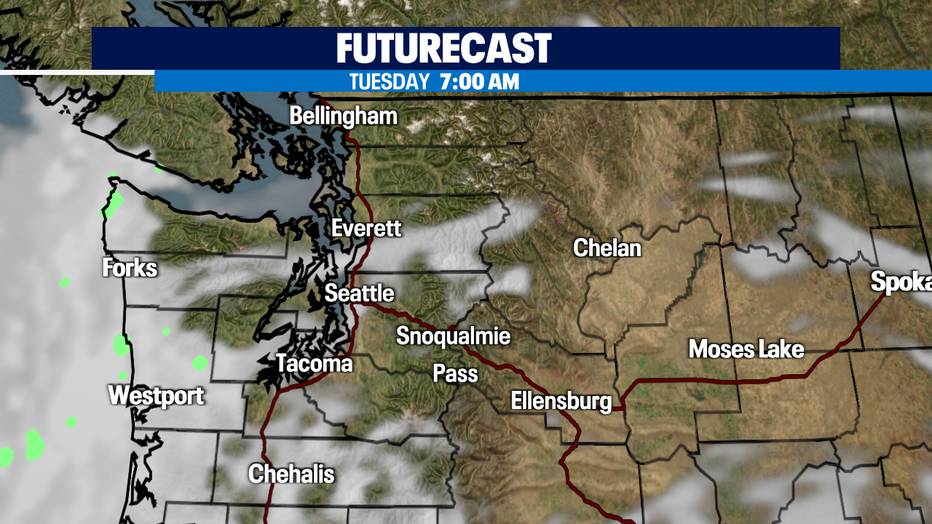
Some onshore flow kicks in a bit cooler weather for Tue/Wed so we’ll see more places like the coast and near the Chehalis Gap and Strait start out with some clouds cover. Inland we'll be closer to 75-80 for most of us around Puget Sound.
Forecast models keep us dry and warm through the end of the week. High pressure ridge over our region looks to amplify again at the end of the week. Some forecast trends are suggesting another temp spike on Saturday where highs in places like Olympia could get close to 100. For Seattle it could be the first 90s of the year.
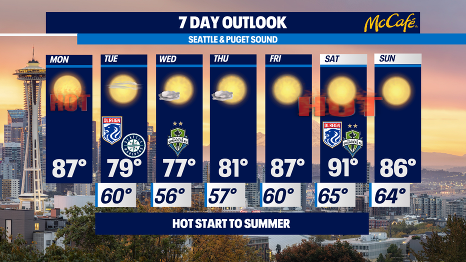
Too soon to tell, those details will come into greater focus in the next few days. But regardless of exactly how much heat comes our way, summer 2021 is getting a hot start. -Tim Joyce
Q13 WEATHER RESOURCES:
DOWNLOAD: Q13 Weather and News Apps
WATCH: Forecast and Radar
READ: Closures and Delays
CHECK: Latest Weather Alerts and Live Traffic Map
INTERACT: Submit your Weather Photo
FOLLOW: Lisa Villegas, MJ McDermott, Tim Joyce, Erin Mayovsky, Grace Lim and Scott Sistek