

Expect thick smoke, unhealthy air quality Friday in Washington
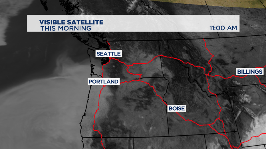
SEATTLE - A large area of smoke has piled up offshore from the wildfires burning in Oregon and California.
It's already affecting portions of the coast as winds are now out of the southwest, ushering in the smoke and cool marine air. The onshore flow and smoke blocking the sunlight is why it is chilly in Hoquiam and Astoria where temperatures are in the 50s and 60s, a near 30-degree temperature drop from this time yesterday!
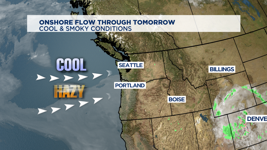
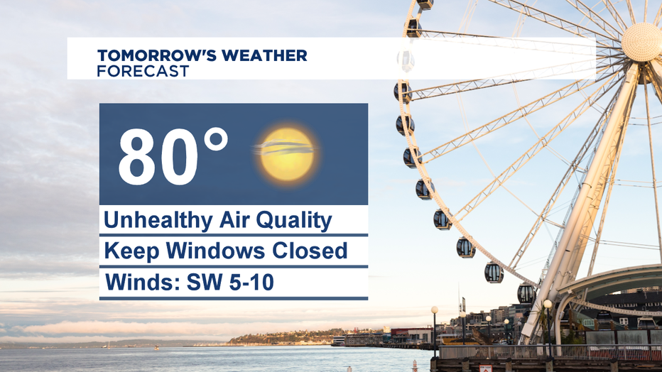
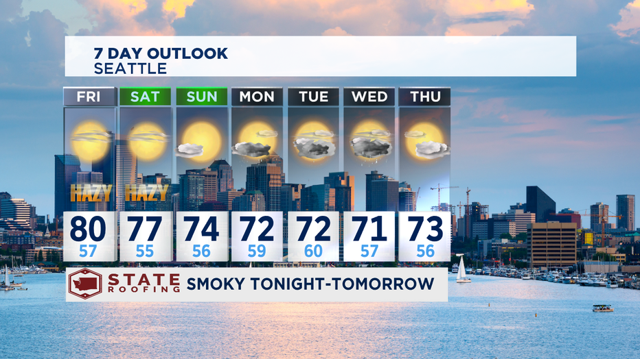
Meanwhile, Seattle set a new record high temperature of 91 degrees today due to offshore flow, ushering in warm and dry continental air. Winds will turn southwesterly for the Puget sound tonight, bringing in the smoke and cooler air. That will lead to UNHEALTHY air quality through tomorrow. Close your windows tonight before you go to bed and keep them shut tomorrow. Smoke will be worse during the overnight hours as winds will calm allowing smoke to just settle. Highs will be warm but not as hot like today, near 80 degrees.
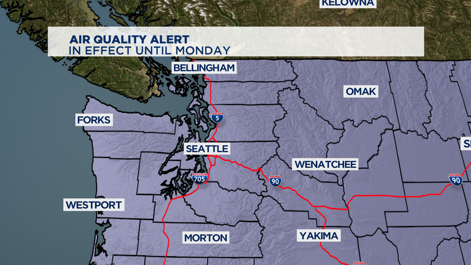
Hazy conditions are possible over the weekend and next week. Air Quality Alert has been extended through next Monday. The good news is, temperatures will be cooler making it easier to keep the windows closed. Highs Saturday will be around 77, and 74 on Sunday.
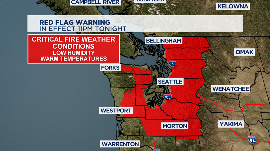
Red Flag Warning is in effect through tonight due to warm temperatures and low humidity.
Next week, a front will bring much needed rain helping the firefight. Highs will be cooler in the lower 70s.
Stay safe everyone!
-Q13 Meteorologist Grace Lim