

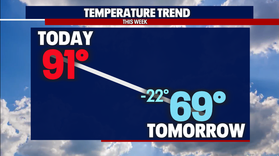
Seattle weather: Temperatures dropping nearly 20 degrees after weekend in the 90s
SEATTLE - We're getting ready for a dose of cool marine air to drop our temperatures tomorrow. This will have a BIG impact and drop us nearly 20 degrees! In fact, we're already seeing the changes.
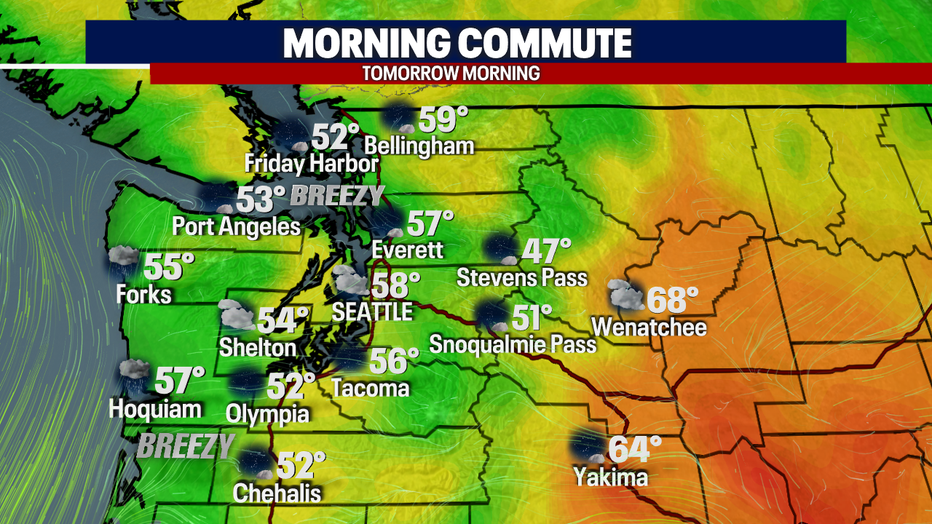
Cooler weather arrived along the coast today and the winds have shifted out of the west. Winds will continue to increase across the Chehalis Gap and the Strait of Juan De Fuca tonight so don't be surprised if you feel them speeding up.
Temperatures will be cooler tomorrow morning (compared to the last couple of mornings) as the clouds slowing increase. The wind speeds will continue to increase for all of us, and we can expect them sustained around 10-20 mph throughout the day.
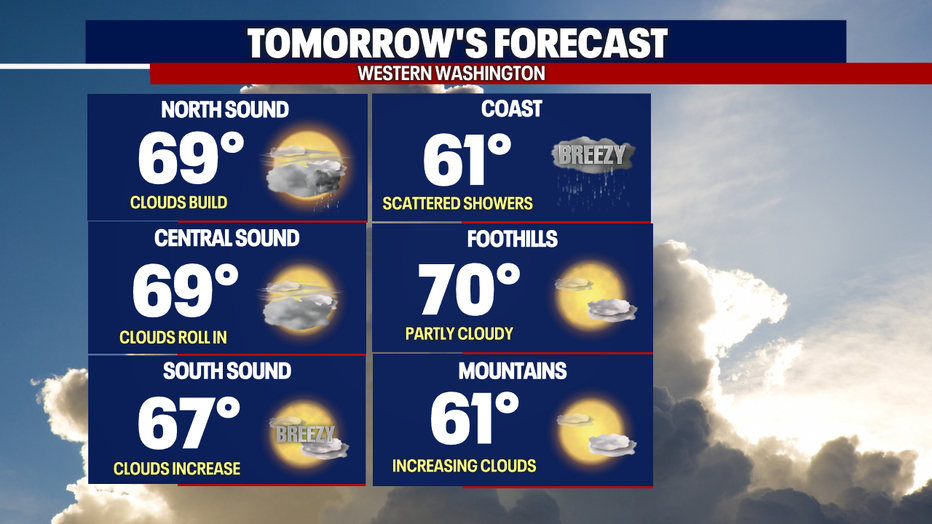
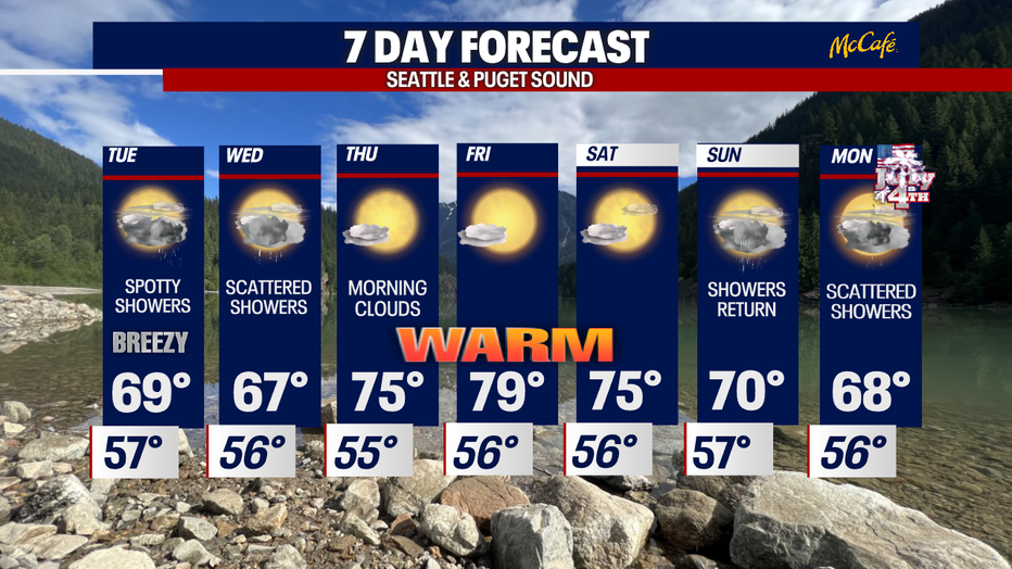
Speaking of the day - check out those temperatures! Significantly cooler, right? We're also expecting spotty showers in the afternoon/evening. Shower chances are higher across the Coast throughout the day and increase more significantly across the North Sound. The rest of us will notice the clouds increase with a few spotty showers late in the day.
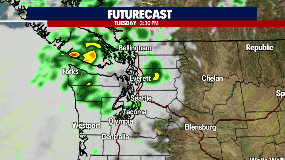
Unsettled weather will not only impact us tomorrow, but it'll hang around through Wednesday. Similar conditions are expected for both days.
We'll dry out by the middle of week with temperatures returning into the 70s. Another round of cooler temperatures and showers looks possible for the 4th!
Here is a look at the 7-day forecast:
Have a good one!