

Seattle weather: Slightly less smoke today, rainy by Friday
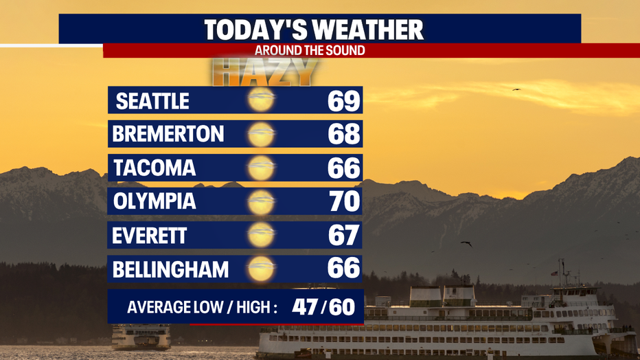
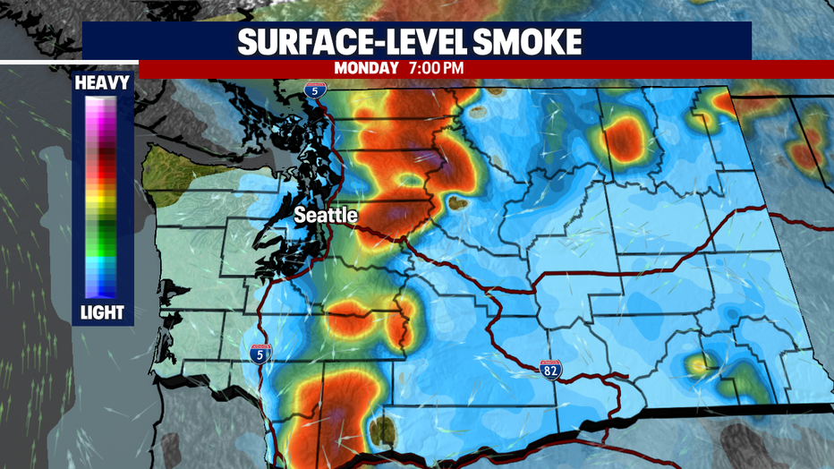
SEATTLE - Thankfully, temperatures will be significantly cooler today compared to Sunday. There will also be slightly less smoke for the Puget Sound lowlands; however, haze will continue to plague many communities over the Cascades.
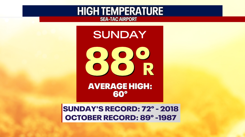
Sunday, a strong combination of offshore winds, high pressure and a "thermal trough" pushed temps to a whopping 88 degrees at Sea-Tac Airport! This obliterated the old record of 72. Sunday's high of 88 made it the second-warmest October day on record in the Seattle area in almost 130 years.
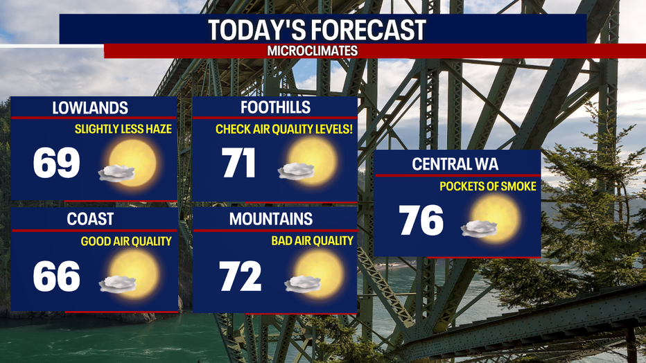
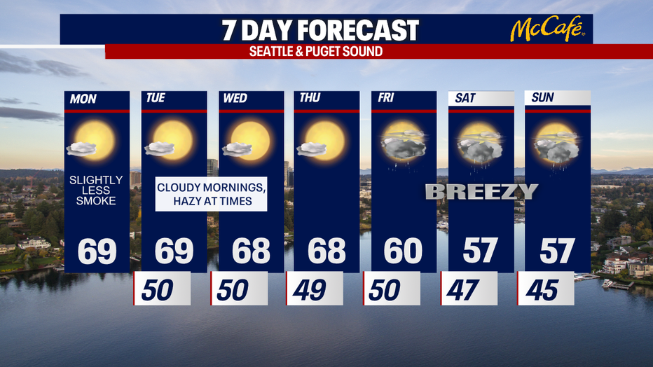
Due to a weak onshore flow, highs today will only likely reach the upper 60s and low 70s.
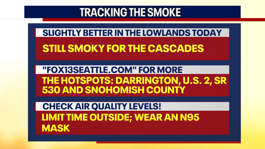
There will be much less smoke in the Puget Sound lowlands today compared to this weekend, but we're not out of the woods just yet. Multiple fires are raging. Until consistent westerly winds and rains arrive on Friday, there will be on-and-off smoke across Western Washington - particularly east of the I-5 corridor.
Today, it's likely that air quality will range from "moderate" to "unhealthy for sensitive groups." Air quality will be worse in communities that are close to those big wildfires.
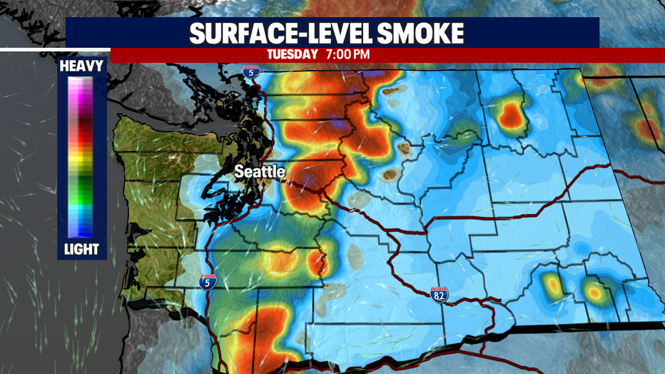
There will be times of smoke through Thursday with morning clouds and afternoon sunshine.
Autumn weather (long overdue) returns on Friday! You can expect cooler and cloudier weather this weekend. It'll be breezy, too. There could even be some snowflakes for the higher mountain passes (e.g. Stevens and White Pass)! The boost of moisture in the atmosphere should improve air quality and lower fire danger.
Until then, make sure to monitor air quality levels if you're sensitive to smoke. We'll be bringing you the latest forecast throughout the week.
Take good care,
Meteorologist Abby Acone
Follow me on Twitter @abbyacone, Instagram @abbyaconewx, TikTok @abbyaconetv and Facebook (Meteorologist Abby Acone)