

Seattle weather: Sizzling heat in Western Washington
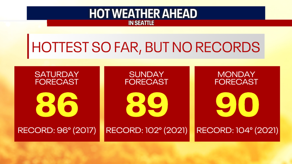
SEATTLE - Brace yourself for the hottest temperatures so far this year. Highs will skyrocket into the upper 80s and 90s by Sunday and Monday!
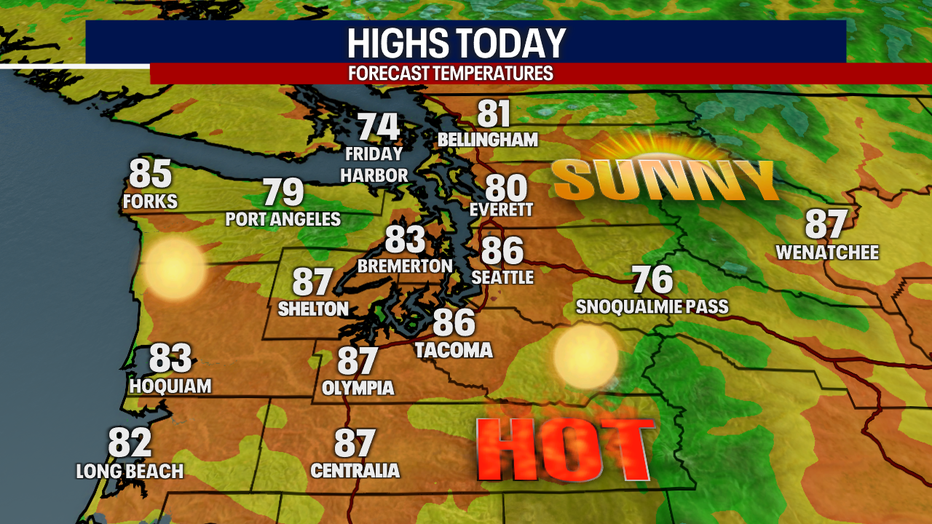
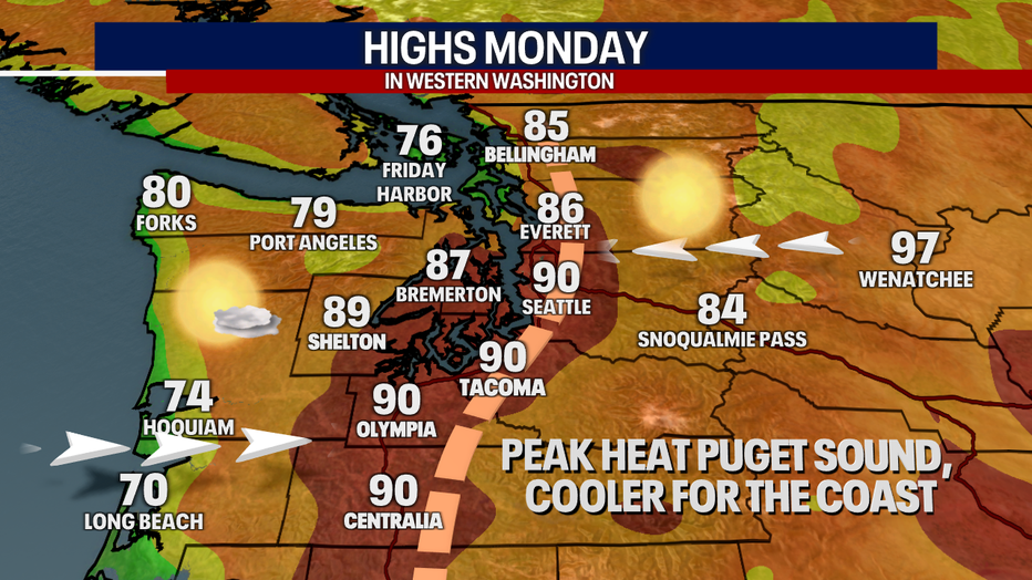
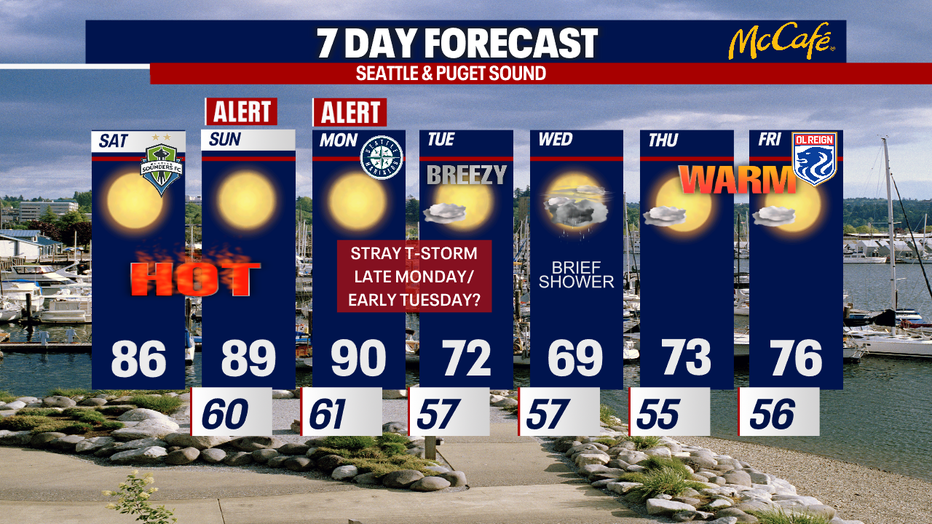
Highs today will reach the mid 80s in Seattle. Tomorrow, temps will boost to 89 in the Emerald City. By Monday, Seattle could see a high of 90 degrees. We're not expecting record-shattering numbers; that's because our heat wave last year around the same time was so extreme.
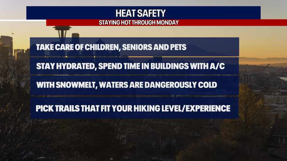
With the heat, make sure to stay hydrated, seek shade and use plenty of sunscreen. If you don't have A/C in your home, make sure to get into a building with air-conditioning this weekend to give your body a break. Take extra care of your children, seniors and pets. Never leave your kiddos or pets in a hot car!
If you're spending time on the water the next few days, remember: there will be a lot of snowmelt happening, so rivers, creeks and streams are dangerously cold. Always wear a life jacket!
For those heading up over the higher elevations for hiking, make sure to pick trails that match your skill level and experience.
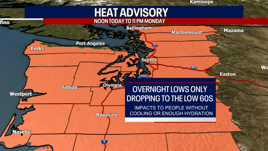
It's no surprise the National Weather Service has issued a Heat Advisory through Monday night. Overnight temperatures will only bottom out in the low 60s the next two mornings, and it's going to take all night to get there. Translation: prepare for horrible sleeping weather if you don't have A/C! Keep those fans blasting.
For temperatures to soar here in Western Washington, we need three ingredients: high pressure overhead, a "thermal trough" and dry easterly/northeasterly winds. All of those ingredients are at play.
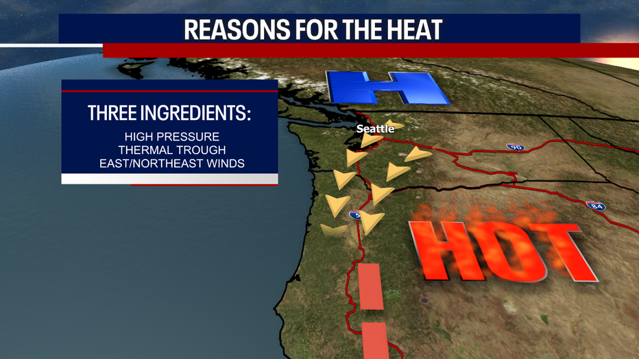
Here's how hot it could get on Monday. The "thermal trough" will be directly over the Puget Sound lowlands. That's why those communities could see peak heating this week on Monday. Meanwhile, westerly winds along the coast will start blowing towards that thermal trough. Those west winds will act as Mother Nature's A/C, cooling off the coastal beaches nicely. If the thermal trough wobbles to the west or east, temperatures could wind up cooler or hotter than what we're forecasting right now.
As if the heat wasn't exciting enough, there's a slight chance for some thunderstorms late Monday to early Sunday. Lightning and small hail seem super unlikely, but stay tuned for updates. The best chance for thunder looks to be over the North Cascades.
Tuesday will be breezy and cooler. Isolated showers are possible on Wednesday. Thursday and Friday (July 1st!) look dry, mild and sunny. Enjoy!
Enjoy our summery weather! Please take care and find ways to stay cool.
Warmly,
Meteorologist Abby Acone
Follow me on Twitter @abbyacone, Instagram @abbyaconewx, TikTok @abbyaconetv and Facebook (Meteorologist Abby Acone)