

Mild temps, showers on Fourth of July for Western Washington
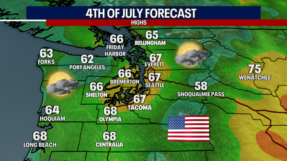
SEATTLE - It wouldn't be a special weekend in Western Washington without the chance for damp and chilly weather :) Thankfully, the Fourth of July doesn't look like an entire washout by any stretch. In fact, showers Sunday and Monday look very isolated.
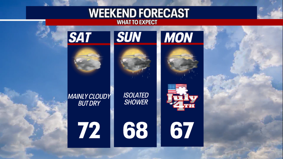
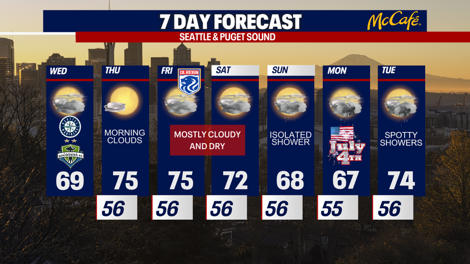
Saturday will be mild and dry though mainly cloudy. Highs Saturday should reach the low 70s comfortably. Sunday and Monday, spotty showers return to the forecast. Highs stay limited, only reaching the mid 60s. As always, stay tuned on this forecast. There's still plenty of time for this holiday forecast to change in either direction: meaning, things could wind up warmer or cooler than we're currently forecasting.
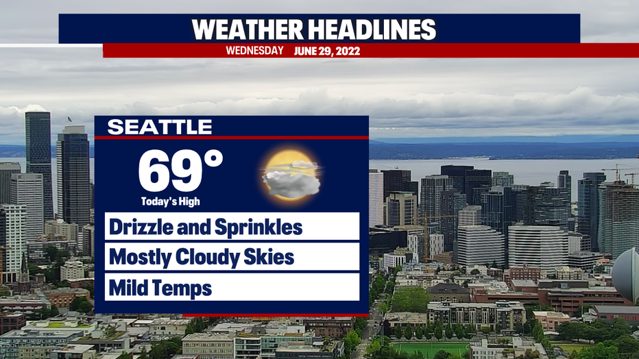
For today, you can expect pockets of drizzle or sprinkles at times. However, most backyards end up dry. We'll have more clouds than sun with highs in the 60s.
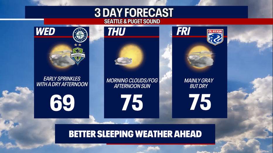
Tomorrow looks absolutely beautiful! Morning clouds and fog should give way to afternoon sunshine and highs soaring nicely to the mid 70s. The 70s stick around through Friday, but the final day of the workweek will trend cloudier than sunnier.
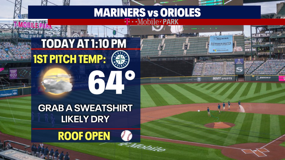
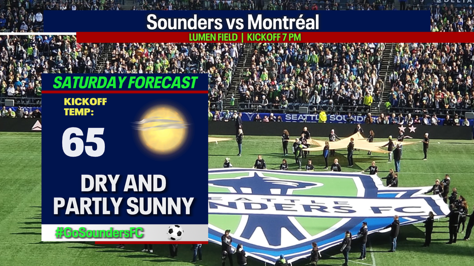
It's a great day to be a Seattle sports fan! The Mariners, Seattle Storm and Sounders are playing. Here's the forecast:
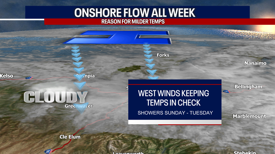
Here's why we're not expecting a big warmup the next seven days: a consistent westerly flow (of varying strength each day) will keep our temps in check. This is also known as our familiar onshore, marine push.
Check out our latest seven day forecast! Enjoy the sunshine when we have it. We'll be watching the forecast closely for Independence Day.
Have a wonderful week!
Sincerely,
Meteorologist Abby Acone
Follow me on Twitter @abbyacone, Instagram @abbyaconewx,