

Last day of extreme heat in Western Washington
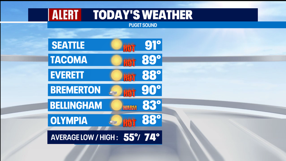
SEATTLE - After yesterday's all-time record-breaking heat, we're cooling down today. We'll top out around 90 for Seattle, but at least that's much cooler than yesterday's 108 at Sea-Tac Airport.
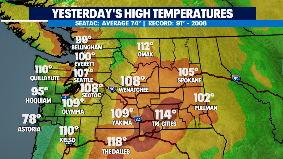
Here's a map of yesterday's mind-boggling highs.
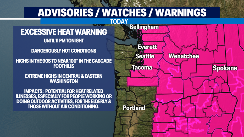
The Excessive Heat Warning continues for one more day in Western Washington, though the coast is not a part of this. Notice how the magenta color does not go out the coast.
Thanks to the Marine Push, clouds have moved all the way in to Seattle this morning. This is "Nature's air conditioning."
Western Washington will be almost 20 degrees cooler than yesterday. However, that cool marine air will not make it over the Cascades, so Central & Eastern Washington will be hotter today than yesterday. In fact, if the Tri-Cities hit 118, it will tie the all-time record for Washington State. The forecast for the Tri-Cities today is 117.
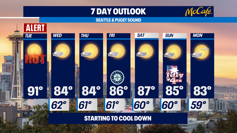
Tomorrow and the rest of the week will be relative comfortable. We'll have that lovely combination of some morning clouds with afternoon clearing and highs in the mid 80s.
Normal for the time of the year is 74, so we'll still be about 10 degrees above normal. But nobody's complaining after the extreme heat wave we have just endured! Our 4th of July Weekend looks fantastic! I'm just a little concerned about fireworks starting fires because it is so extremely dry around here.
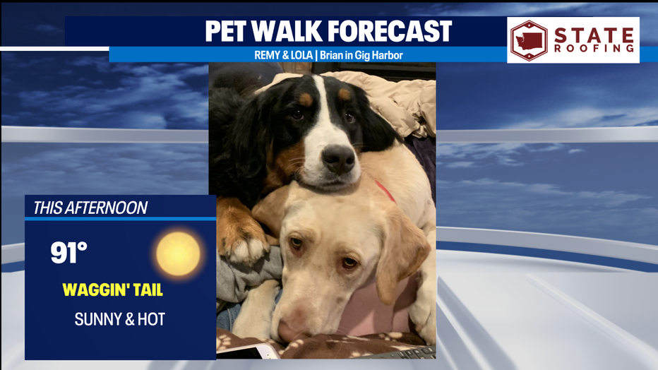
It's still a Panting Tongue Day for the Pet Walk Forecast with highs around 90.
Meteorologist M.J. McDermott
Q13 FOX WEATHER RESOURCES:
DOWNLOAD: Q13 Weather and News Apps
WATCH: Forecast and Radar
READ: Closures and Delays
CHECK: Latest Weather Alerts and Live Traffic Map
INTERACT: Submit your Weather Photo
FOLLOW: Lisa Villegas, MJ McDermott, Erin Mayovsky, Grace Lim and Scott Sistek