

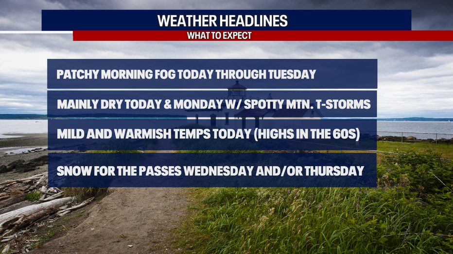
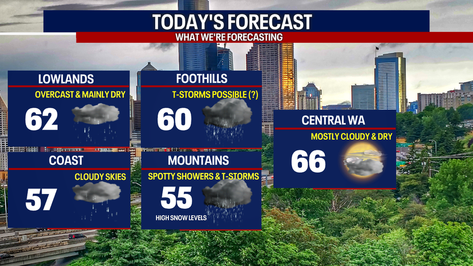
Highs in the 60s today with spotty mountain thunderstorms
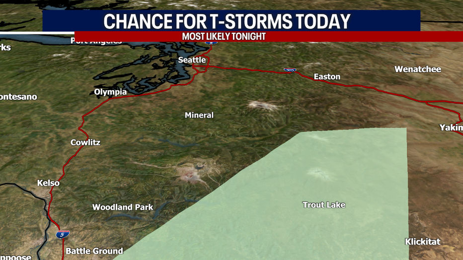
SEATTLE - Mild and warmish temps are on tap today! Many backyards will have highs in the low to mid 60s. Up over the Central and South Cascades, isolated thunderstorms are possible tonight.
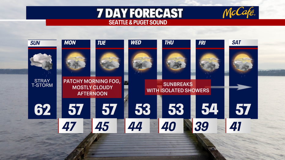
Today through Tuesday, rounds of morning fog are in the forecast. Over the passes, we're not forecasting snow until Wednesday and/or Thursday.
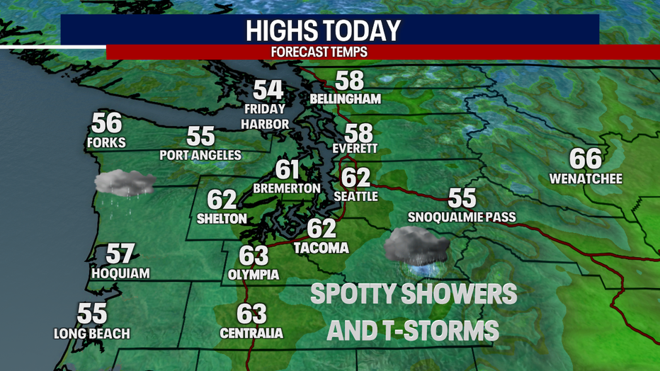
Check out our high temps today. Clouds will stick around all day. There may be a light, passing shower, but much of Western Washington stays dry.
Spotty lightning and small hail could bubble up later tonight.
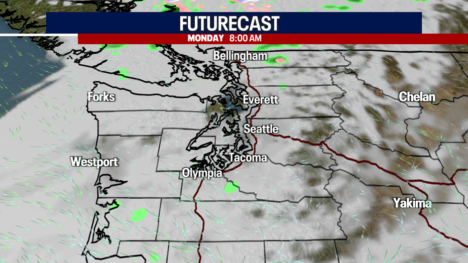
Here's the timing of the showers and storms today:
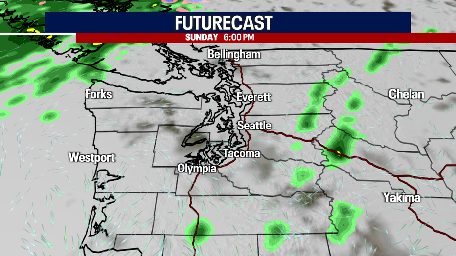
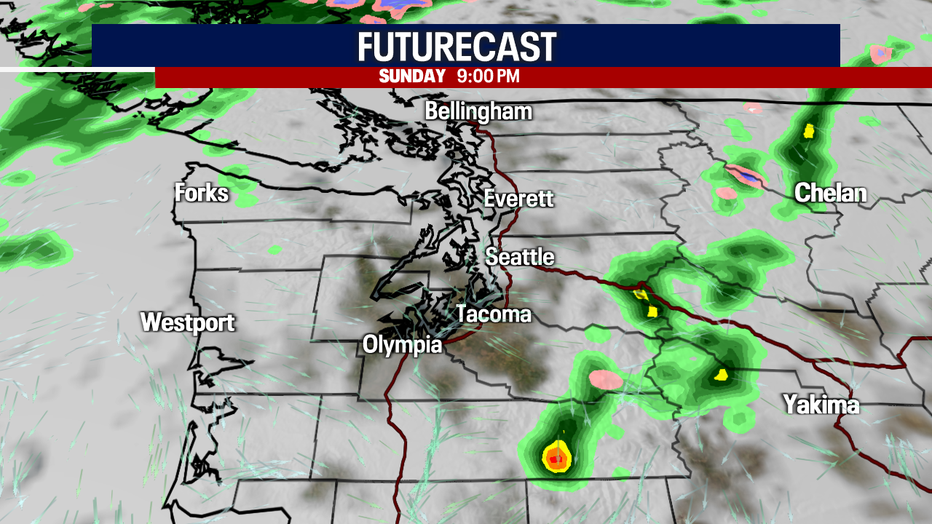
Here's a map of the communities with the best chance for a weak thunderstorm today:
Low 60s are possible for many backyards in the lowlands and foothills. The coast should have highs in the mid to upper 50s. Temps will boost to the mid 60s in Central Washington.
Tomorrow, you can plan on morning fog with a sparse shower. Tuesday will start with fog and end with dry and mostly cloudy skies. Wednesday through Saturday, we're forecasting sunbreak and showers.
Hope you catch FOX 13 today!
Take care,
Meteorologist Abby Acone
Don't hesitate to reach out on social media:
Facebook (Meteorologist Abby Acone), Twitter @abbyacone, Instagram @abbyaconewx and TikTok @abbyaconetv
MORE FROM FOX 13 WEATHER:
DOWNLOAD: FOX 13 Weather and News Apps
WATCH: Forecast and Radar
READ: Closures and Delays
CHECK: Latest Weather Alerts and Live Traffic Map
INTERACT: Submit your Weather Photo
DAILY BRIEF: Sign Up For Our Newsletter
FOLLOW: Lisa Villegas, Erin Mayovsky, Brian MacMillan, Abby Acone and Scott Sistek