

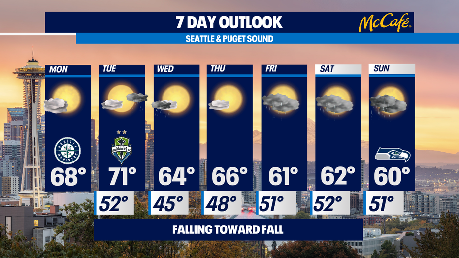
Falling toward Fall - cooling down and getting wet the last weekend of summer
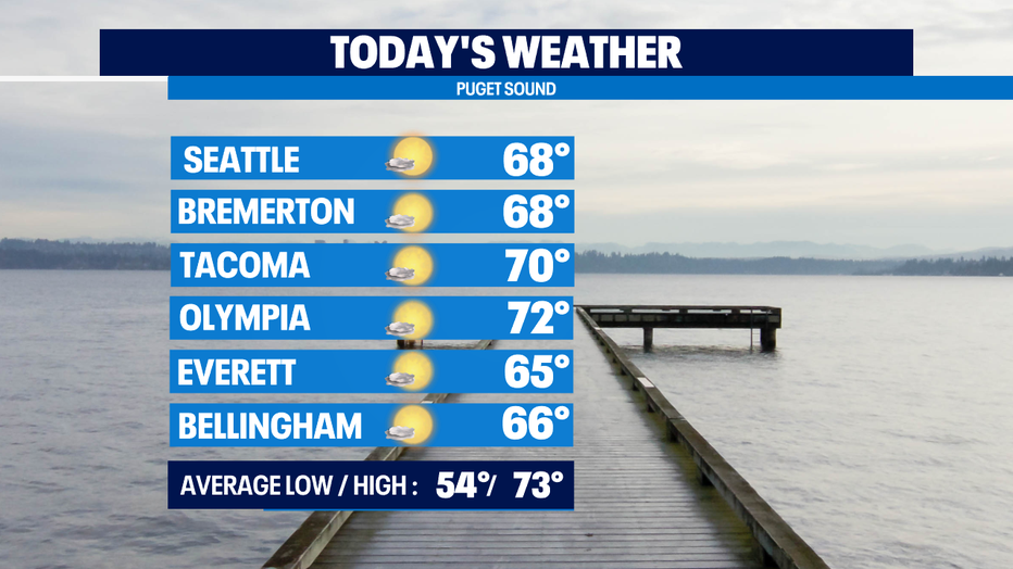
Seattle - Today will be pleasant. We're starting out with clouds, but the clouds will clear and this afternoon will be mostly sunny with highs below normal - upper 60s to near 70. 73 is normal for this time of the year.
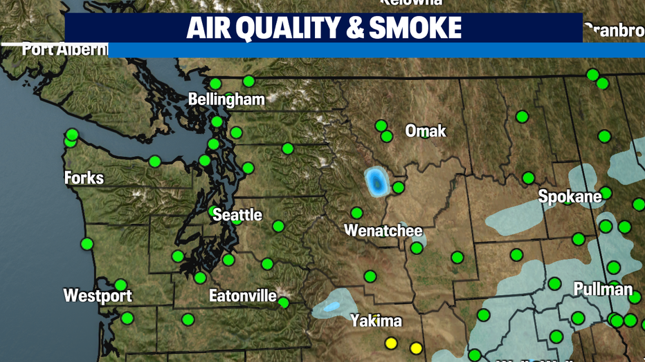
The current smoke and air quality map for the state looks great! Almost everyone has "good" air quality (green dots). Just a bit of "moderate" air quality (yellow dots) near Yakima due to the Schneider Springs fire. The rainfall that E. Washington got on Friday and other favorable conditions are helping tamp down the fires. Hopefully this trend continues!
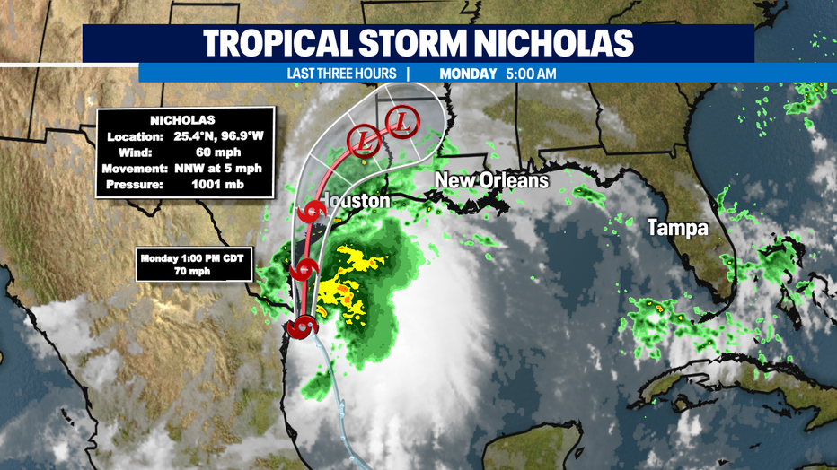
Tropical Storm Nicholas will make landfall on the Gulf Coast of Texas this evening. It is intensifying and could become a Category 1 hurricane before making landfall probably just south of Corpus Christi.
Tomorrow will be mostly sunny, but there is a chance of a little rain on the north coast in the afternoon that could produce some showers in Seattle northward by tomorrow evening. Temps will top out in the low 70s.
Wednesday might start out with a lingering shower, then it'll be mostly sunny, but cooler - topping out in the low/mid 60s.
Thursday looks mostly sunny with highs in the mid 60s.
THEN . . . our last weekend of summer will have a fallish feel. Friday through the weekend there will be showers at times with highs topping out around 60 or into the low 60s - well below normal.
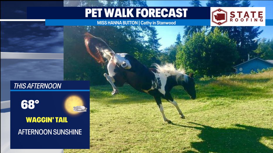
With afternoon clearing and highs in the upper 60s to near 70, it's a Waggin' Tail Day for the Pet Walk Forecast. Kick up your heels, like Miss Hanna Button below!
-Meteorologist M.J. McDermott
Q13 FOX WEATHER RESOURCES:
DOWNLOAD: Q13 Weather and News Apps
WATCH: Forecast and Radar
READ: Closures and Delays
CHECK: Latest Weather Alerts and Live Traffic Map
INTERACT: Submit your Weather Photo
DAILY BRIEF: Sign Up For Our Newsletter
FOLLOW: Lisa Villegas, MJ McDermott, Erin Mayovsky, and Scott Sistek