

Big midweek cooldown with thunderstorms possible
After another scorching afternoon around Western Washington, some backyards are waking up to thunderstorms! We're also tracking a big cooldown on the way by Wednesday.
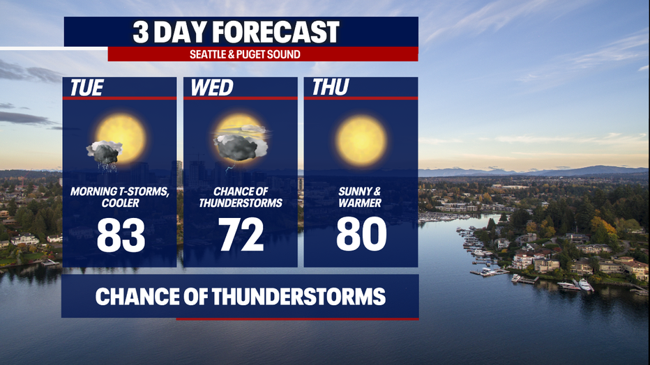
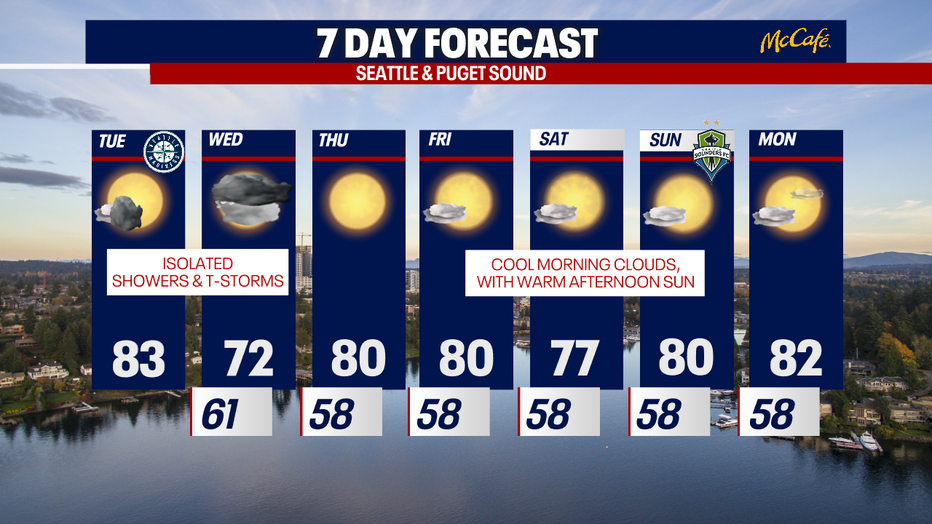
Highs today will reach 83 degrees. While some neighborhoods stay dry all day, others may see downpours and storms. Keep a light rain jacket with you in case a shower pops up in your neck of the woods! Also, be sure to download our free FOX 13 weather app to track any showers on radar.
With any weak thunderstorms that develop today and tomorrow, there could be small hail and heavy rain. The Cascades have the best chance for lightning.
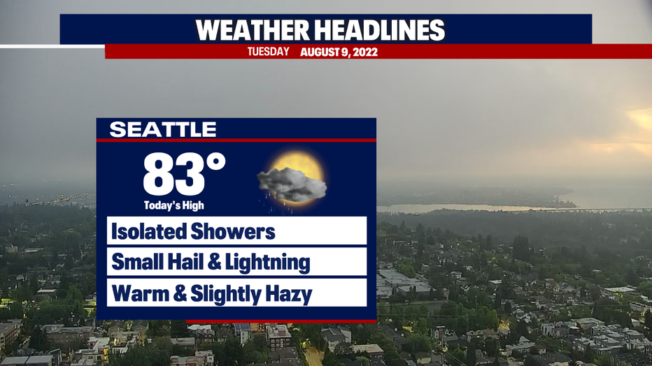
Some clouds are in the forecast for today, too. A thin level of high-level haze is still possible (especially over the Cascades), but little to no impact to air quality is expected. Some spots could drop to "moderate" readings today. That means there's a medium health impact to people with asthma, respiratory issues or other medical sensitivities.
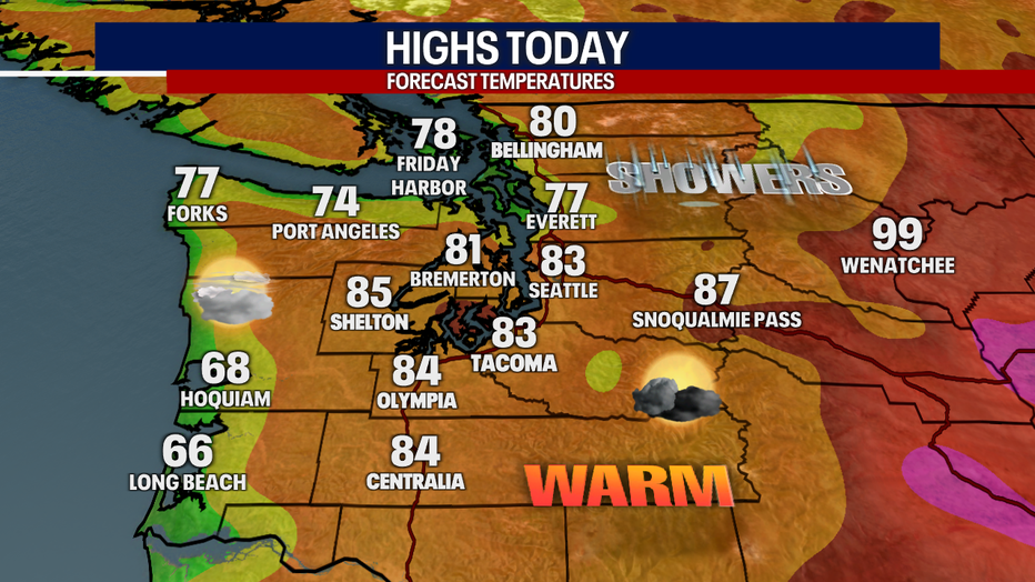
The hottest temps today will once again be over the South Sound and the Cascade foothills. Cooler and cloudier weather is on tap for the coast. Hoquiam and Long Beach will be refreshingly cool with highs only reaching the mid to upper 60s.
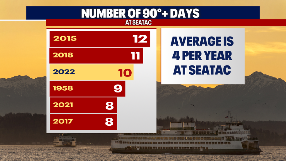
Sea-Tac Airport is nearing the all-time record for the most 90-degree days in a year. We've had ten days in the 90s this season – which is just behind the 12 days we had in 2015. In 2018, there were 11 days in the 90s. We average four 90-degree days every year at Sea-Tac, and we've more than doubled that in 2022 and the summer isn't even over yet!
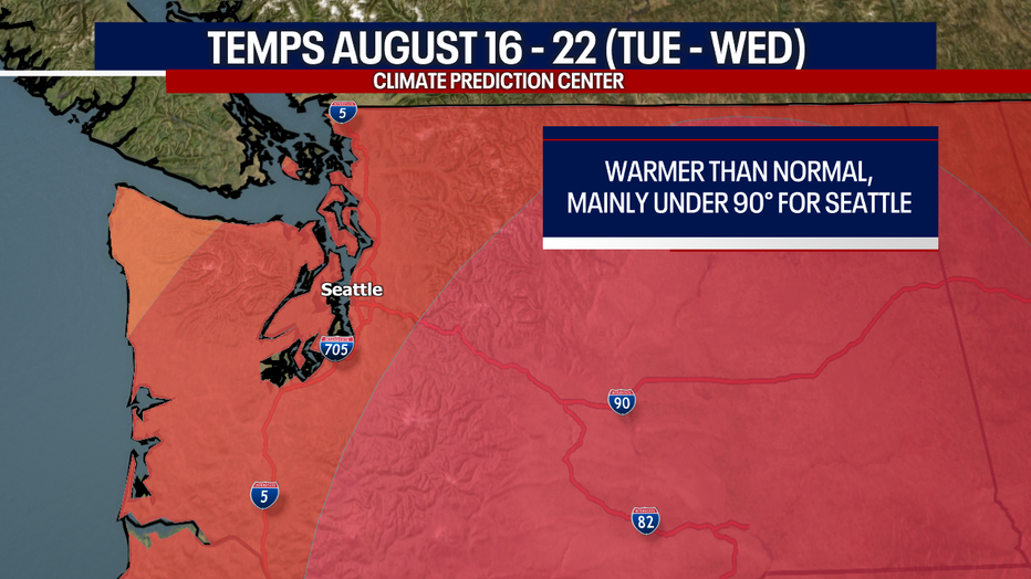
For the rest of August, long-range models are forecasting temperatures to stay above-average (here's a little context: today's normal temp is 79). It's possible some days could flirt or exceed the 90 degree mark, but the current models suggest we'll mainly be shy of that threshold.
For everybody in the red, the Climate Prediction Center is forecasting warmer-than-normal temps for August 16 - 22 (that's a Tuesday through Wednesday).
Tomorrow, showers and lightning could fire up again. We're worried about thunderstorms triggering new wildfires if there isn't much rain. Stick with us for updates!
Otherwise, we're expecting highs to drop to the low 70s on Wednesday. Thursday looks spectacular with tons of sunshine and a high around 80.
We'll fall back to our cozy, familiar pattern of morning clouds and afternoon sunshine Friday and Saturday. Sunday and Monday will offer mostly sunny skies. A light onshore flow (aka westerly winds) will keep temps from getting too hot. This should also usher in clean Pacific air, helping us maintain good air quality (barring changes in the forecast or new wildfires).
Hope you catch Good Day Seattle this morning! We're on air through 10 a.m.
Warmly,
Meteorologist Abby Acone
Follow me on Twitter @abbyacone, Instagram @abbyaconewx, TikTok @abbyaconetv and Facebook (Meteorologist Abby Acone)