All eyes on Sunday as a series of wet systems continue
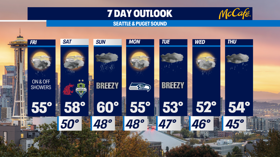
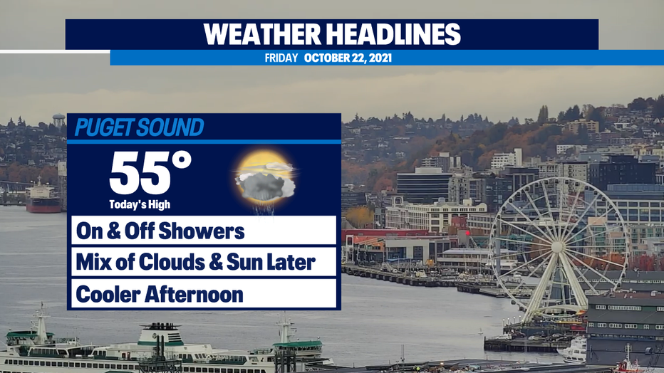
Seattle - Rain showers will continue through the afternoon Friday with much cooler highs in the mid 50s.
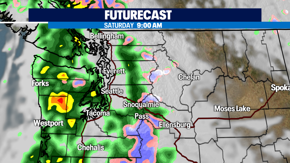
Saturday morning will bring another round of widespread rain in in the morning, but the afternoon will be drier. Highs will be back in the upper 50s.
Sunday will likely bring us the strongest system that we’ve seen in the past week. The track of this storm will make a BIG difference on its impacts to Western Washington. Right now, the models aren’t agreeing on how this storm will act as it heads our direction. It could weaken quickly as it approaches the coast or move farther north as other systems have. Best case scenario, it’s a breezy wet day like what we’ve seen already this week. Worst case, we get a decent wind storm with heavy rain for Western Washington.
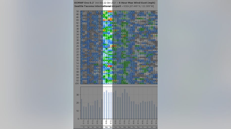
Along with maps, one of the things we look at are the ensemble members (the various simulations of a model). This is the European model which runs 50 simulations and it shows us the max wind gust in mph over 6 hours. The bottom shows us the mean or average, which is 35-40 mph gusts Sunday. That's breezy and may bring down some tree limbs, but we aren't going to see widespread damage with that kind of wind. Also, only 14 of the 50 ensemble members on Sunday evening (Mon. 00z) to Monday morning (Mon. 12z) are packing gusts of over 40 mph. That doesn’t give me a whole lot of confidence… yet.
The bottom line is, keep checking back on our forecasts tonight and this weekend. We will have a better idea on the path and strength of this storm as we get closer to Sunday.
Next work week will continue to bring a series of wet weather systems with cooler than average temperatures.