A White Christmas? Most of us will have to wait until Christmas night
Seattle - Merry Christmas Eve!
We have one more day of cool showers and sunbreaks before winter weather impacts Western Washington. Most won't see a "White Christmas" this year, but many will have a "White Day After."
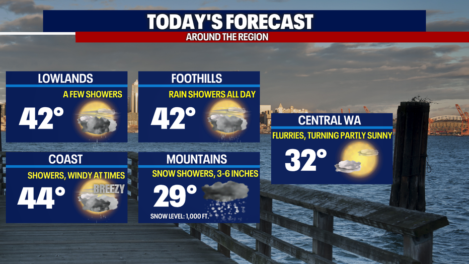
On and off showers continue today with breezy conditions in the north sound and on the coast. Some areas could catch a rain/snow mix, especially later tonight. Highs will be in the low 40s for Christmas Eve.
The picture is becoming more clear for snow on Saturday night into Sunday.
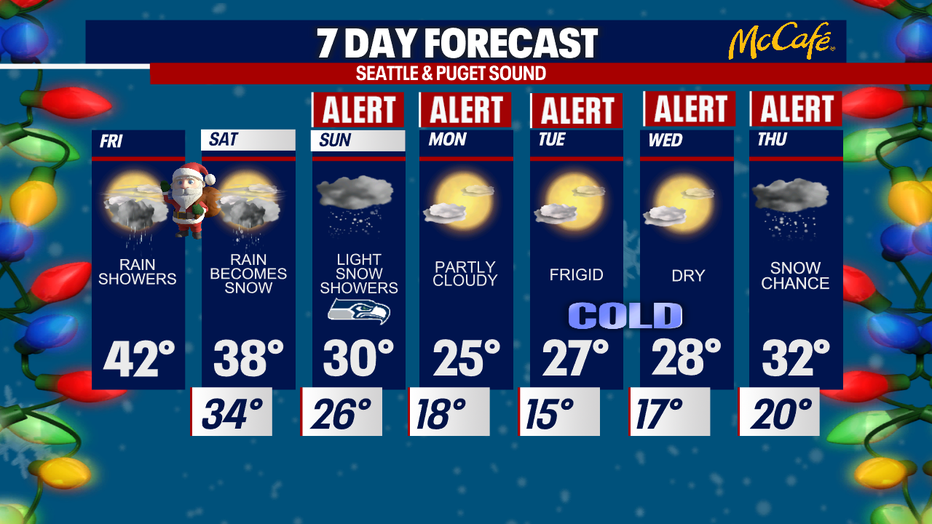
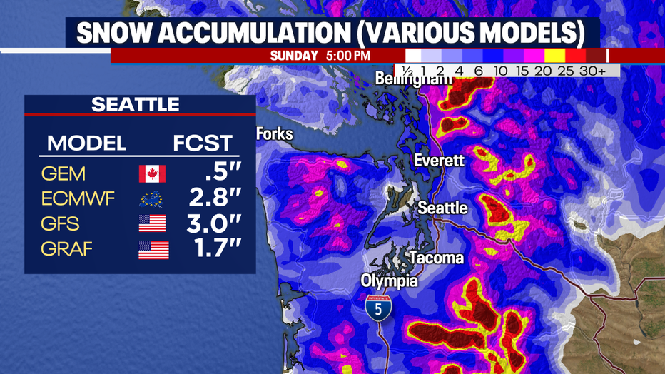
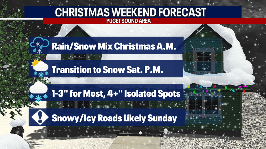
Saturday (Christmas Day) – This is our big transition day from rain to snow. Most of our models give us 1-3" of snow in the lowlands of the central and south sound. This will be a showery pattern, so some spots may get less while others could see more. The north sound will likely get hit the hardest.
Sunday – Roads could be in rough shape in the morning hours if a few inches fall overnight. Light snow showers will taper off throughout the day and we’ll stay below freezing. Flurries are expected for the Seahawks game and it will be very cold, with temps in the upper 20s.
The models are in good agreement this morning with 1-3" expected around the Seattle area and more to the north.
Travel will be difficult on the roads starting Saturday night. Make sure you're prepared for winter driving if you're planning to hit the roads between then and Sunday.
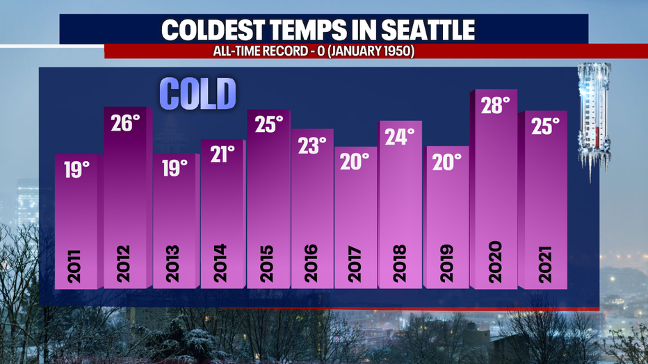
Monday through Wednesday – This will be our coldest three day period in several years (a "deep freeze"), with high temps in the mid 20s and overnight lows in the mid teens. We haven’t been in the teens at SeaTac since 2013 (we hit 19°). Snow/ice will likely still be on the ground, since we won’t have a chance to thaw.
Thursday – It’s still a ways out, but we’ll have another chance for snow as temperatures warm slightly and our next wet system arrives.