

Do you live near a landslide? DNR map tracks areas of slide risk across Western WA
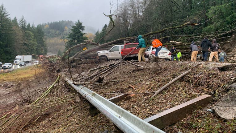
Photo: Washington State Patrol
SEATTLE - A map provided by the Washington Department of Natural Resources (DNR) shows areas of landslide susceptibility, with steep banks and cliffs of concern denoted in orange, and areas potential landslides may affect denoted in yellow.
The database was compiled using information from the Washington Geological Survey’s landslide mapping protocol in 2017.
Interestingly enough, FOX 13 headquarters is located in one of these landslide pockets, which extends from our parking lot up to Aurora Bridge. The danger comes from a steep wall along Aurora Avenue, which runs a certain risk of coming down and causing a landslide in Westlake.
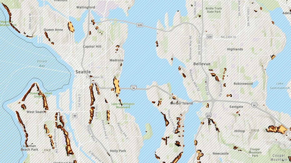
Snapshot of the Seattle-Bellevue area in DNR's landslide map. (Washington Department of Natural Resources)
In the Seattle area, most prominent areas are along the coast in Magnolia, West Seattle, Mercer Island, East Renton Highlands and the mountains surrounding Issaquah.
Other notable areas include Enumclaw Chinook Pass Road just south of Grass Mountain, Enumclaw Mountain, the mountains surrounding Kummer and Green River, and a smattering of landslide pockets in the Mt. Baker-Mt. Larabee area.
You can view the full map on the Washington Geologic Information Portal website.
RELATED: Issaquah roadway closed due to landslide
MORE FROM FOX 13 WEATHER:
DOWNLOAD: FOX 13 Weather and News Apps
WATCH: Forecast and Radar
READ: Closures and Delays
CHECK: Latest Weather Alerts and Live Traffic Map
INTERACT: Submit your Weather Photo
DAILY BRIEF: Sign Up For Our Newsletter
FOLLOW: Lisa Villegas, Erin Mayovsky, Brian MacMillan, Abby Acone and Scott Sistek