Winds start to relax as we get ready for the first frost/freeze of the Fall season
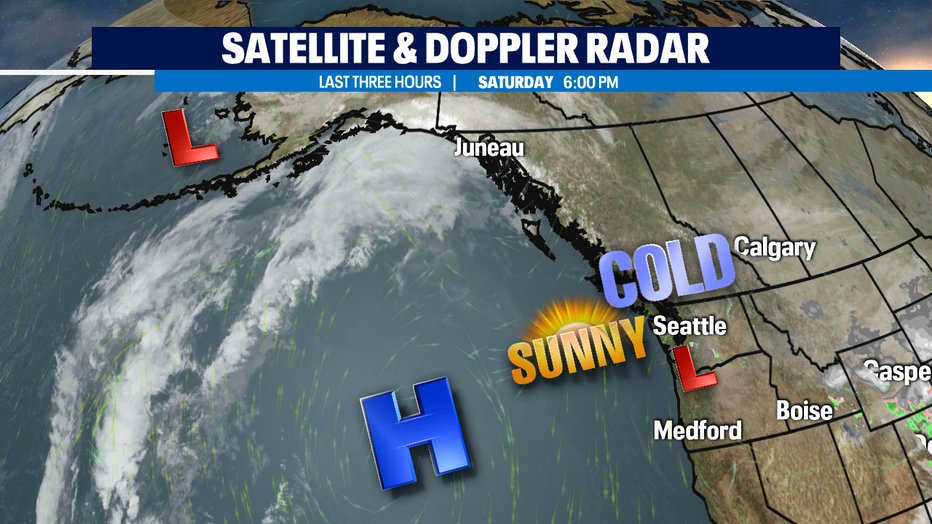
SEATTLE - What a gorgeous afternoon across Western WA! Skies were blues with breezy to windy conditions and tempertures pretty cool, only in the low to mid 40s. Normal for this time of year is 57 with our average low dropping to 44 overnight. We'll be much cooler than that for most of Puget Sound. In fact, most of us will see the coldest temperatures yet of this fall season. Lows will drop dramatically into the upper 20s to near freezing triggering a "Frost Advisory" from 2am-10am Sunday. A "Freeze Watch" also is in place for Sunday night into early Monday morning. Areas to keep an eye on are SW WA to the coast and south into Oregon.
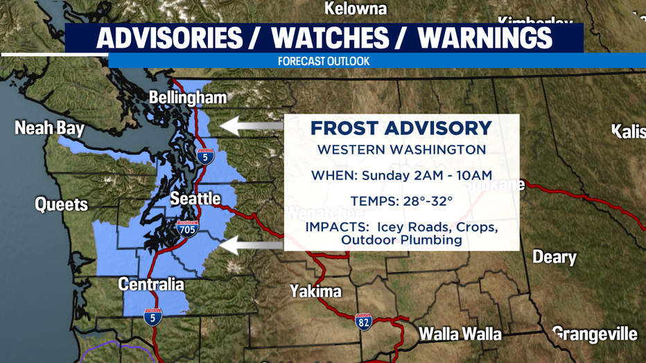
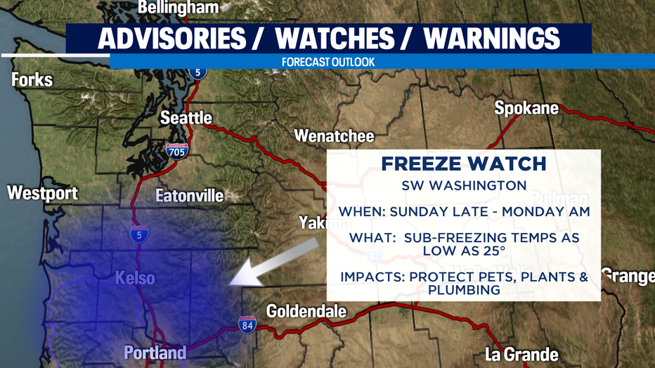
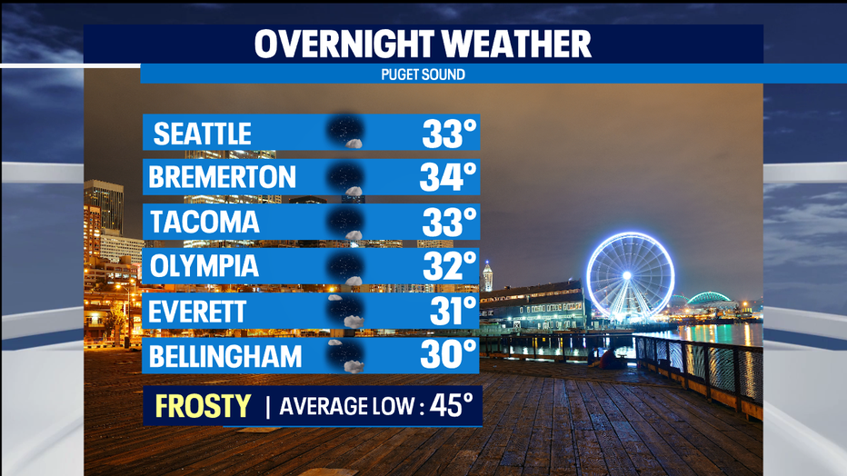
Drier air is setting into the area and our cloud cover will slowly start to break apart tonight giving way to mostly clear skies. Our wake-up weather will be very chilly Sunday and Monday. Any rain/water left on streets or yards of shaded areas will not be able to completely dry out so keep an eye out for icey and slick roads. Also, protect pets, plants and pipes as temperatures take a deep dive into the upper 20s to low 30s.
Also, mountain pass travel could be dicey with very slippery roads. Temperatures tonight will fall into the mid to upper teens for Snoqualmie and Stevens Passes. Sunday, look for beautiful blues skies over the Cascades with a freezing level near 1,500ft. Highs will only climb just above freezing for Snoqualmie with colder highs at Stevens in the upper 20s.
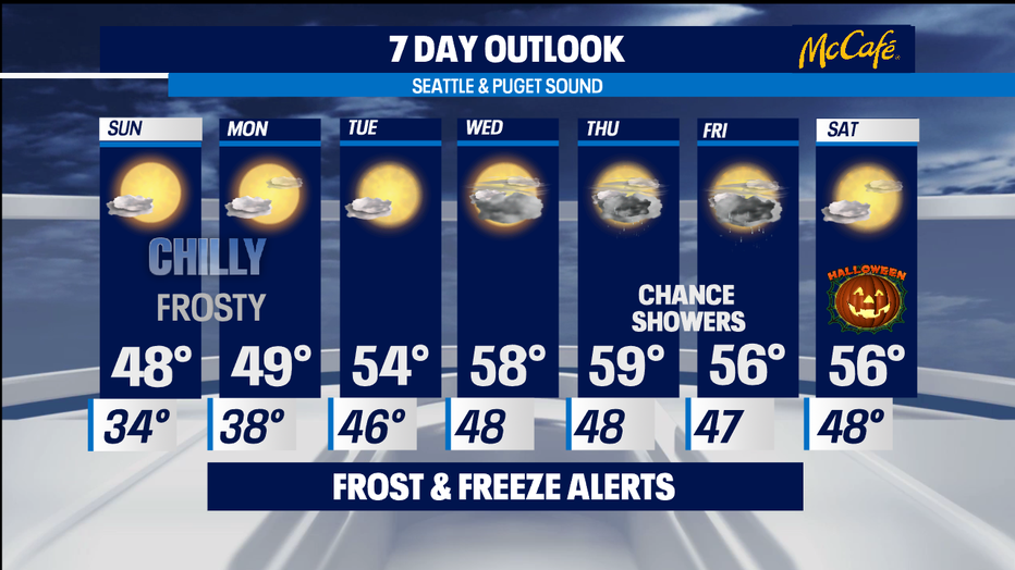
Back down in the lowlands highs will only make into the mid to upper 40s Sunday and Monday. Overnights will jump into the upper 30s Monday night. By Tuesday sunshine will still dominate our forecast with temperatures pushing into the mid 50s. Wednesday expect even warmer highs, slightly above average, in the upper 50s.
Towards the end of the week, Thursday, Friday, and Saturday, we could see a chance of showers with a mostly cloudy days. Highs Thursday near up60 with Friday and Saturday dropping to the upper to mid 50s. Overnights will hang in the upper 40s just above normal.
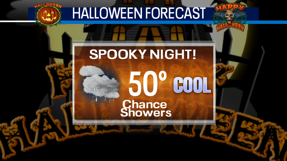
So what does this mean for Halloween 2020? At this point we have a shot at of seeing some dry conditions with just a few showers, but we'll be able to get a better handle on the forecast as we get closer to Saturday. Stay tuned for now!
Have a great night! ~Erin
_________________________________________________
- Erin Mayovsky, Q13 Forecaster
Twitter: @ErinMayovsky
FB: /ErinMayovsky
Instagram: @ErinMayovsky
_________________________________________________