

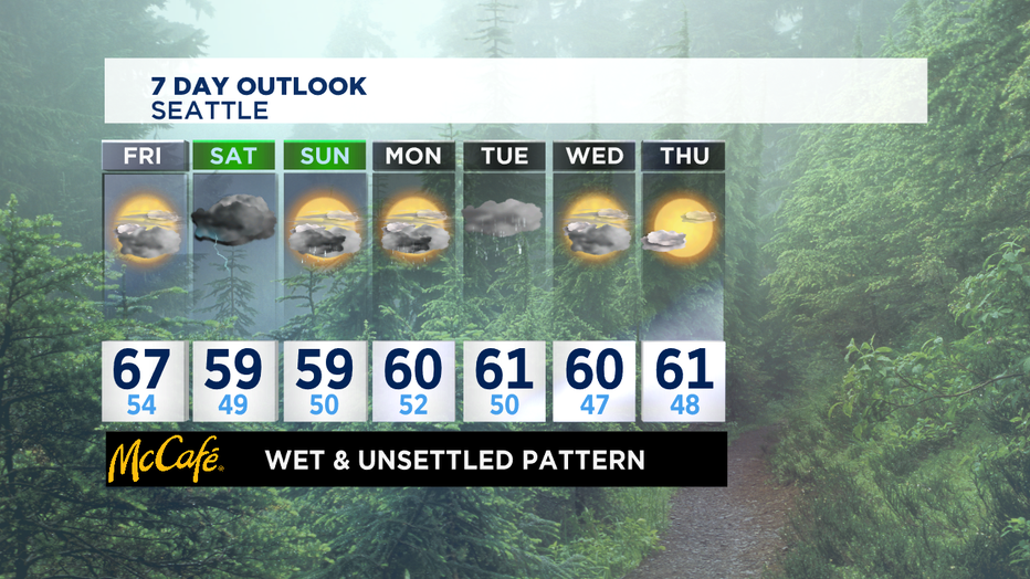
Wet and unsettled weather pattern through the weekend
SEATTLE - *"SOG"tober IS ON THE WAY*
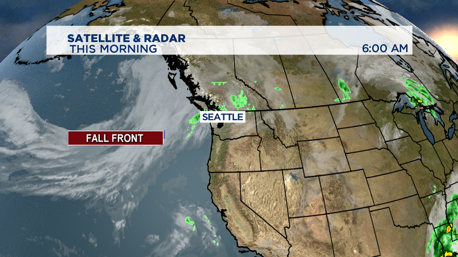
Happy Blue Friday! We're tracking some light rain in the NW part of the state this morning associated with a stalled front. Our main focus is a pair of cold fronts that will pick up winds this afternoon, bring us rain and cooler temperatures through the weekend.
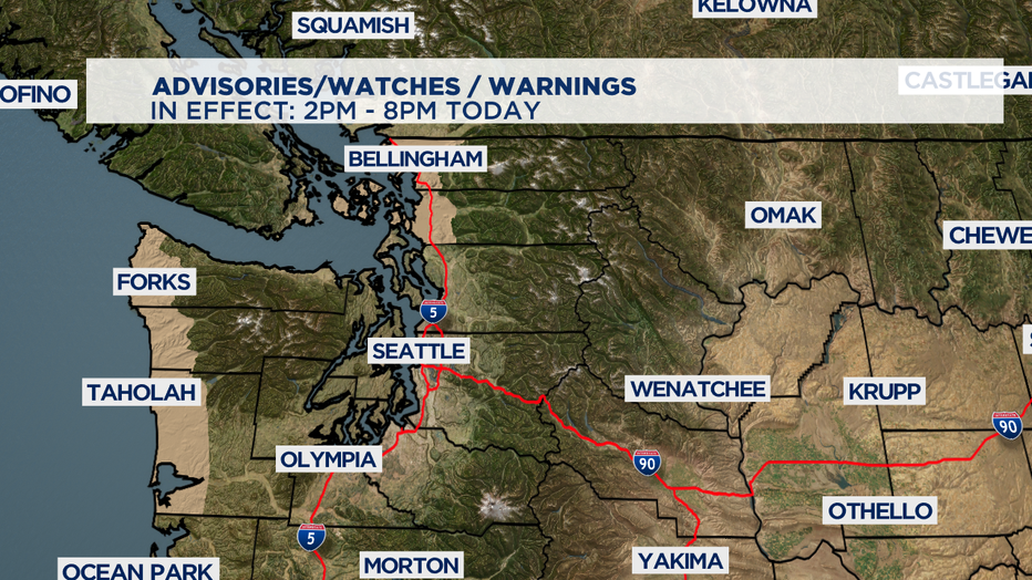
*WIND ADVISORY*
In effect for our coastal counties and northern counties of Whatcom, Skagit, and San Juan from 2pm-8pm. South gusts of up to 50mph are possible. This can blow around unsecured objects, tree limbs could be blown down, and a few power outages are possible.
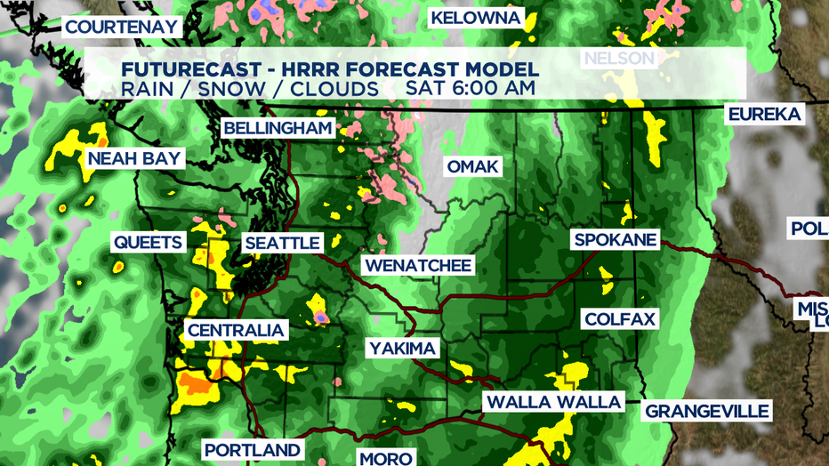
*TIMING OF THE RAIN*
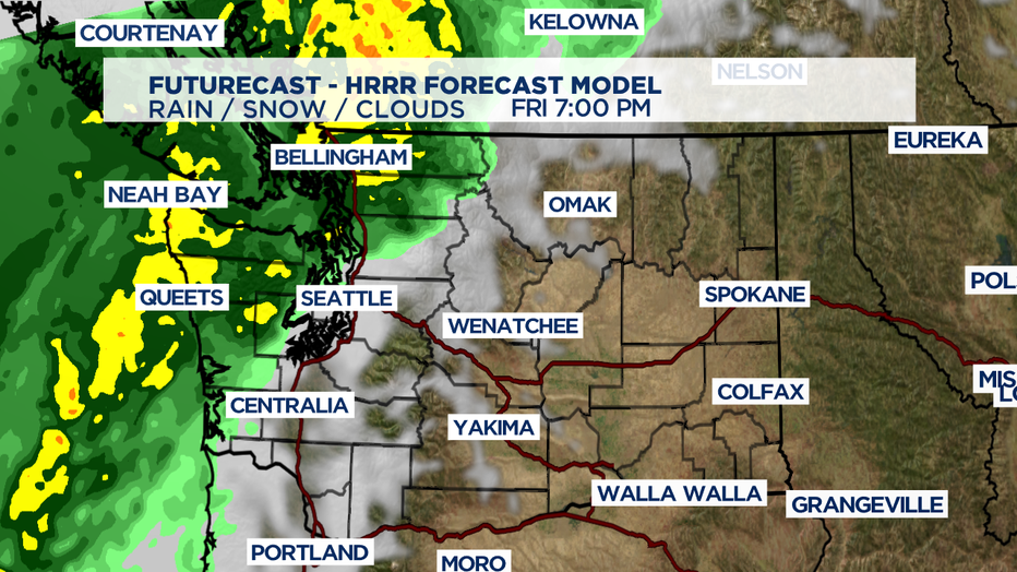
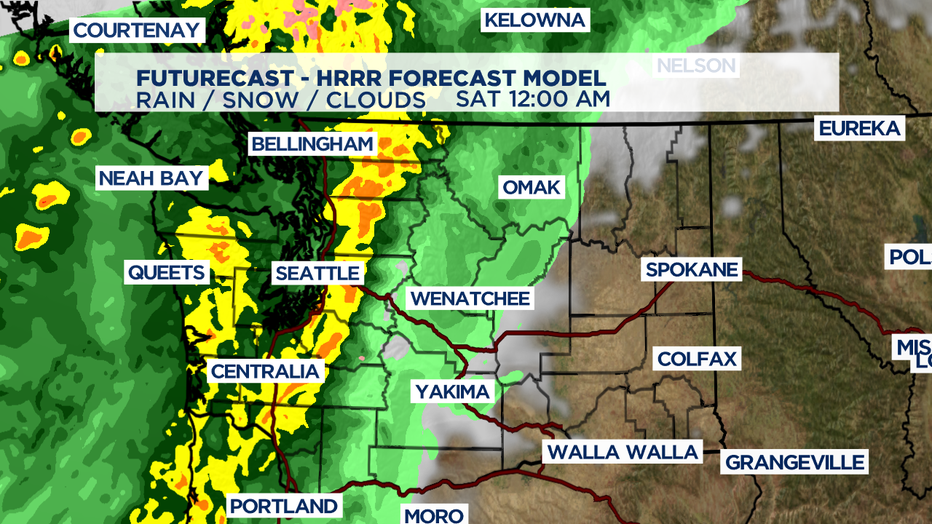
Cold Front #1: Expect rain from west to east starting this afternoon and lasting through tonight. Elevated winds and moderate rain will arrive around 2pm today for the coast and spread into the Peninsula and our northern counties of Whatcom and Skagit through around 7pm. Moderate to heavy rainband will move inland into the Sound bringing widespread rain across Western WA late tonight. Overnight, the front will move into the foothills.
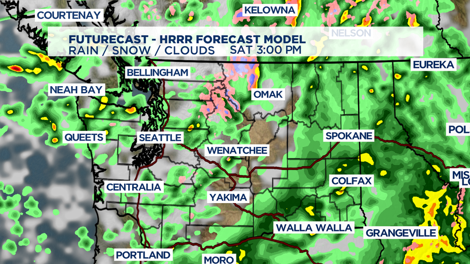
Cold Front #2: Another band of rain will approach Saturday morning bringing another round of rain. There is a chance for isolated thunderstorms Saturday afternoon. Remember: When thunder roars, go indoors. There is also a chance for snow showers in the North Cascades and high mountain tops as snow levels drop to around 5,000'. Rain chances will become more scattered in nature by Sunday. There may be a few showers for the Seahawks game.
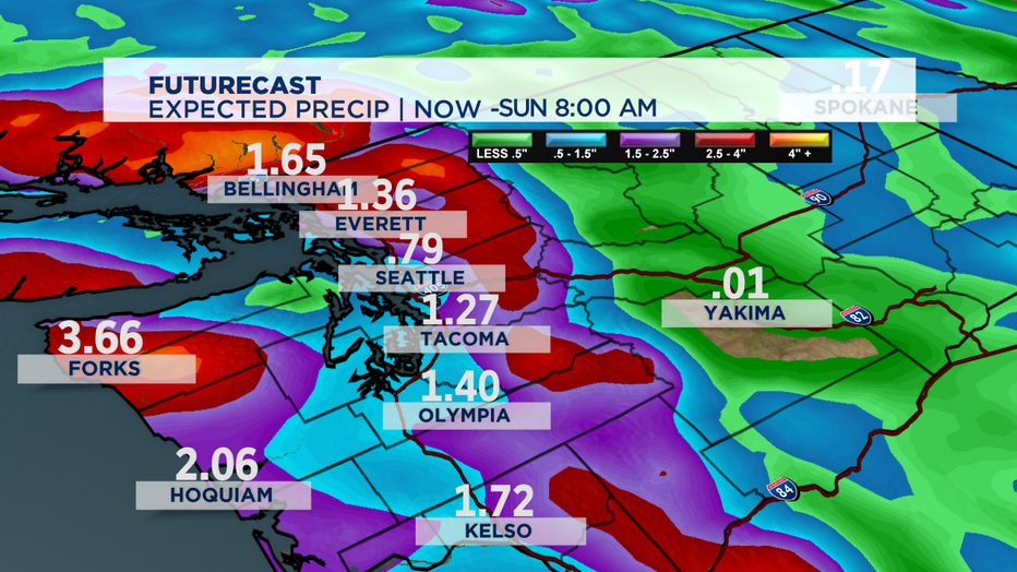
*RAINFALL TOTALS*
Higher amounts of 2-3" will be on the coast through Sunday morning. Our inland locations can pick up around an inch to an inch and a half of rain, but higher amounts locally are possible where t-storms set up.
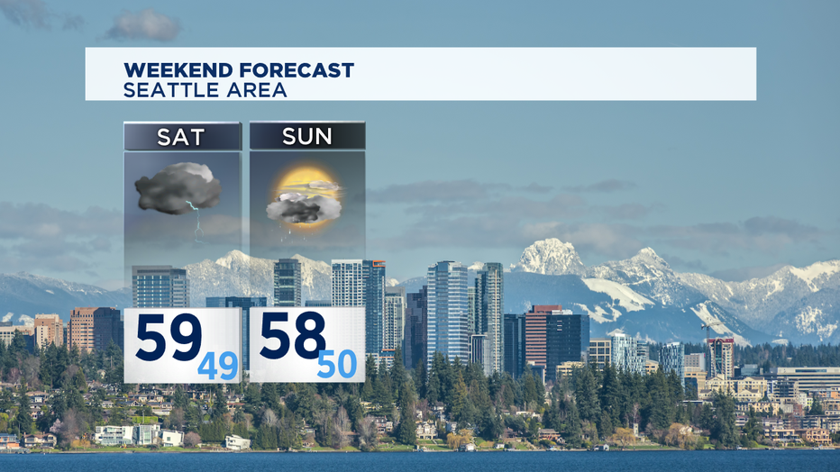
*COOLER TEMPS THIS WEEKEND*
Today, highs will be around 67 degrees. With the passage of the back to back cold fronts, highs will only top off in the upper 50s over the weekend and low temps around the upper 40s. Average for this time of year: High 62, Low 47.
*NEXT WEEK*
Lingering showers on Monday and another system arrives Tuesday, bringing rain and breezy conditions. Rain chances will taper off Wednesday and it looks like we dry out by Thursday with some sunshine. Temps will be near the seasonal norm with highs in the lower 60s and lows in the upper 40s and lower 50s.
Have a great day!
-Q13 Meteorologist Grace Lim