

Welcome to Decemberrr
SEATTLE - The dry December weather we're seeing around our region comes at a cost: cold temperatures!
Today we're starting out frosty and foggy in many areas. And while the sun will emerge for most of us this afternoon our high temps will only make it into the low 40s. That will make for the coldest afternoon we've seen so far this fall and early winter.
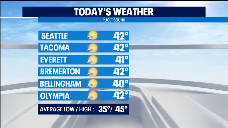
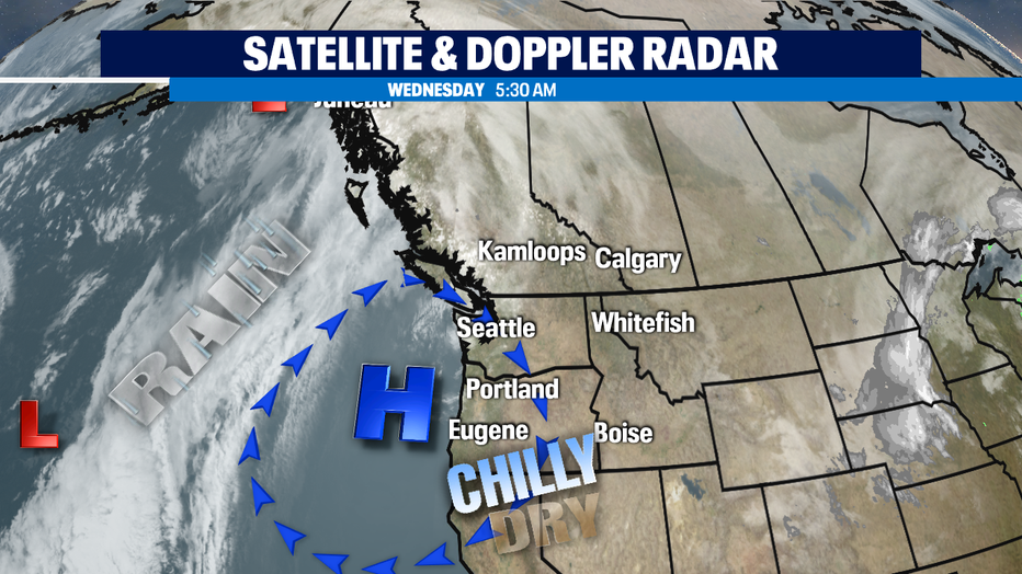
Tonight where we see clear skies our temps will fall into the mid to low 20s in parts around Puget Sound. On the east side of the Cascades, we could see temps in the teens and single digits! Brrrrr. The high pressure ridge sitting over us keeps us dry today and tomorrow, too.
The next weather system offshore will start to bring in south winds. That will help warm up our Thursday temps a bit into the seasonal mid 40s. High clouds start to move late in the day on Christmas Eve.
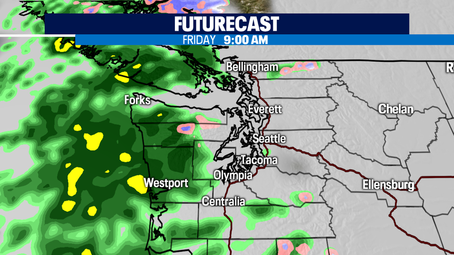
On Christmas, it looks like the precipitation will arrive into Puget Sound by mid-morning. That will mean it starts for just about all of us as rain. If the front comes in sooner, we could see a rain/snow mix in a few places, but it's all rain by the afternoon.
A soggy Christmas night and a soggy Saturday are ahead. This will mean some more mountain snow for our passes and resorts. Not huge amounts, but some nice powder. More of an on/off shower pattern expected to bring a few raindrops for the Seahawks game.
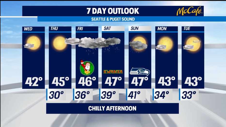
We look to dry out for Monday and most of Tuesday, but some of the forecast models are suggestion some mid-week rain for next week. Stay tuned. -Tim Joyce