

Weekend weather whiplash as we jump to summer-like temps
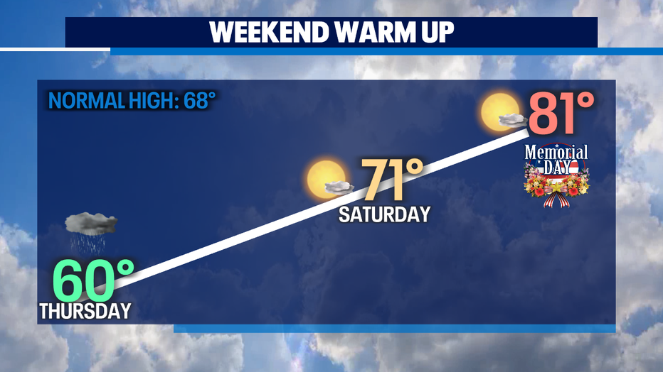
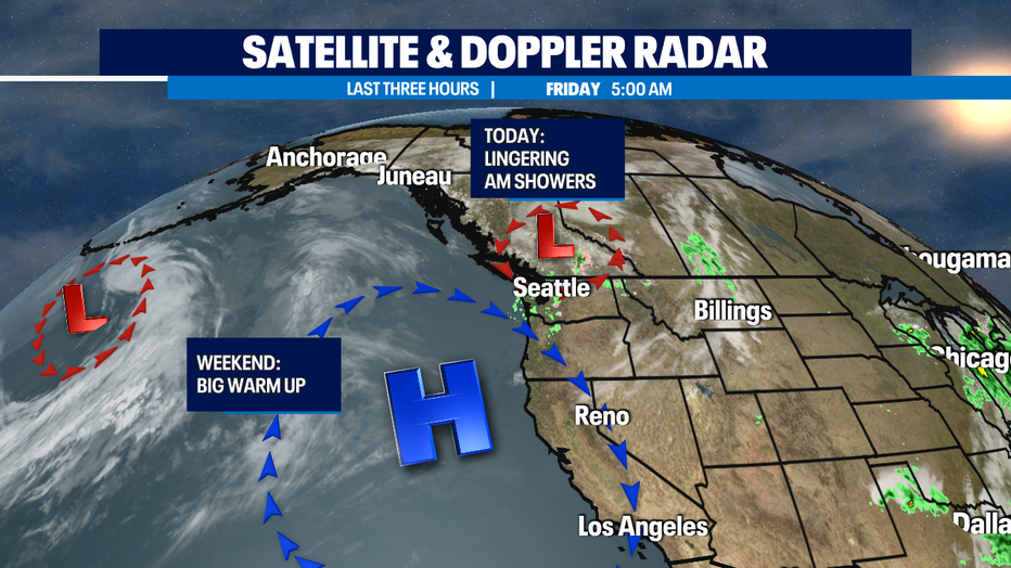
SEATTLE - Lingering showers in a few spots this morning. But, today is our transition day to a drier and significantly warmer forecast. Yesterday a soggy blustery high temp got up only to 60. Big changes this weekend as we get to what will end up being the longest stretch of warmth we've seen so far this year. With highs getting to near 80 on Sunday that will last for Memorial Day and several days beyond.
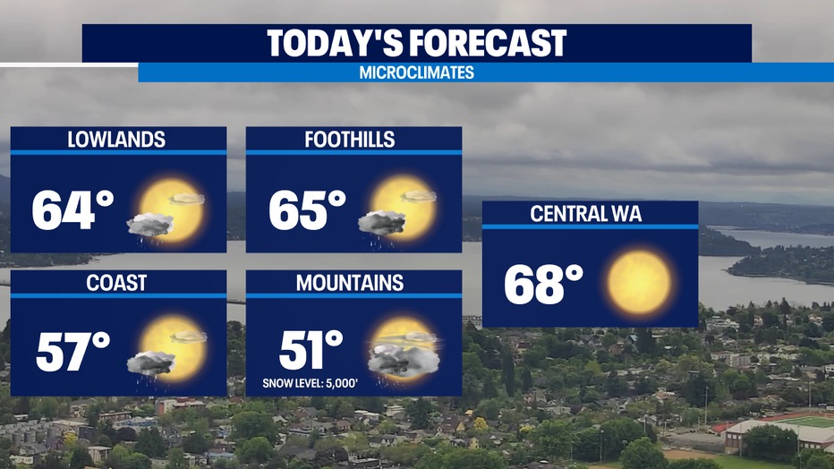
Today some lingering showers and some nice afternoon clearing. Highs in the mid 60s. That's warmer than yesterday, but still chillier than the normal of 68 for this time of year. Showers could linger a tad longer in the Cascades, foothills, and Central Puget Sound than elsewhere. But by late afternoon, everywhere should see nice clearing.
Saturday starts out cloudy with nice afternoon sun and highs near 70. Sunday we'll have high pressure fully build in to help drive in the blue skies and temps that will be near 80 for Sunday through the middle of next week. That's warm for May and early June, but record breaking would be near 90.
Despite the warm air temperatures coming soon -- keep in mind that our area waterways are COLD. Dangerously and deadly cold. Near 50 for Puget Sound / Pacific Ocean, 40s for lakes and rivers fed from snow melt. Cold water shock can kill even the strongest swimmers. In fact, the more fit you are the faster the water will sap the heat from your body. Hypothermia can happen in a matter of minutes. Nearly every drowning death is a preventable death.
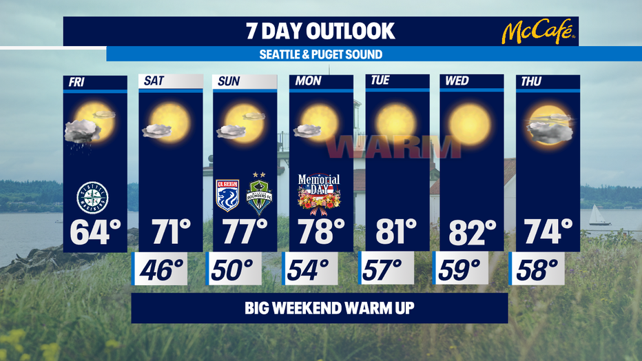
First raindrops of June look to arrive late Wednesday/early Thursday. Still too far out to know timing for sure. Stay tuned. -Tim Joyce
Q13 WEATHER RESOURCES:
DOWNLOAD: Q13 Weather and News Apps
WATCH: Forecast and Radar
READ: Closures and Delays
CHECK: Latest Weather Alerts and Live Traffic Map
INTERACT: Submit your Weather Photo
FOLLOW: Lisa Villegas, MJ McDermott, Tim Joyce, Erin Mayovsky, Grace Lim and Scott Sistek