

Warmer, wetter and muggier weather ahead
SEATTLE - Clouds rolled in late yesterday and will be with us most of the day today. A lot of the incoming front that will mostly stay off shore -- but we could get a bit of wet commute for an hour or so with some light steady rain around the Central Puget Sound for an hour or so.
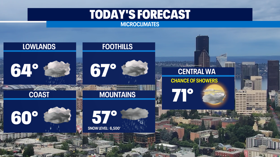
By the afternoon we'll be mostly cloudy with some on/off showers. Today will be the chilliest day of the next 7 with highs in the mid 60s. Normal is 70 for this part of June.
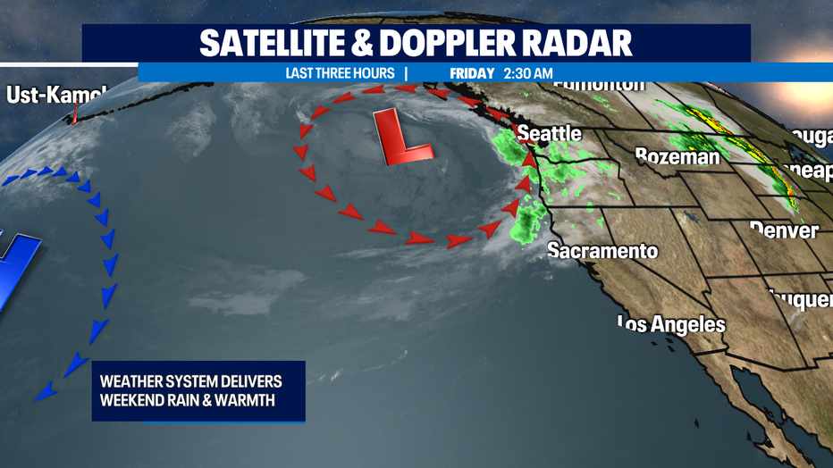
The low offshore will stay offshore for most of Saturday, so we'll see some on/off showers -- and most of us could end up totally dry -- but our temps will jump up about 5-10 degrees for most of us around Puget Sound. On Sunday that low moves closer and will help bring in southerly flow that could result in feeling a bit muggy around here along with some very soggy conditions Sunday afternoon/evening into Monday.
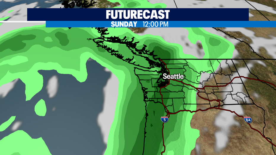
Sunday looks wetter than Saturday, especially by the afternoon. Rain at times continues overnight into Monday the moist air mass could make things a tad muggy. Some lingering showers Monday into Tuesday.
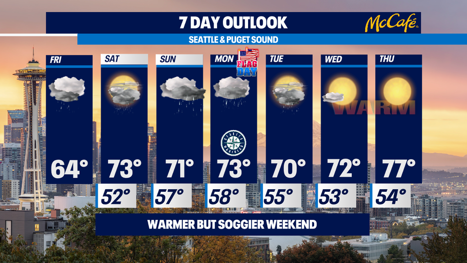
By the middle of the week, we'll see more spring sunshine and keep those temps in the seasonal 70s. Maybe even some 80s late week, stay tuned! -Tim Joyce
Q13 WEATHER RESOURCES:
DOWNLOAD: Q13 Weather and News Apps
WATCH: Forecast and Radar
READ: Closures and Delays
CHECK: Latest Weather Alerts and Live Traffic Map
INTERACT: Submit your Weather Photo
FOLLOW: Lisa Villegas, MJ McDermott, Tim Joyce, Erin Mayovsky, Grace Lim and Scott Sistek