Warm with a slight chance for thunderstorms Thursday
Seattle - Fog and low clouds have lifted this Thursday morning with partly to mostly cloudy skies and warm temperatures sticking around the rest of the day.
Other than a few stray showers, most spots in the lowlands and on the Washington Coast will stay dry. Highs will be in the low to mid 70s around the Seattle area.
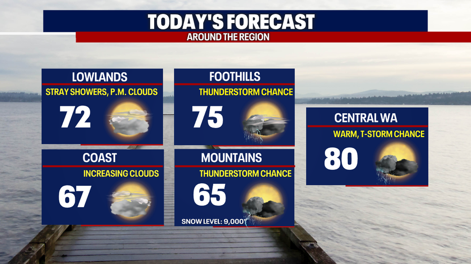
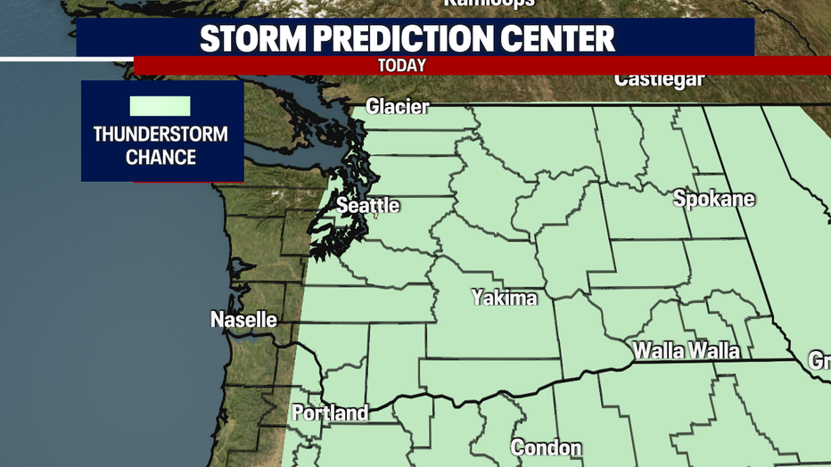
There is a slight chance for thunderstorms for everyone east of Hood Canal in the state this afternoon and early evening. The best chance for thunderstorms will be in the Cascades, the foothills, and Central Washington. 3:00 to 7:00 PM will be the sweet spot for the most active weather.
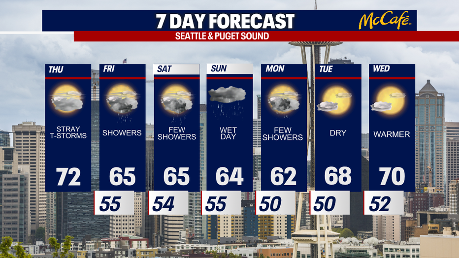
More widespread on and off showers arrive on Friday with cooler temperatures, back into the mid 60s. Sunday will likely be the wettest day of the next seven with cooler than average high temps. If you're looking forward to dry weather again, you'll have to wait until the middle of next week.