

Tuesday: Widespread rain and gusty winds
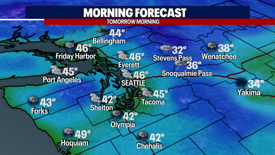
Seattle - It's going to be a chilly night ahead as temperatures fall into the mid-lower 40s. The cloud cover will be thick with showers on and off throughout the night. Isolated thunderstorms will be possible for those in the convergence zone too! That activity will weaken overnight.
Here is a look at your commute forecast:
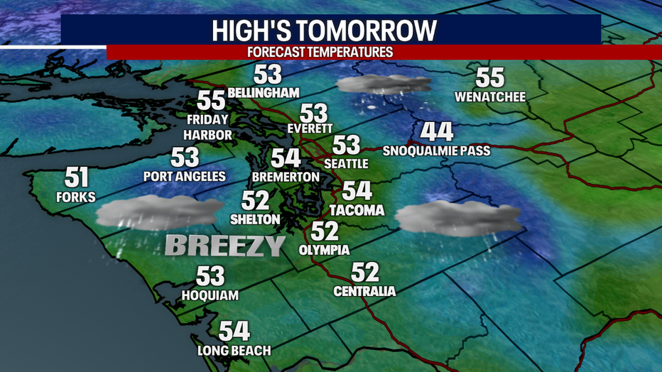
Tomorrow afternoon's commute will be a different story. Expect widespread rain and gusty winds as highs peak in the mid-lower 50s. A new frontal system will approach the area, and we'll be greeted with more accumulation!
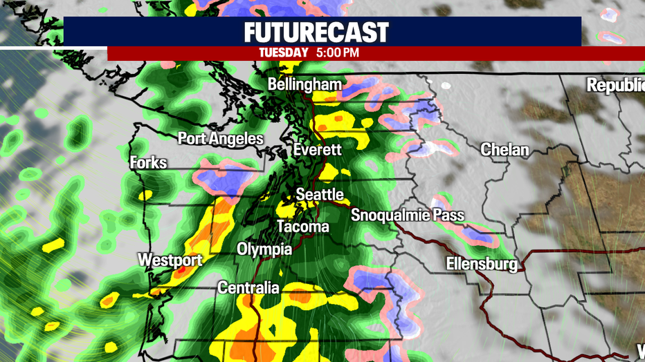
Here is a look at the futurecast showing rain chances increasing around 5pm. Moderate-heavy downpours will be embedded throughout the rain band tracking eastward.
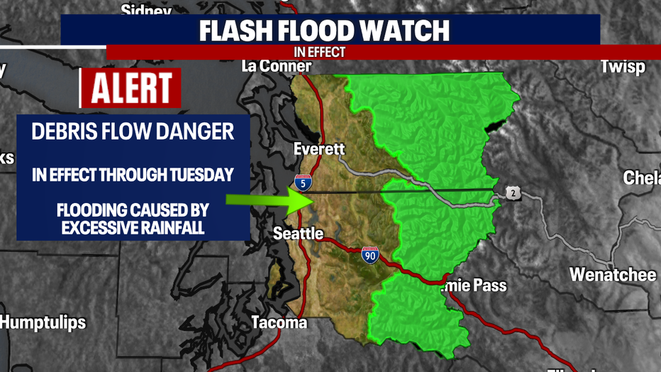
A *Flash Flood Watch* will remain in effect tomorrow due to burn scars from the recent fires in the area. As the rain ramps up, use caution in the area!
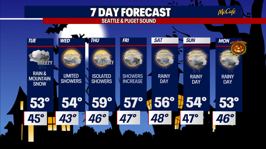
I'll leave you with a look at your 7-day forecast:
Have a good one!