Tracking showers, cooling temps and chances for a wintry mix for the lowlands this weekend.
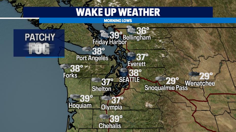
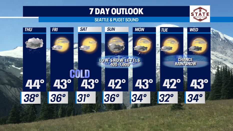
Seattle - Showers move in tonight lasting through Thursday mid-day. Overnights sit near normal, but that won't be the cast as we push into the weekend. Highs will drop below the norm (47) into the low to mid 40s . We're also watching the chances for patchy fog to develop early Thursday, especially for the Cascades which could be dense at times.
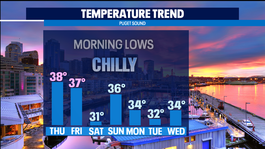
Chilly overnight temps on the way as we push through the weekend into next week.
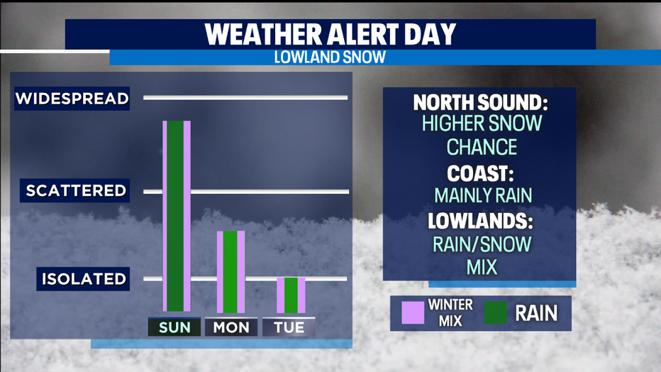
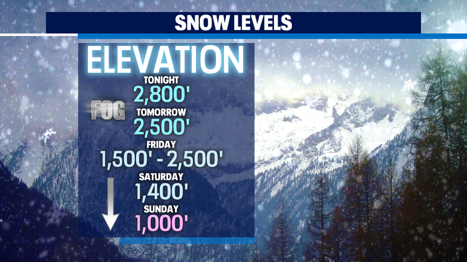
Chances for lowland snow is a possibility for some while others will be left out, seeing just rain. Snow levels fall over the next several days from 2,500' down to 400' by Monday.
So, right now models show the best chance for lowland snow for the North Sound. We're watching Whatcom, Skagit & Snohomish Counties as snow could drop Sunday with chances decreasing into the start of the week. The Central Sound at this point will support a rainy mix with the South Sound seeing rain and rain/snow mix at times. Again, this wintry event is developing, and our team will keep you up to speed as the situation unfolds.
Have a great night and be well! ~Erin
______________________________________________
- Erin Mayovsky, Q13 Forecaster
Twitter: @ErinMayovsky
FaceBook: /ErinMayovsky
Instagram: @ErinMayovsky
______________________________________________