

Tonight's Forecast: Winds and rain taper off
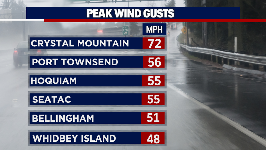
Seattle - It has been an active day! We finished it off with some strong wind gusts across the region. Here is a look at some of the peak wind gusts across Western Washington:
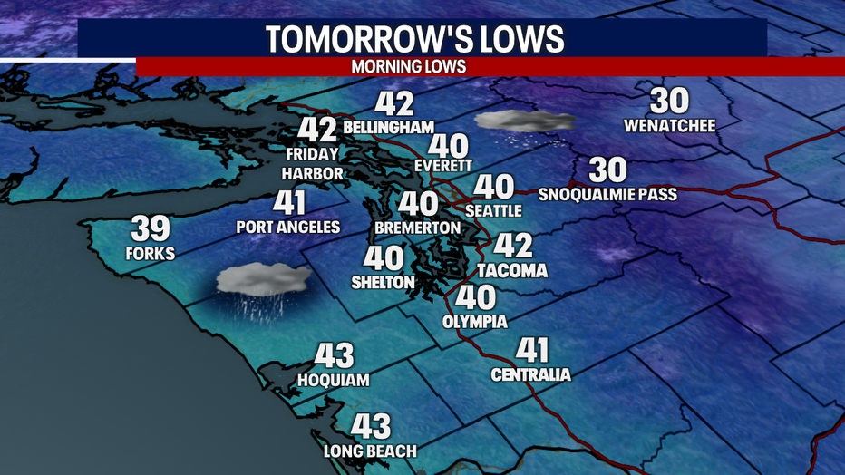
The rain will continue to taper off along with the wind speeds. Temperatures will begin to drop, and we can expect some chilly weather tomorrow morning. Here is a look at your morning lows:
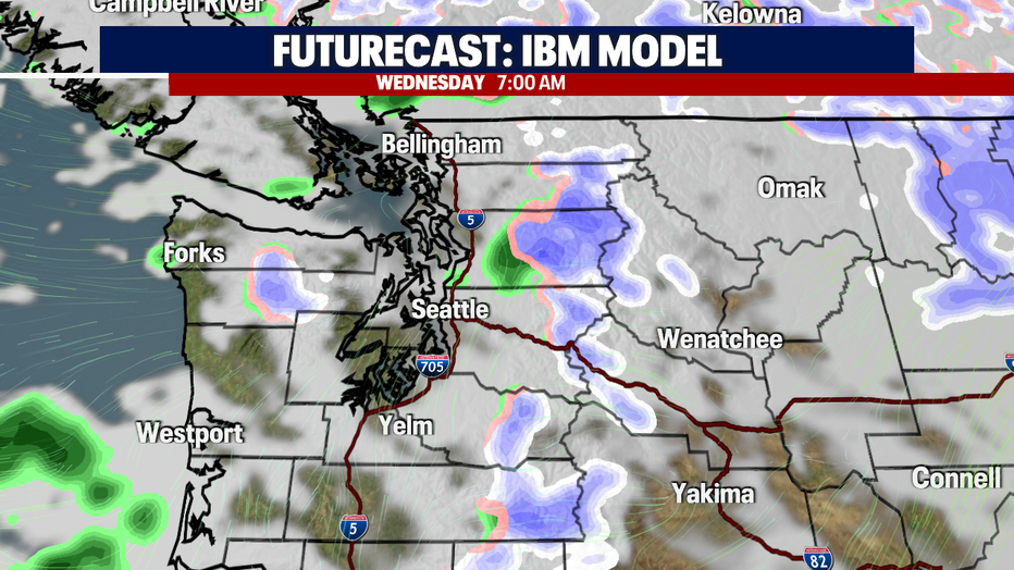
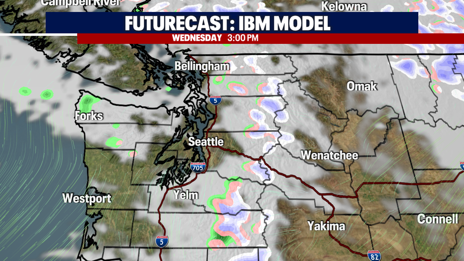
Most of the region received between 1-3" of rain accumulation. The good news is that we will continue to clear out overnight. Expect only a few isolated showers tomorrow. Here is a look at your FutureCast showing the rain chances through tomorrow:
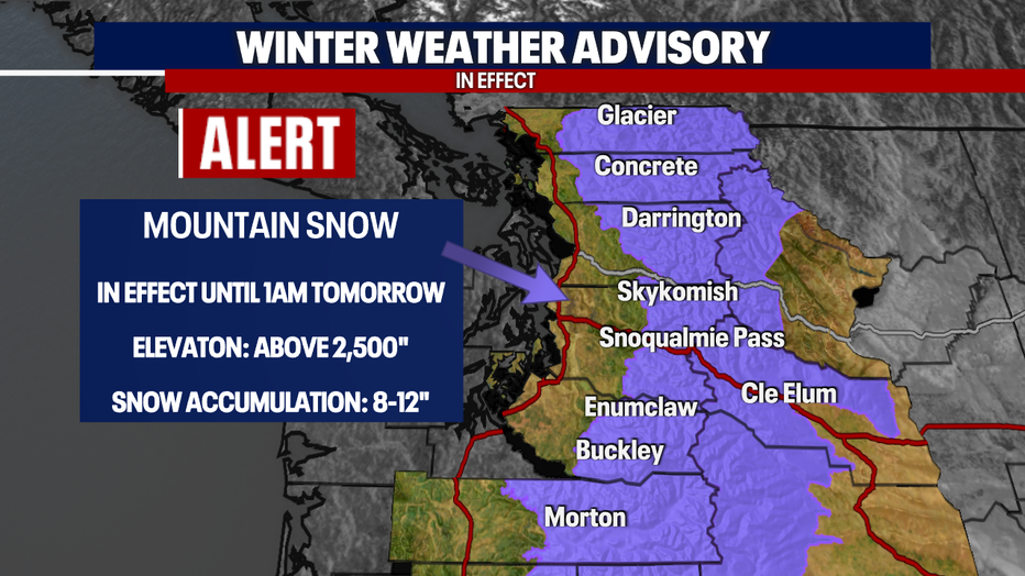
The biggest concern tonight will be the snow accumulation in the Cascades. This is where we have a *Winter Weather Advisory* in place until 1:00 a.m. Wednesday morning. Passes could receive between 8-12" of snow! Watch for pass conditions as they are expected to deteriorate quickly.
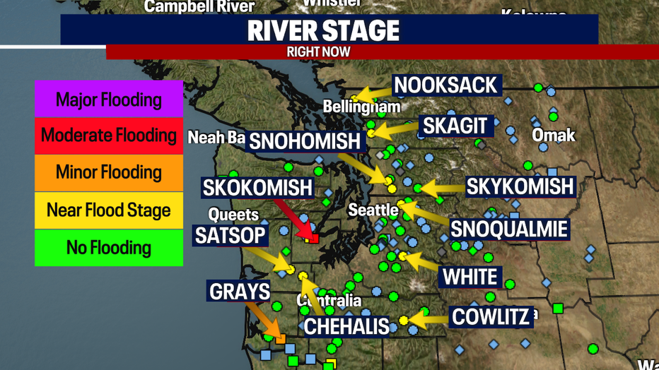
With all the recent rain, our rivers have been cresting. Here is a look at our current flood stage (as of 9:15 p.m.):
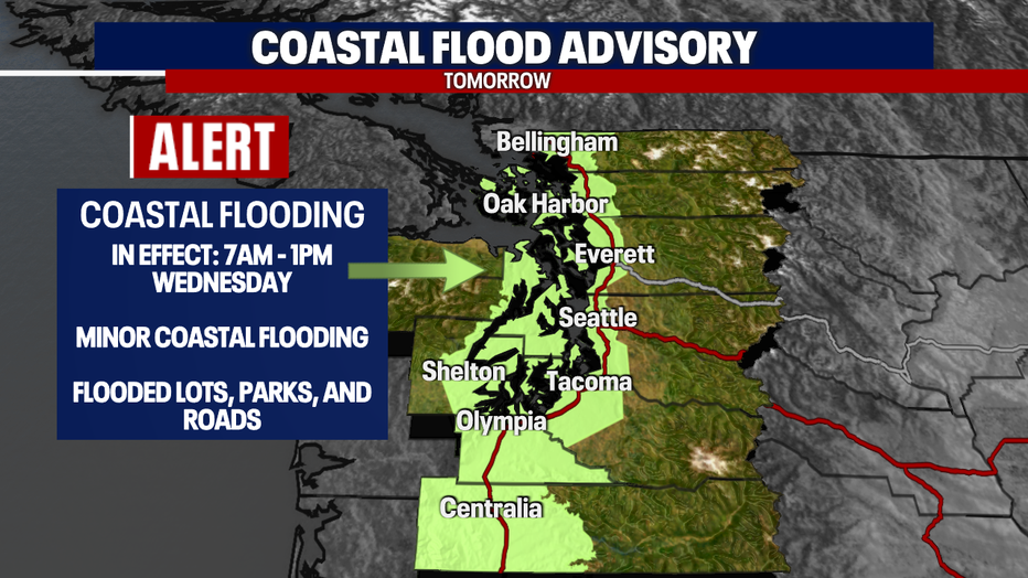
One of the bigger weather issues from earlier today was the coastal flooding. Due to high tides returning again tomorrow, we will be under a *Coastal Flood Advisory* for the Puget Sound. Here is a look at the details:
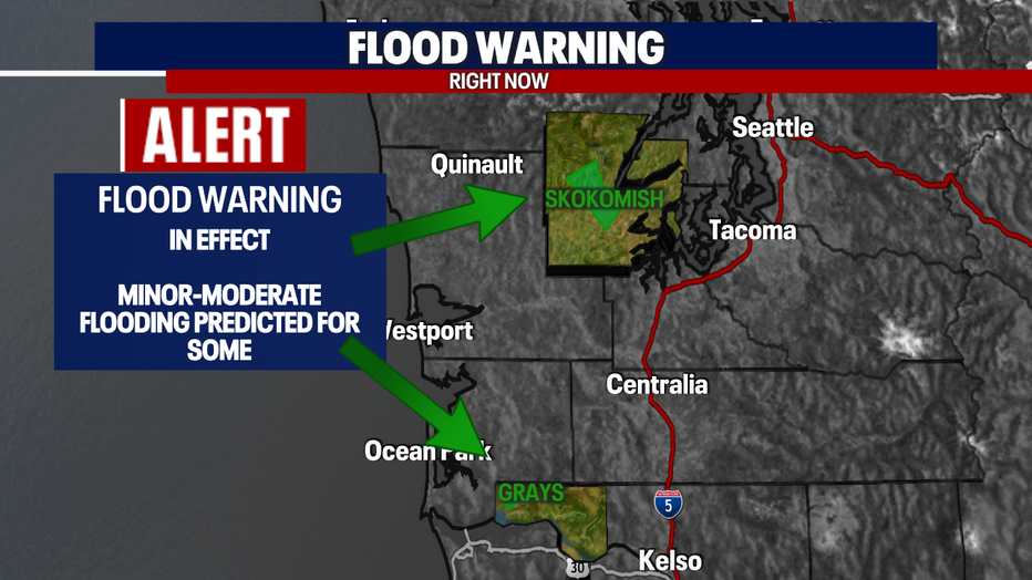
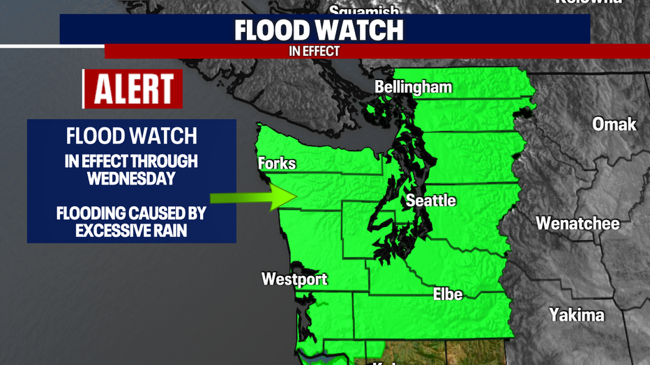
By the way - The *Flood Watch* will remain in effect through tomorrow.
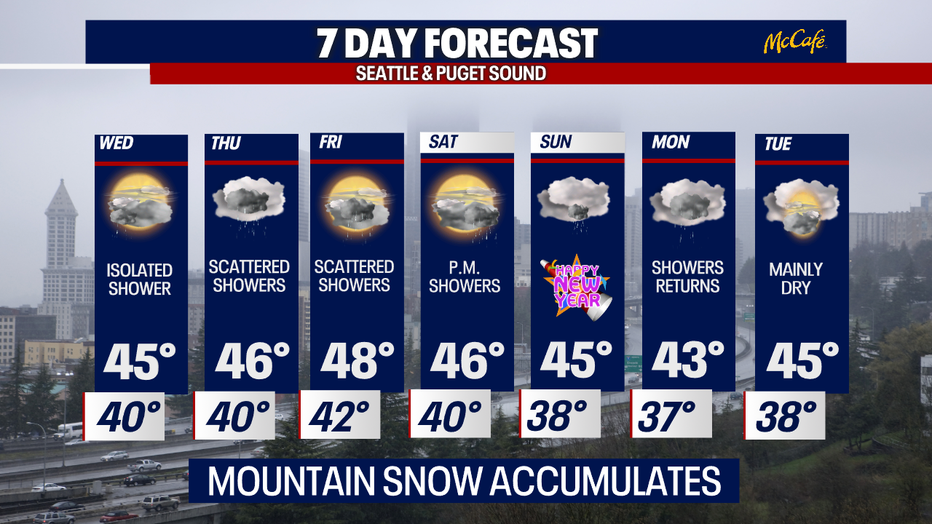
We are still expecting rain in the coming days, but NOTHING like what we just went through. Here is a lock at your 7-day forecast:
Have a good one!