

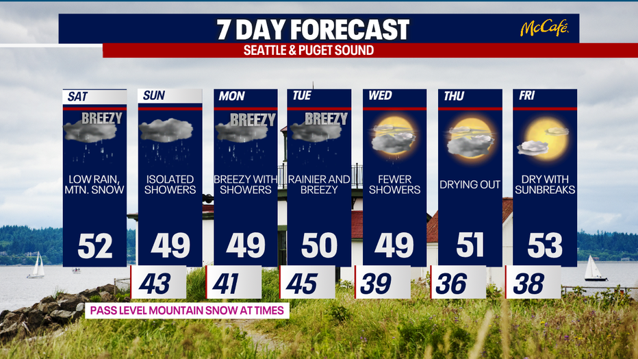
Times of lowland rain, mountain snow this weekend
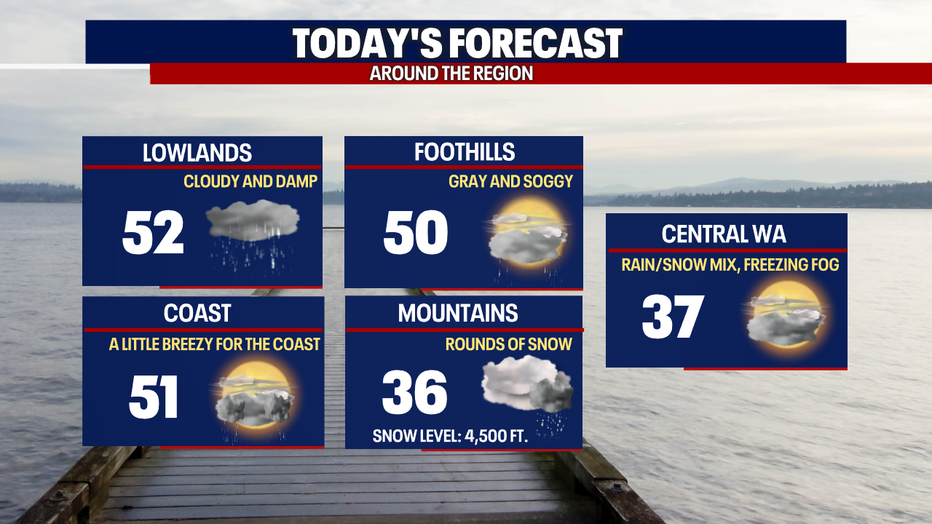
Even though temperatures will be mild today, you can plan on cloudy skies and scattered showers. Over the next several days, there will be times of lowland rain and mountain snow.
Thankfully, winds are much lighter today than what we experienced on Friday. The coast could still see gusts between roughly 15-30 mph, but winds won't be a big deal.
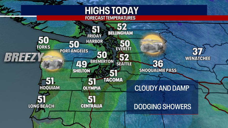
Highs today will lift to about 52 degrees in Seattle with similar temps around the region. Even though highs are slightly above average, it'll feel cooler with the overcast skies and rain.
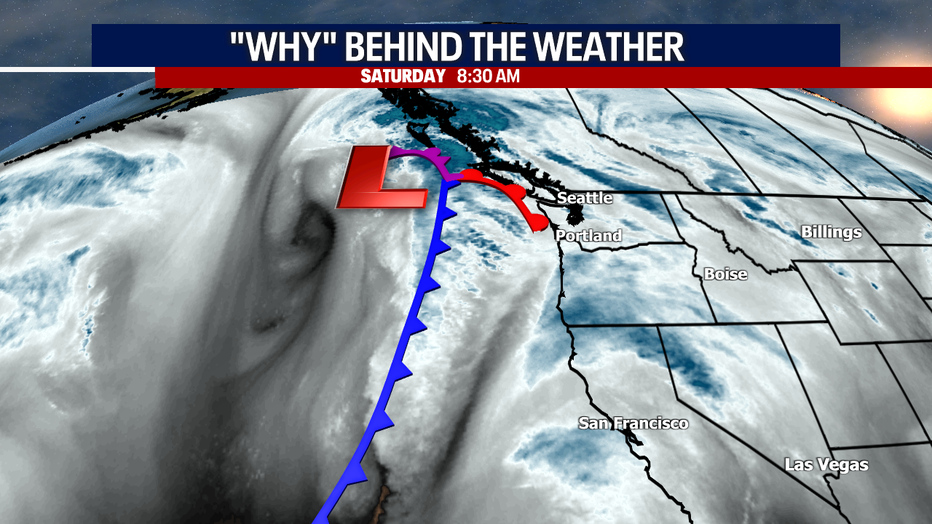
There's a better chance for showers this afternoon and evening. Our "weather maker" today is a warm front that will be moving overhead. It's not very strong, and that's why we're only forecasting gentle showers for the most part.
Over the mountains today and tomorrow, Stevens and White Passes could accumulate between three and eight inches of snow. Snoqualmie Pass should just see rain or a rain/snow mix today with perhaps a little snow tomorrow.
RELATED: Ski Report: Free refills (fresh snow) this weekend in the Cascades
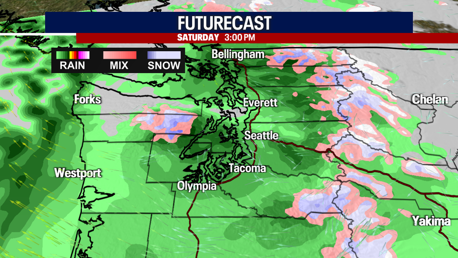
Check out Futurecast here:
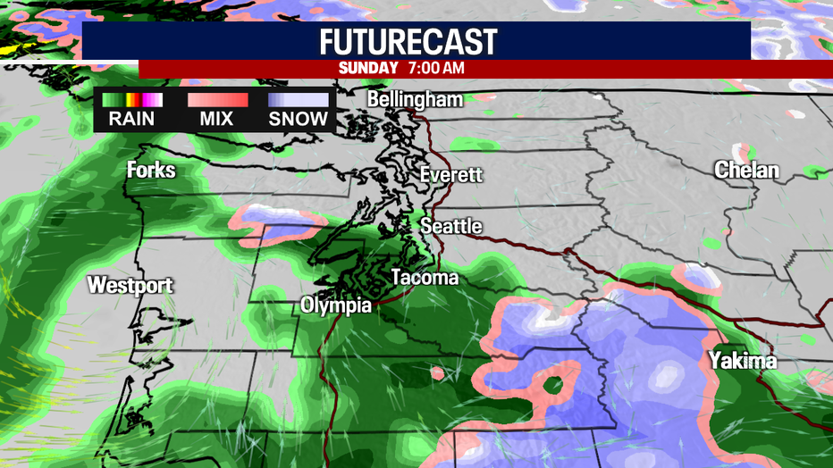
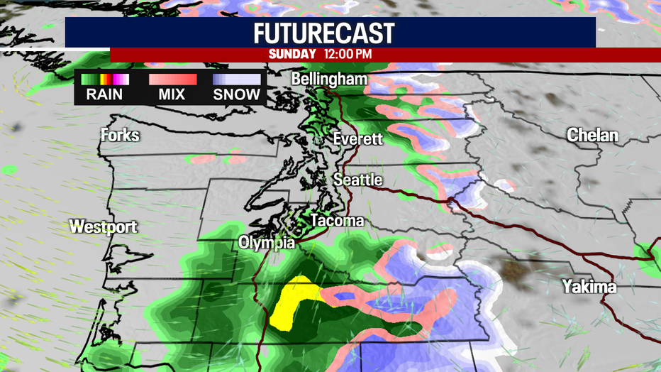
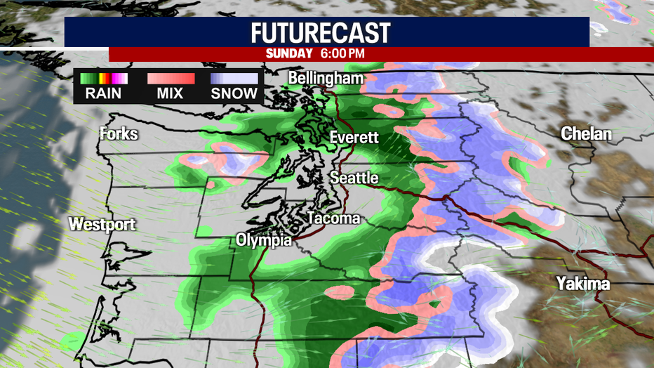
Sunday will offer the chance for pockets of lowland rain and mountain snow. You'll still be dodging showers on Monday as winds pick up in the afternoon and evening. It could stay gusty into Tuesday morning. Tuesday looks to be the wettest day of the next seven days.
Wednesday will be mainly dry with only spotty showers. Thursday looks great with sunbreaks amidst a mostly cloudy sky. We'll get a blast of "false spring" on Friday as highs warm to about 53 degrees with partly sunny skies.
One note: there's a chance that the Skokomish River in Mason County could get minor flooding at some point Monday into Tuesday. Right now, we don't expect any other river flooding in Western Washington this week.
Hope you have a wonderful weekend!
Warmly,
Meteorologist Abby Acone
Follow me on Twitter @abbyacone, Instagram @abbyaconewx, TikTok @abbyaconetv and Facebook (Meteorologist Abby Acone)