Thunderstorms, mountain snow, and strong wind Monday
Seattle - FOX 13 meteorologists have issued a Weather Alert Day for Monday as a strong storm pushes through the Pacific Northwest.
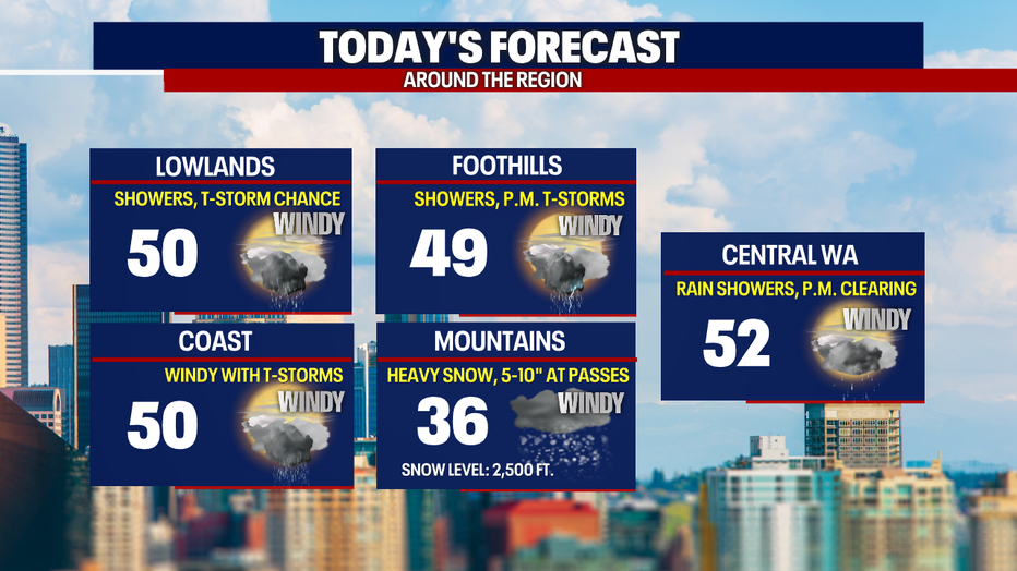
Thunderstorms are moving through the area this morning and will continue to pop up into the afternoon. Some of these storms may become severe. We are also seeing strong, potentially damaging wind gusts in Western Washington.
There is a lot to go over today. Here are the headlines:
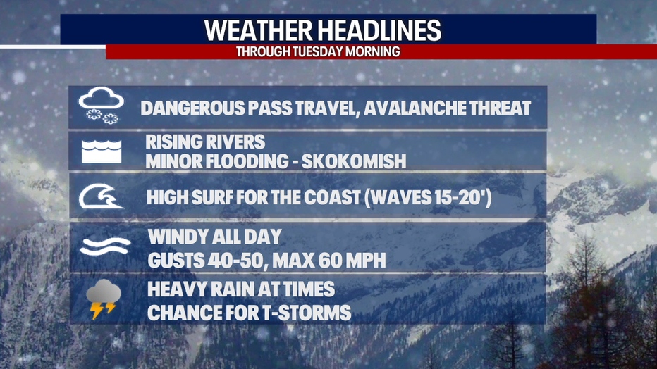
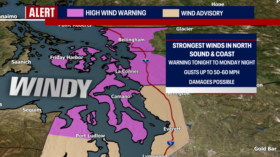
Winds will remain strong and peak again this afternoon into the early evening. Gusts could reach up to 40-50 mph in the central and south Puget Sound areas. A Wind Advisory is in effect in those locations.
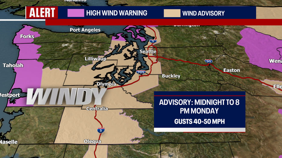
A High Wind Warning is in effect for the north sound and Washington Coast, where winds could exceed 50-60 mph. Early this morning, a 61 mph gust was recorded at the Bellingham Airport.
Snow will also continue to fall at the mountain passes. An additional 4-8 inches could fall the rest of the day at the pass level.
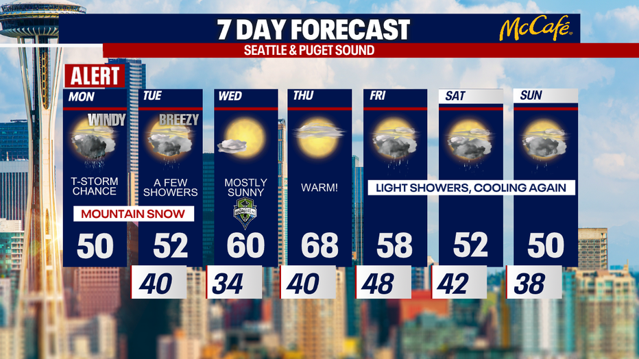
After we get through today, Tuesday will bring breezy, but much calmer weather. After a few morning showers, expect afternoon clearing and lots of sunshine. Wednesday and Thursday look fantastic as high pressure takes over and temps soar into the upper 60s on Thursday. Some spots could hit 70 degrees for the first time this year.
The warm weather will not last though. Friday through the weekend, showers return with much cooler temperatures.