

The fog is back!
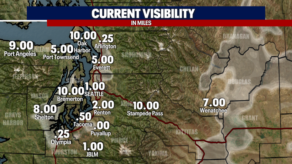
SEATTLE - The fog is returning across the Puget Sound. Visibilities are dropping as the temperatures dip into the mid-lower 30s. Expect some frosty/icy spots late tonight/early tomorrow morning.
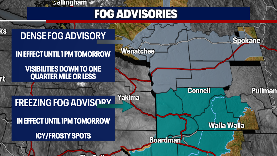
Dense fog and freezing fog advisories are in effect for parts of central and eastern Washington. Visibilities will be reduced down to .25 of a mile along with icy/frost roadways as the temperatures fall below freezing.
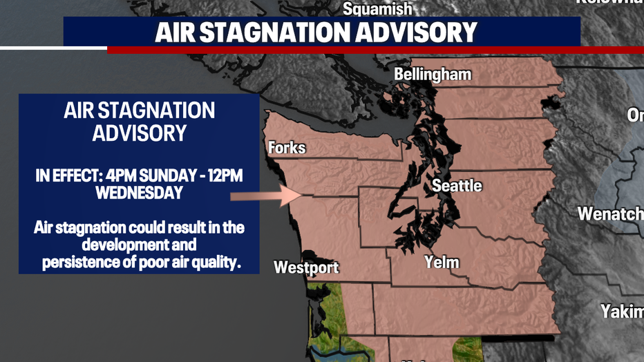
An air stagnation advisory goes into effect later tomorrow afternoon. High pressure won't budge, and we have less mixing in our atmosphere. As the air sits in place, the risk of poor air quality rises. This is something we'll have to watch over the next couple of days.
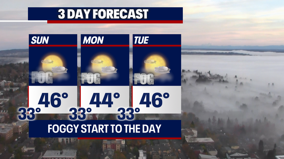
This forecast will be (for the most part ;) ) on repeat through the majority of the week. The fog and cold temperatures will kick of the day, and then the sun will shine through. Highs will be below normal. Typically, we'll be in the upper 40s.
Have a good one!
MORE FROM FOX 13 WEATHER:
DOWNLOAD: FOX 13 Weather and News Apps
WATCH: Forecast and Radar
READ: Closures and Delays
CHECK: Latest Weather Alerts and Live Traffic Map
INTERACT: Submit your Weather Photo
DAILY BRIEF: Sign Up For Our Newsletter
FOLLOW: Lisa Villegas, Erin Mayovsky, Brian MacMillan, Abby Acone and Scott Sistek