Sunshine Sunday then back to a few showers and cooler highs.
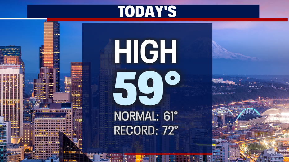
Seattle - A sunny Sunday is on tap after a beautiful Saturday. Highs landing in the upper 50s to low 60s once morning clouds burned off today.
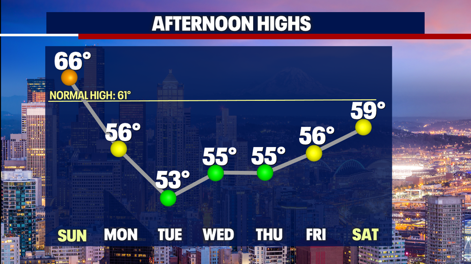
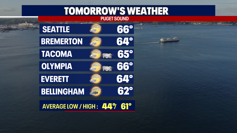
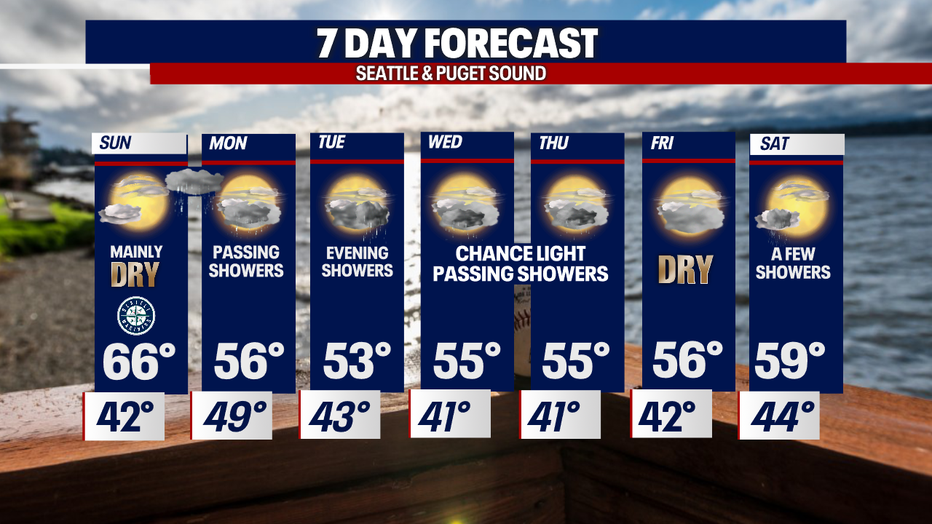
Sunday features more blue skies with highs jumping into low to mid 60s around the region.
The 60+ temps won't last long as temperatures trend back down into the mid to low 50s through much of next week.
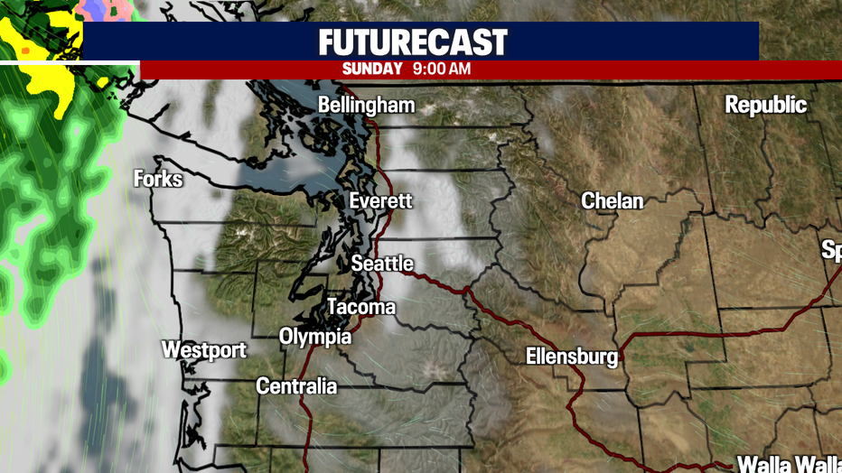
The ridge that's keeping us dry and warmer will slide east tomorrow opening the door for the next system and the return of showers.
Sunday will start out with a little cloud cover and patchy fog for some just as we did Saturday, but by mid-morning most clouds will lift and break apart.
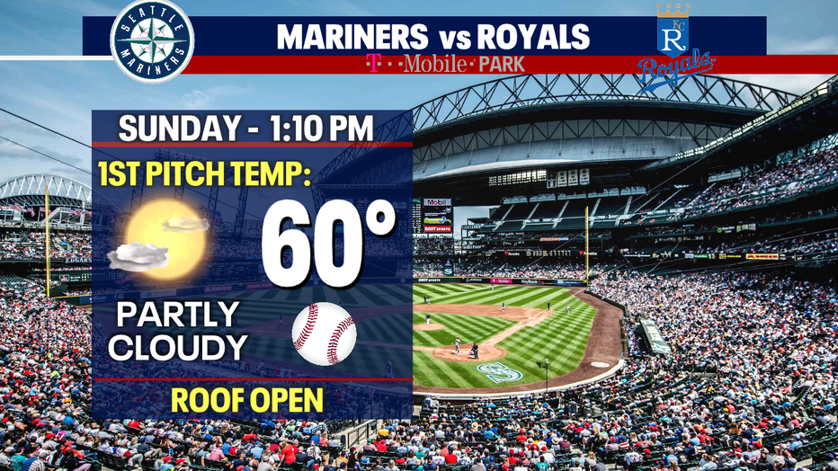
If you're heading to the Mariners matinee match up at T-Mobile Park, the roof will be open. Temps will push into the upper 50s to near 60 for the 1:10pm start with KC.
We'll top out tomorrow in the low to mid 60s around the region. Average for this time of year is 61 and will warm a degree to 62 by Tuesday next week.
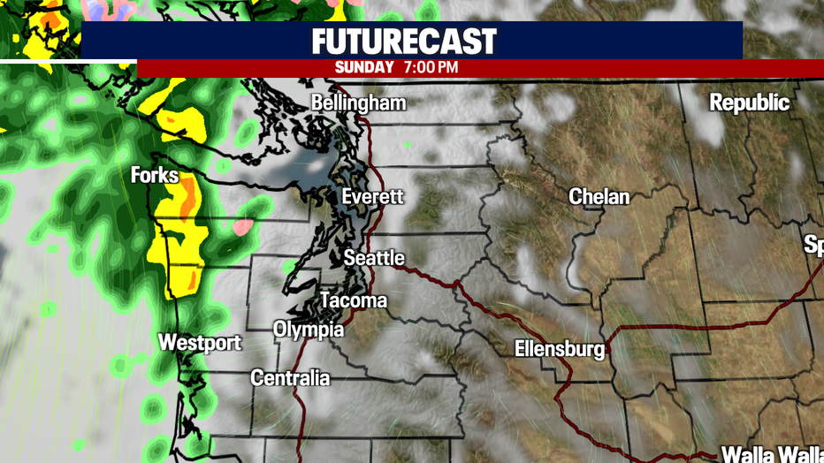
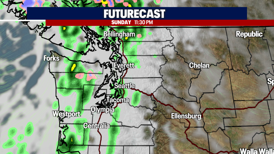
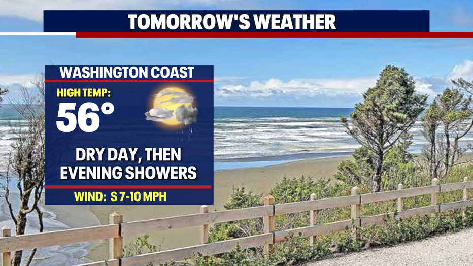
Showers hit the coast first Sunday evening and slowly push into Puget Sound near midnight.
We'll start the work week out with scattered showers Monday as highs will cool back into the mid 50s.
Tuesday, looks dry out of the gate with showers returning around dinner time. Highs drop to near 53.
The rest of the week features light passing showers with highs hovering in the mid 50s, below normal. Enjoy!
Have a great weekend all! ~Erin Mayovsky, FOX 13 Forecaster
*Beach Forecast
*Mountain Forecast
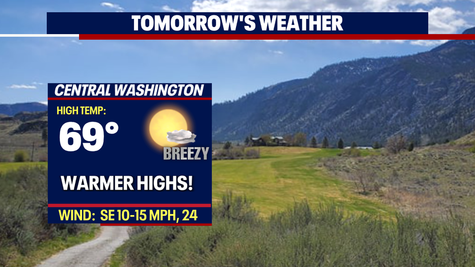
*Central WA Forecast