

Sunshine returns with chilly north wind
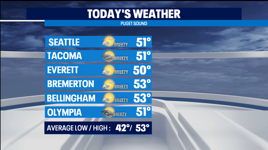
SEATTLE - A weather system moving into Oregon is delivering some morning showers into the SW corner of our state. As it moves to the south, the raindrops will follow. Sunshine will emerge as we get later into the day as well. Temperatures only getting into the low 50s today for most of us.
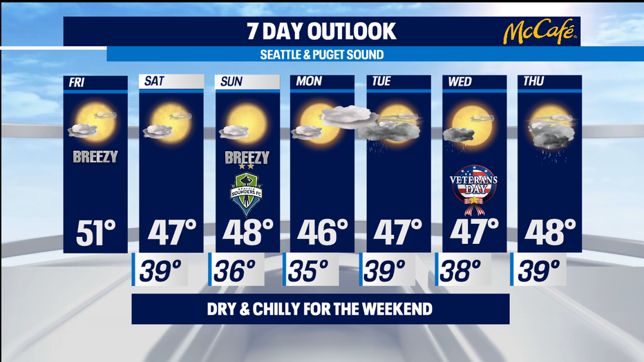
The whole weekend looks to be nice and sunny-- with chilly north winds keeping things brisk. It's a nice treat to have a fully dry weekend during our wettest month of the year. Wind sheltered areas could end up being a bit foggy in the morning. Everyone sees blue skies in the afternoon. The dry weather will allow our the levels on the very flood prone Skokomish River to fall back fully to within its banks.
Highs this weekend will be in the mid to upper 40s and overnight lows will be in the 30s-- but for most of just staying a bit above freezing. Next week, we'll see a NW flow deliver some passing showers at times. The wettest periods look like late Monday into Tuesday. A few early morning Wednesday showers and antother round of some rain on Thursday with seasonal temperatures.
While the outlook for the lowlands next week looks just soggy, the precipitation for our high elevations looks to be a bit more persistent. That means our resorts and passes could catch a lot of accumulating snow next week. -Tim Joyce