Sunshine on tap for Sunday, morning showers returning Monday
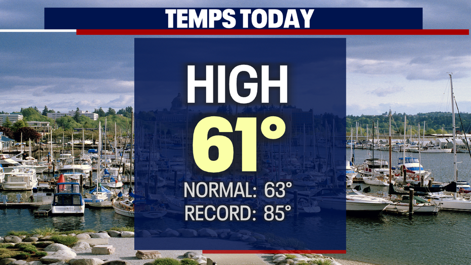
SEATTLE - We're still under an active Spring pattern where skies will continue to vary from day to day! Saturday saw rain, hail, and then clearing for a nice afternoon in the low 60s.
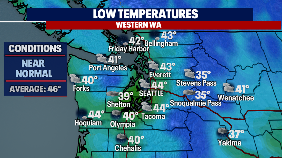
Overnight temperature for Seattle will land near average for this time of year in the mid 40s. We'll see some cooler spots to the south and the NW WA Coast.
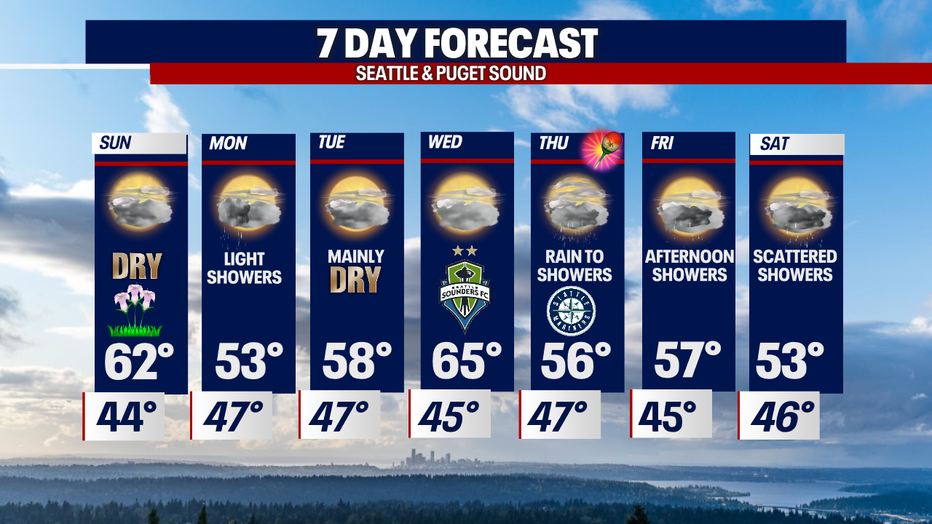
Sunday starts out with low clouds and patchy fog for some, especially over the mountains. By midday clouds will lift giving way to a higher cloud deck for May Day! Temperatures will rise into the low 60s again under mostly cloudy conditions.
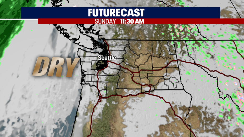
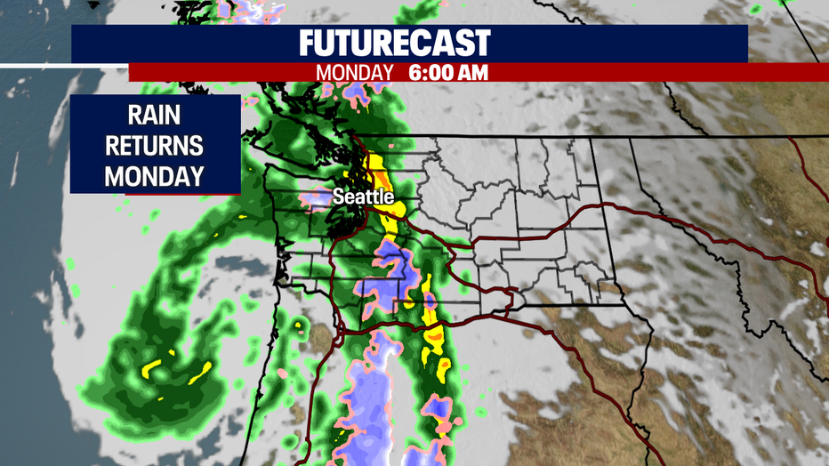
Our nice and dry weather lasts through late Sunday into early Monday. Rain returns for the morning commute with the heaviest showers pushing into the Cascades. By Monday afternoon most activity will turn light and scattered. Highs cool about 10 degrees from some into the low 50s.
We'll keep riding that Spring wave of pleasant, dry days followed by showers with highs bouncing up and down throughout next week.
Tuesday looks mainly dry with warmer highs in the upper 50s. And good news for the Sounders Wednesday.... conditions look very nice for leg 2 of the Concacaf Champions League final at Lumen Field. Highs should ride into the mid to upper 60s. Kickoff is set for 7pm again Pumas. #GoSounders
Rain hits the region again later Thursday with showers hanging around through Saturday. Temperatures cool into the mid to low 50s. Enjoy!
Have a great night all! ~Erin Mayovsky, FOX 13 Forecaster
*Beach Forecast
*Mountain Forecast
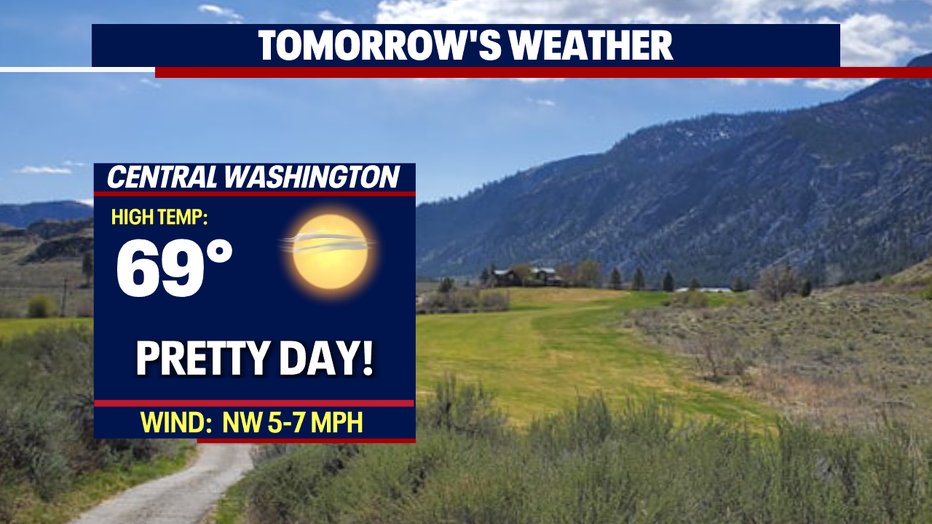
*Central WA Forecast