

Summer showers ahead as temperatures get more seasonal
SEATTLE - If you liked yesterday, you'll love today. But, we've got a pattern shift headed our way that will affect our Northwest weather in the next few days.
GET THE FREE Q13 WEATHER APP FOR SEVERE WEATHER ALERTS
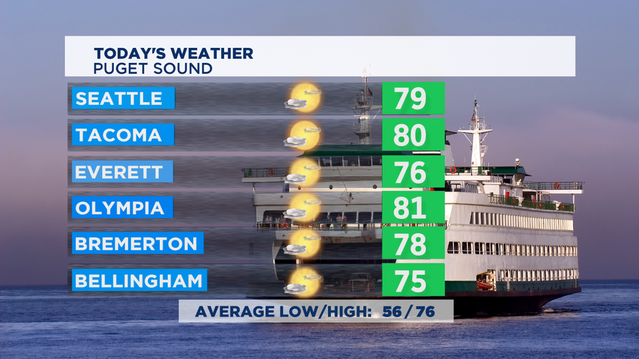
Today we'll be a little bit cooler than yesterday. Cooler marine air overnight brought in some areas of morning clouds and a few foggy spots too. We'll clear out our skies this afternoon sunshine around Puget Sound and get our temps just shy of 80 in most places. The coast will stay mostly cloudy all day with temps near 70. East of the Cascades, lots of hazy sunshine and heat, just not quite as hot as yesterday.
The next weather system pushes in later today with some possible showers for the coast as soon as tonight. Overnight that precipitation will spread inland all the way up to the Cascade crest.
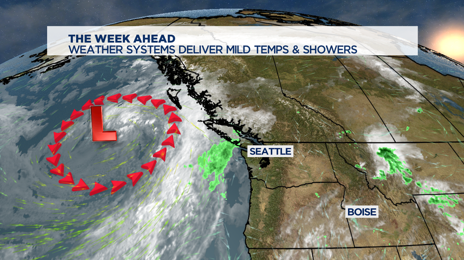
The dip in the jet stream off shore, called a trough, will provide more clouds, milder temps in the upper 60s and low 70s for the Puget Sound lowlands-- and then some rain at times on both Thursday and Friday.
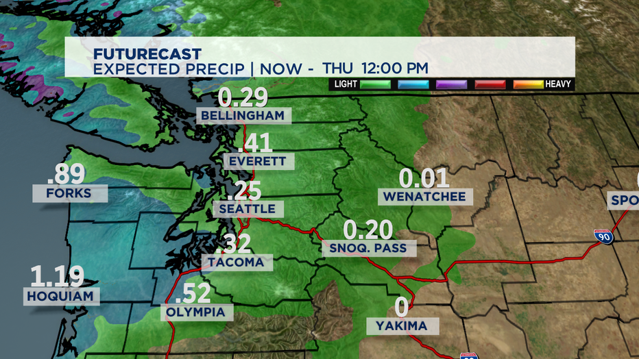
The way the next few systems work their way into Western WA looks like we'll get some soggy conditions for the Thursday AM commute and then a bit of an afternoon break. Based on some of the computer forecast models through noon on Thursday, it looks like the central coat is wettest and the Seattle area will benefit from a rain shadow effect from the Olympic Mountains compared to Everett and Tacoma. Friday looks like the precipitation is more widespread for all of us.
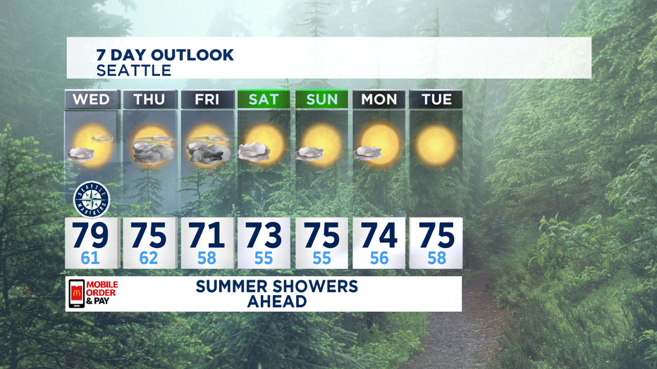
August is our second driest month of the year, so this kind of rainy pattern typically doesn't last too long. We should return to some summer sunshine by Saturday afternoon at the latest. Sunday looks like some full-on summer sunshine with some seasonal temps right near the normal of 76.
-Tim Joyce