

Summer-like weather continues
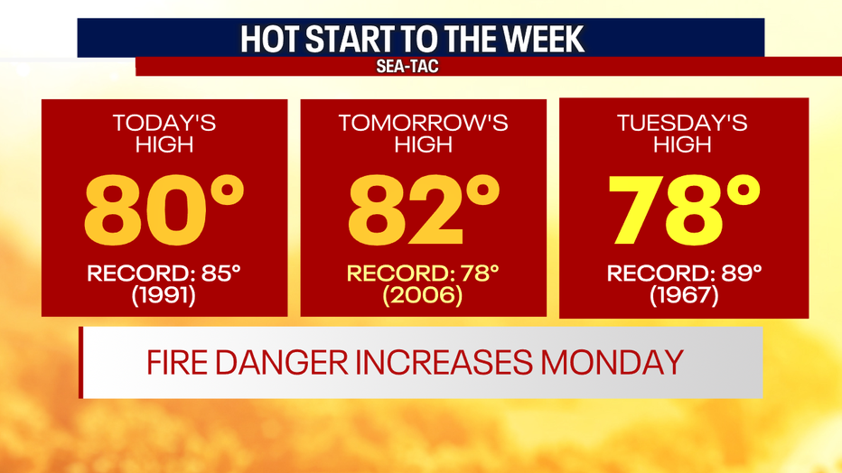
Seattle - Talk about a toast Fall day! High temperatures were well above normal (68F) today as the sun was beating down. They will remain above normal tomorrow, and we could be looking at a new record high!
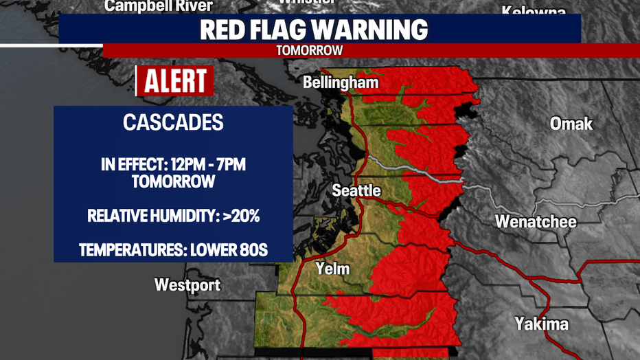
A *Red Flag Warning* will go into effect tomorrow afternoon as the humidity drops and the temperatures rise. The potential for fires will be elevated once again, so it's up to us to be mindful.
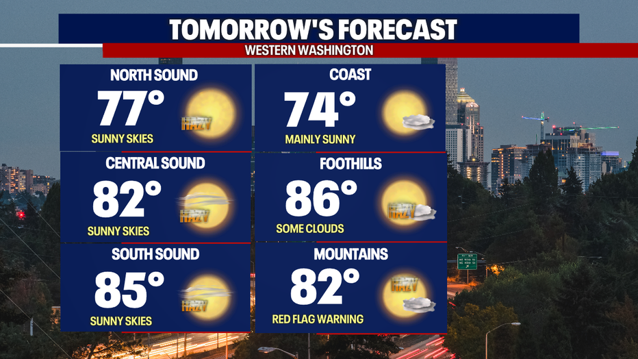
As the heat continues, the haze will once again increase. Our air quality is currently worsening, especially in the Cascades, Foothills and parts of the lowlands (King & Pierce). Expect the hazy sunshine tomorrow along with the heat. Here is a look at your forecast:
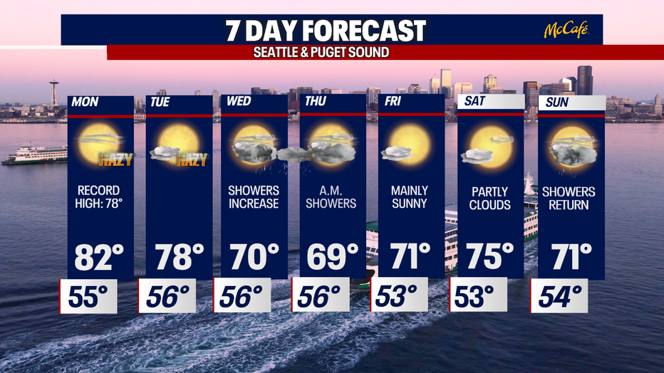
The sunny haze, heat, and fire threat will peak tomorrow, but changes are just around the corner! A new system will increase showers and cool us down. This takes place on Wednesday as our temperatures reflect the change. Showers will happen in waves, and we can expect spotty to scattered showers from Wednesday - Thursday morning.
Have a good one!