

Weather Alert Day: Monday's strong April storm brings mountain snow, flooding, and wind
Brace yourself for active weather Sunday afternoon to Tuesday morning. A strong spring storm is set to bring us lowland rain, mountain snow, wind, thunderstorms and high surf.
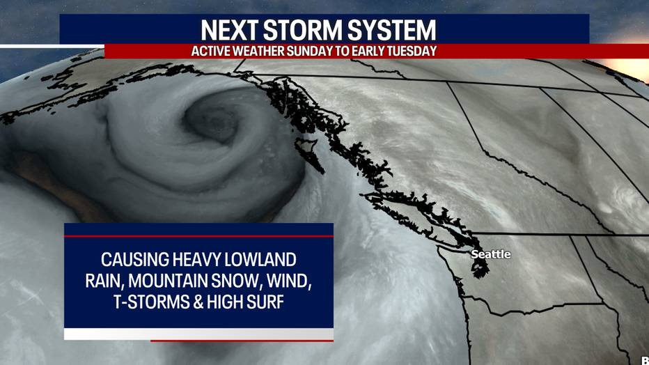
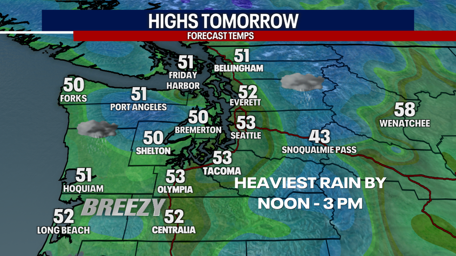
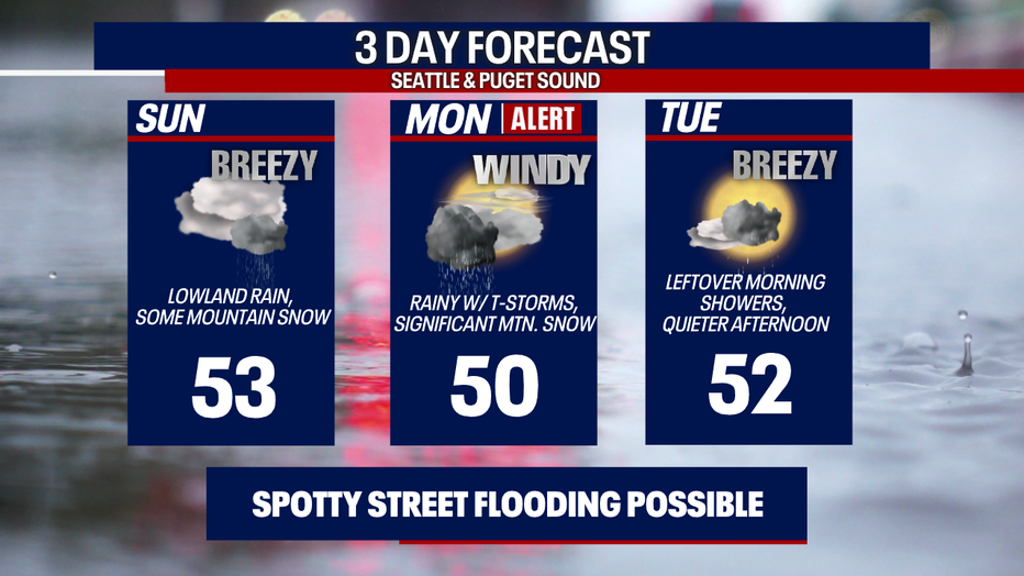
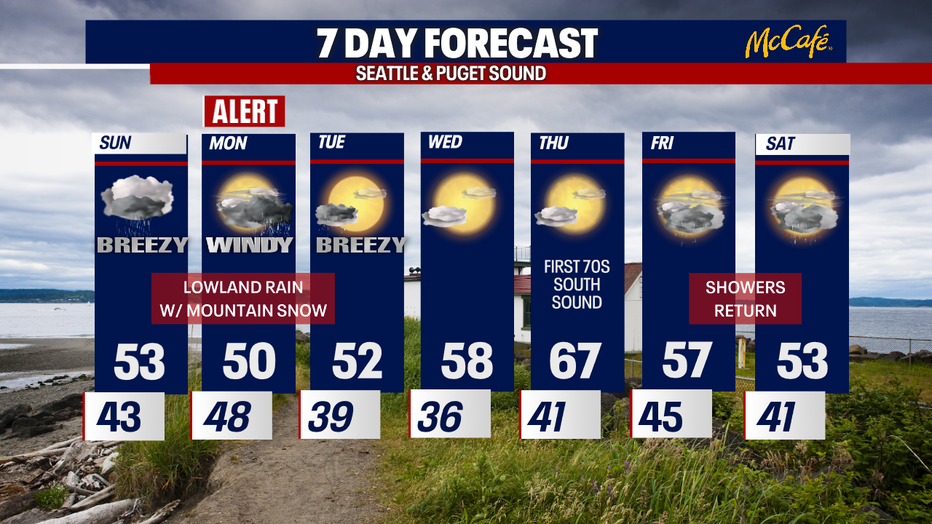
Sunday will feel chilly. We'll start the day with isolated showers, but rain becomes more widespread throughout the afternoon as a warm front sweeps through the region. Gusts Sunday will range from about 20-30 mph. Highs will reach the low 50s. Mountain snow will start falling on Sunday, but the heaviest stuff arrives after midnight Monday; by that time, a cold front will have passed through.
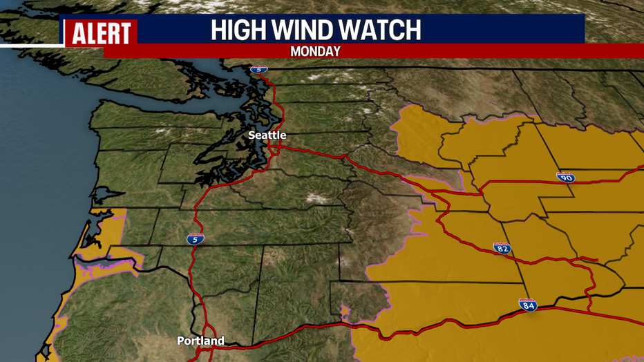
Monday will be windier. I think the North Coast, the San Juans and Western Whatcom/Skagit Counties could see some isolated gusts to 50 mph, but I think gusts to 40-45 mph there will be more common. Elsewhere in Puget Sound, we can't rule out gusts to 40 mph, but 30-35 mph will be the rule for many. With these kinds of winds, there could be some power outages and minor damages. Stay tuned!
Over the South Washington coast and Eastern Washington, winds are expected to be more powerful and destructive Monday. There, a High Wind Watch is in effect.
Drivers, beware: some downpours in the lowlands Sunday and Monday could make the roads super slick. I can't rule out localized, brief street flooding under stronger cells.
A few thunderstorms with small hail could bubble up Monday, too.
Tuesday could still be breezy. The day looks to start off with some showers, but quieter and drier weather is on the way for the afternoon.
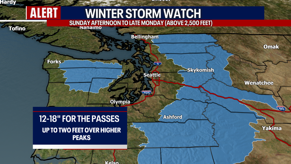
In terms of the mountain snow, between 12-18 inches could fall over Stevens and Snoqualmie Passes. Up to two feet could stack up along White Pass and the higher peaks! There's good reason this Winter Storm Watch is in place. I'm concerned that pass travel could be difficult if not impossible at times Sunday afternoon to late Monday. Avalanche danger will also be high.
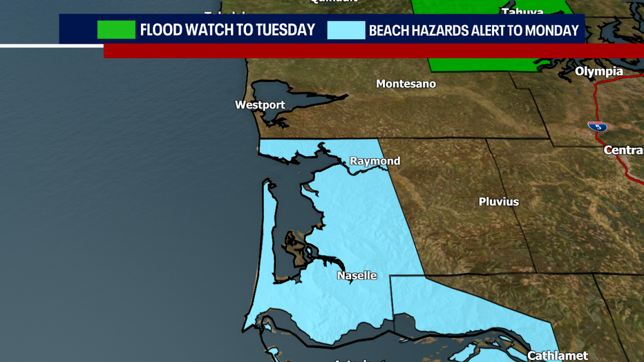
If you live in Mason County, a heads-up: a Flood Watch is posted through Tuesday. Minor to moderate flooding is in the forecast for the Skokomish River. We're also monitoring river levels in King County. While the Snoqualmie River isn't expected to flood, it'll come close.
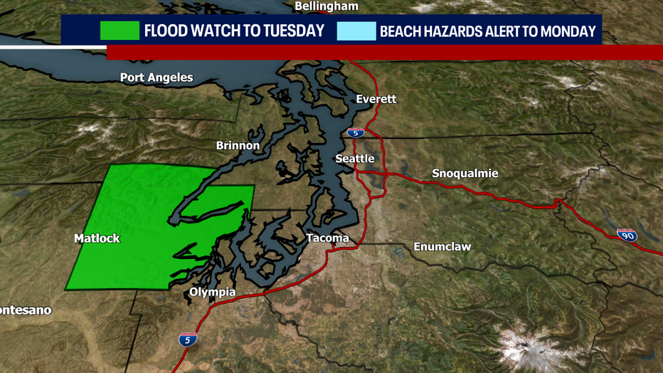
For the Southwest Washington Coast, sneaker waves will create dangerous conditions through Monday afternoon.
The weather calms down by Wednesday. Enjoy partly sunny skies and mild temps! Thursday looks warm and beautiful; highs will start flirting with the 70s!
Hope you catch FOX 13 this weekend.
Warmly,
Meteorologist Abby Acone
Follow me on Twitter @abbyacone, Facebook (Meteorologist Abby Acone), Instagram @abbyaconewx and TikTok @abbyaconetv