

Seattle weather: Stormy today and warm by Tuesday
SEATTLE - For some people, the weather so far this month has felt more like January than June! Soggy weather continues this weekend before clearing by Monday afternoon.
As of noon today, Sea-Tac Airport has seen 0.57" of rain since midnight – this is awfully close to the record for daily rainfall today which stands at 0.63" – this is impressive by June standards.
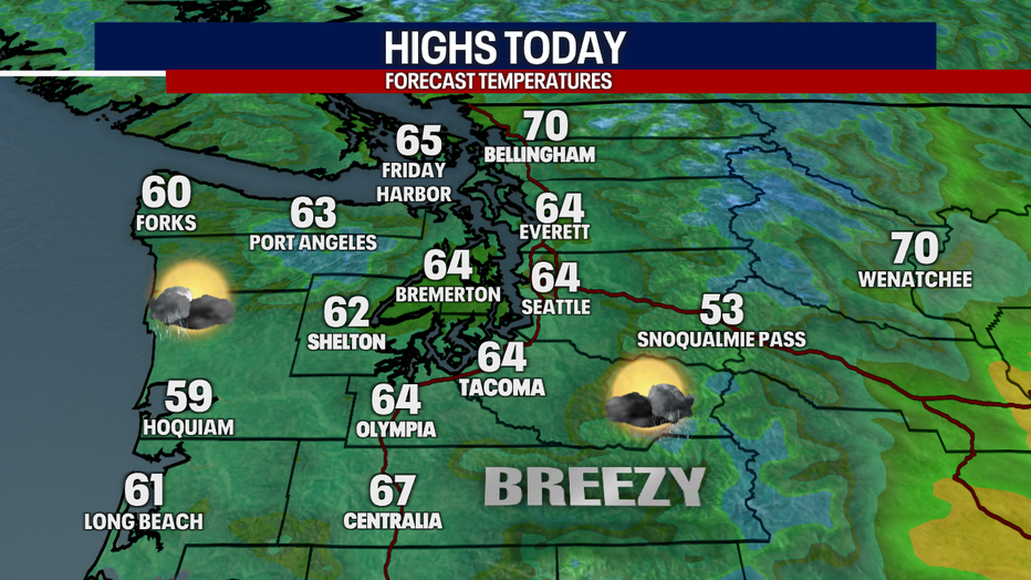
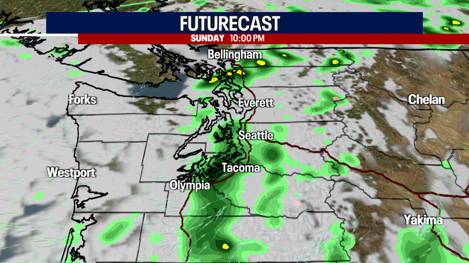
Even though there will be fewer showers today than Saturday night, there's a better possibility for thunderstorms than yesterday. Highs today will only reach the mid 60s. It'll feel muggy, breezy and sticky at times. A few sunbreaks are possible.
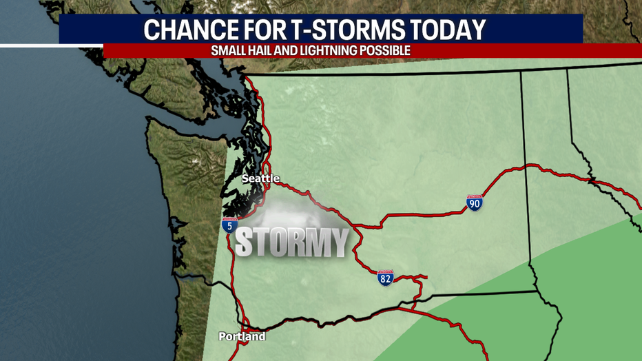
For the far southeastern corner of the state (in darker green on the map below), there's a small chance for severe weather today where large hail is possible. Everyone else in light green has a chance for lightning, small hail and gusty conditions where thunderstorms develop. Flooding could be a concern today for many places in Eastern Washington.
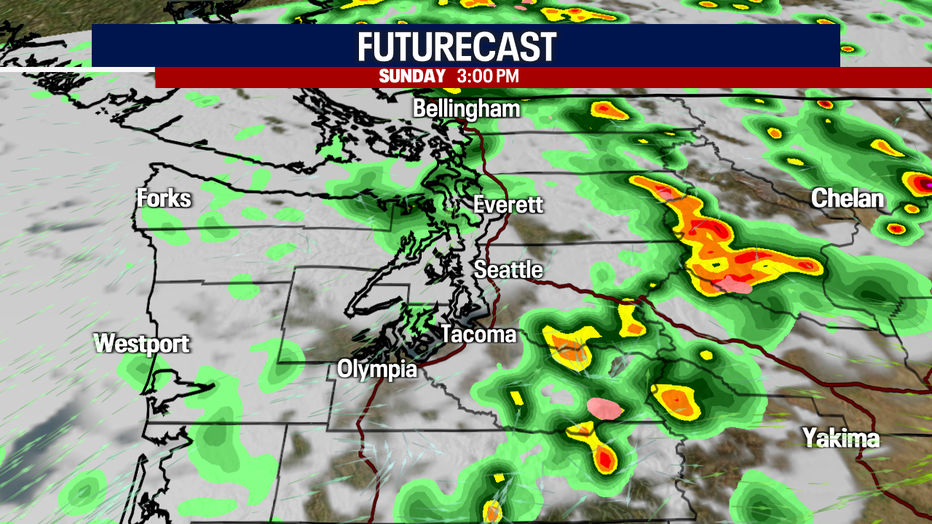
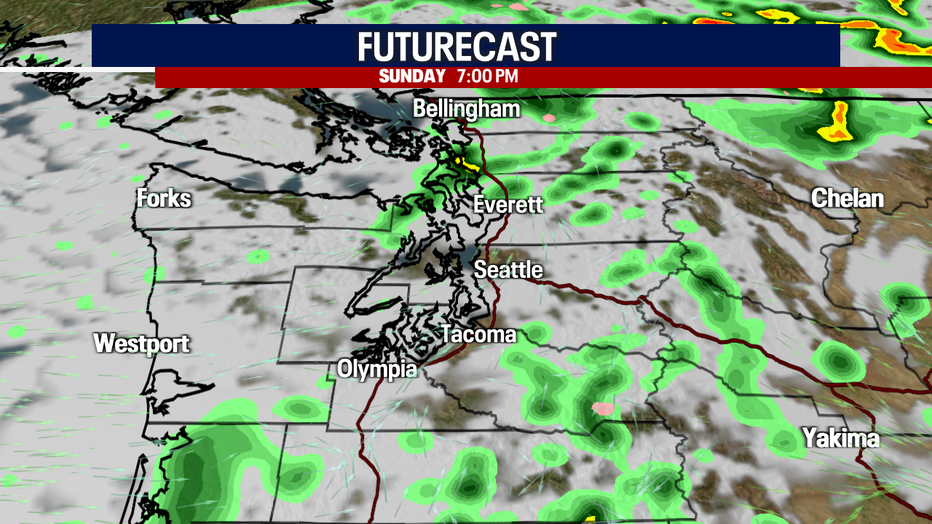
Here's the timing of the showers and storms today:
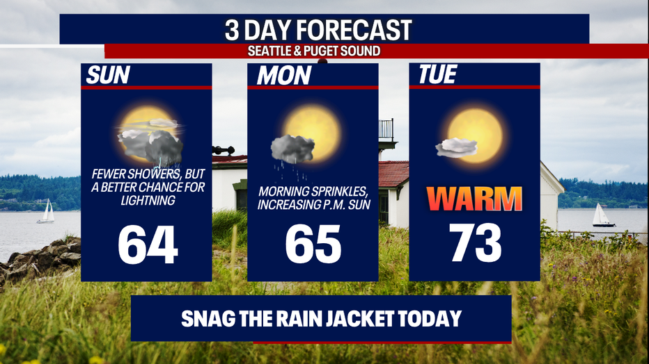
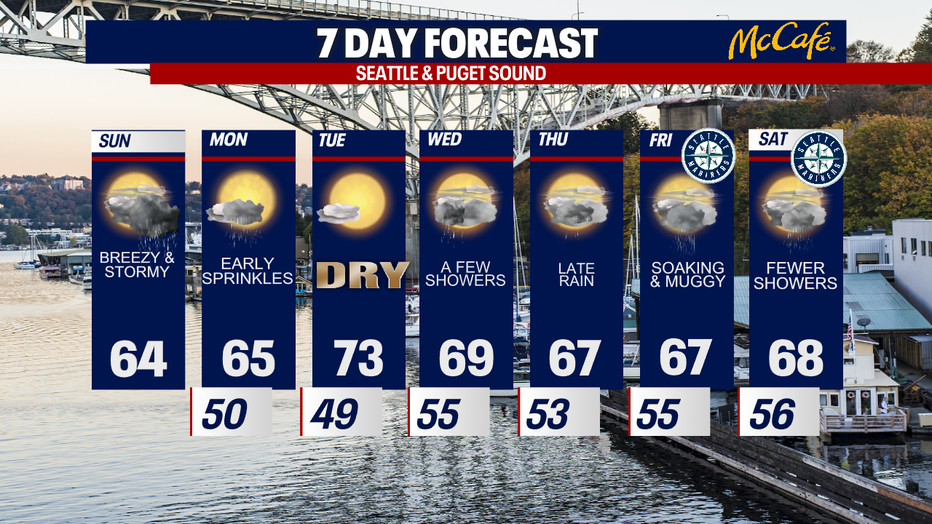
A few sprinkles are expected around the region Monday morning before clearing for afternoon sunshine. Tuesday will be the bright spot in our seven-day forecast: highs could soar into the low to mid 70s! An "atmospheric river" event could arrive by late Thursday into Friday (translation: it could be rather soggy and muggy).
Hope you catch FOX 13 tonight!
Warmly,
Meteorologist Abby Acone
Follow me on Twitter @abbyacone, Instagram @abbyaconewx, TikTok @abbyaconetv and Facebook (Meteorologist Abby Acone)