Staying dry and cool through Saturday
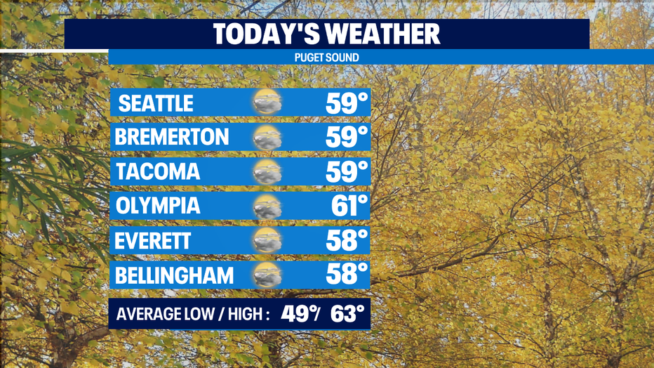
Seattle - Brrrrrr! Western Washington is seeing another chilly morning with temps in the 30s and low 40s to start the day. A weak system will push through this morning bringing showers to the Washington Coast, but just clouds around the Puget Sound area. This afternoon and early evening the sun will peak through the clouds, so don’t forget your sunglasses for the evening commute.
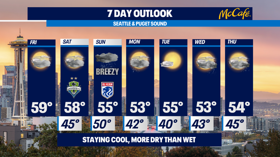
The forecast still looks good for the first half of the weekend. Saturday will be dry, but mostly cloudy. Widespread heavier rain hits late Saturday night and will continue as showers into Sunday. That system will bring a chance for afternoon thunderstorms and breezy wind at times. Lowering snow levels on Sunday could bring a dusting of snow to the Cascades. Leftover showers continue through Monday morning.
If you’re looking for another completely dry day, Tuesday looks to be our best bet!
Today or Saturday would be good days for heading out to the pumpkin patch like this sweet pup, Luni.