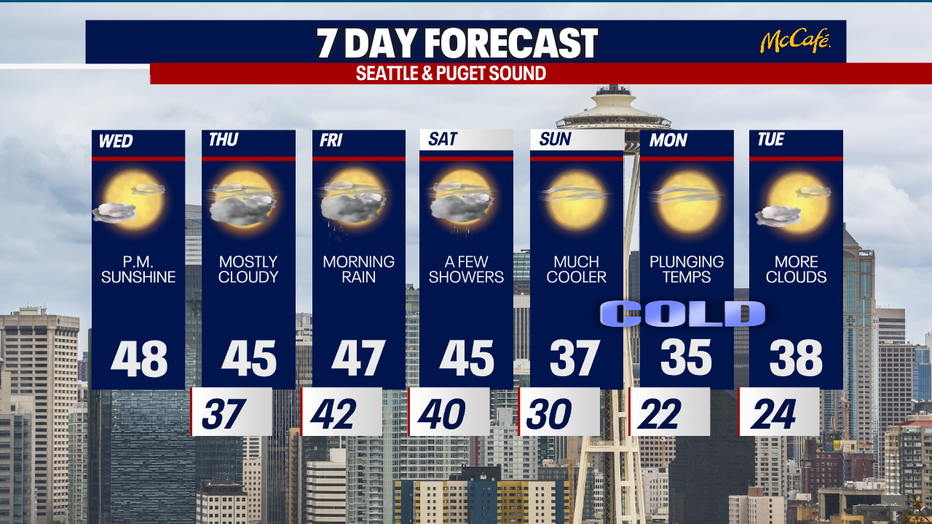
Some sunshine Wednesday, chilly next week
SEATTLE - High pressure offshore will keep the Pacific Northwest mainly dry Wednesday and most of Thursday.
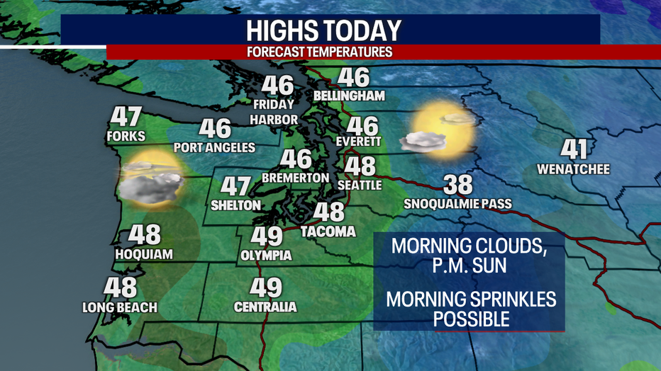
Morning clouds and afternoon sunshine will be the story Wednesday. Temps will stay mild in the mid to upper 40s.
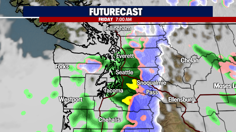
After a mostly cloudy Thursday, the next wet system will hit Thursday night into early Friday morning. This will bring a period of widespread rain showers to Western Washington and snow to the Cascades. Another round of light showers will hit on Saturday.
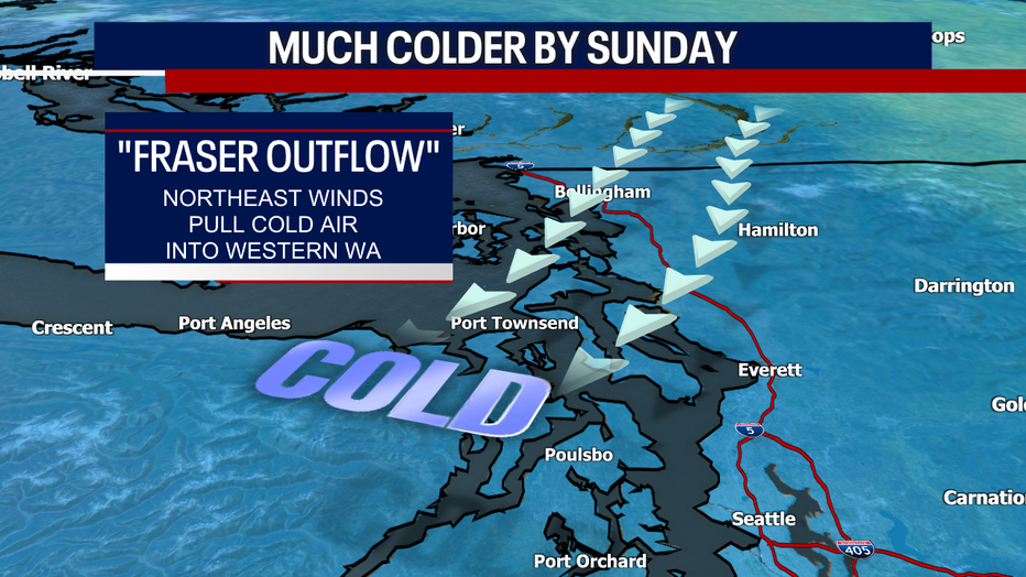
A ridge of high pressure will build over the area on Thursday as a low pressure system strengthens off the Washington and Oregon coast. This setup will allow modified arctic air to push into the Puget Sound area, dropping temperatures into the 20s and 30s and bringing back chilly Fraser Valley outflow winds and Cascade gap winds. Winds could gust 30-40 mph.
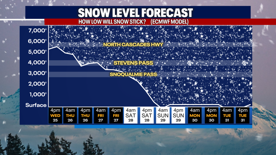
Snow levels will drop on Friday and Saturday to below pass levels. Expect winter driving conditions over the passes both days.
Sunday through Tuesday of next week, we'll see daytime highs in the 30s and overnight lows into the 20s. Snow is not expected for now, but we'll keep an eye on it.