

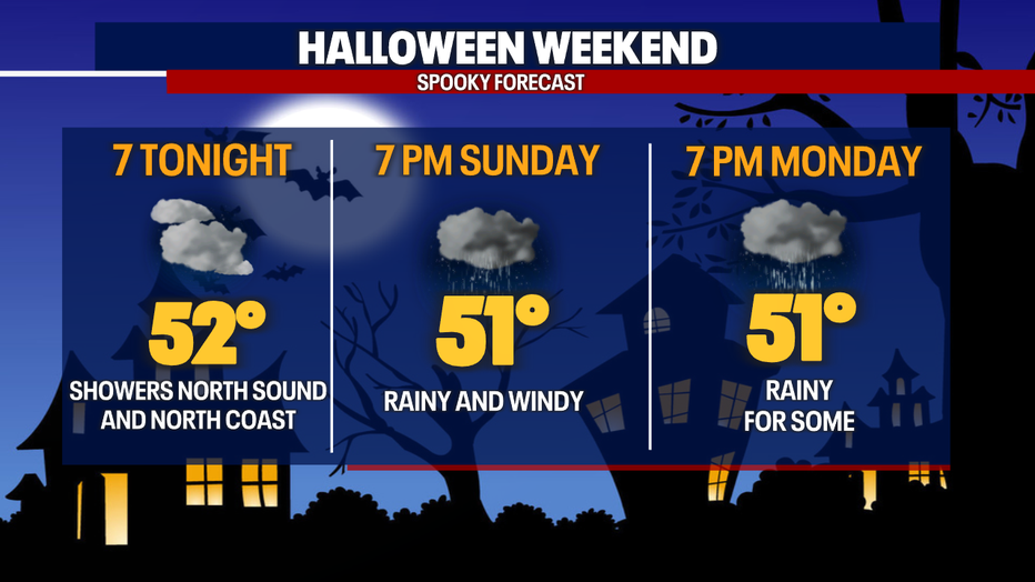
Soggy weather Sunday, fewer showers Halloween night
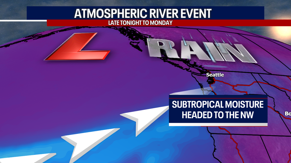
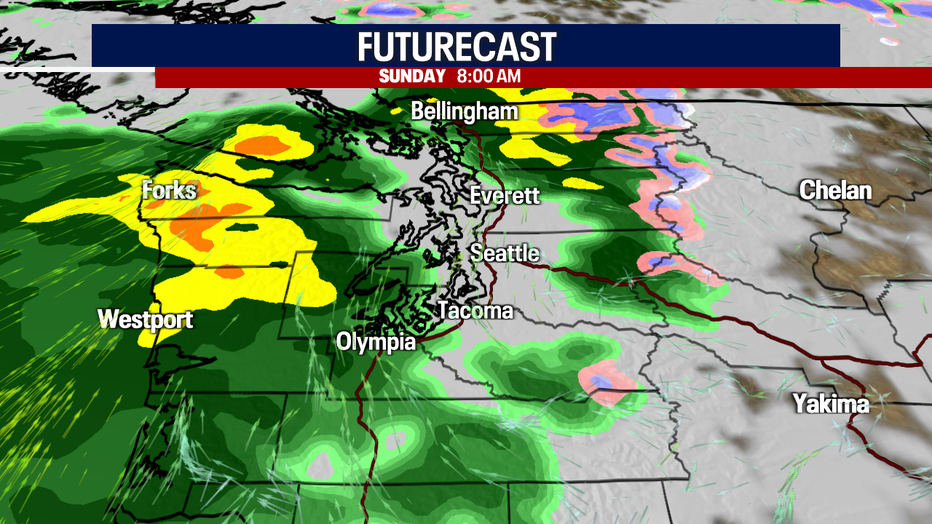
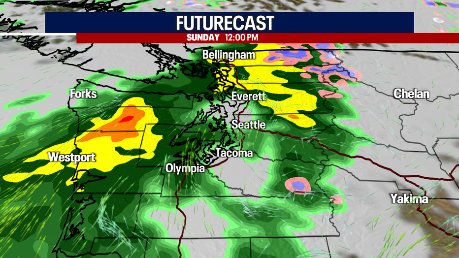
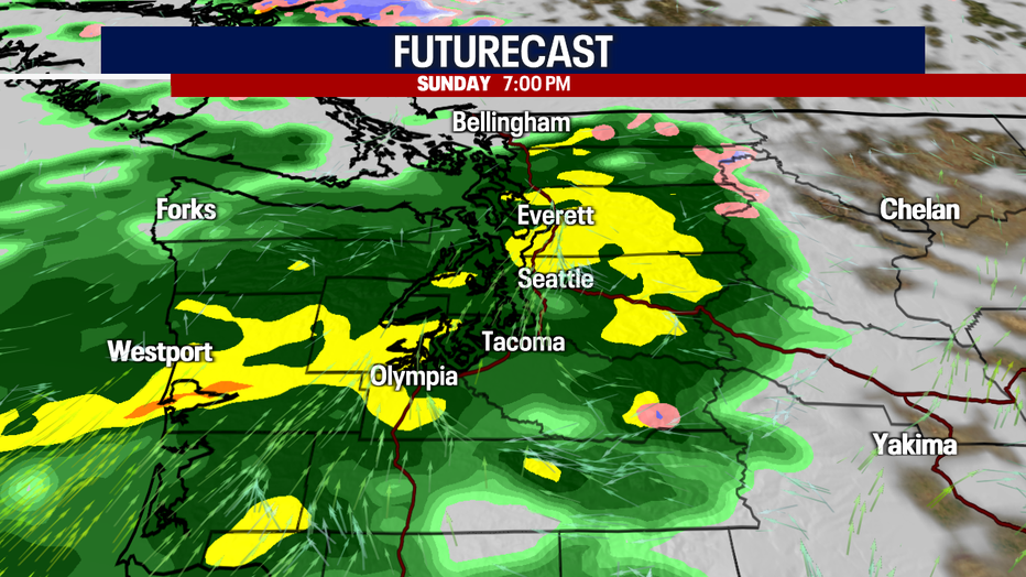
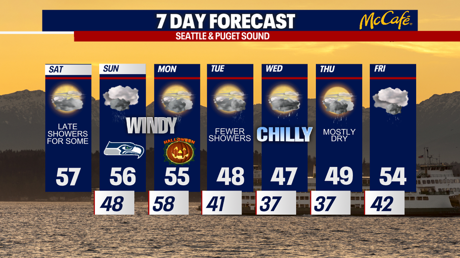
Enjoy the dry weather today while we have it! An "atmospheric river" event is on tap Sunday into Halloween. This means that a corridor of moist, subtropical air in the mid-levels of the atmosphere will dump heavy rain across Western Washington. The latest models are pulling back on shower chances by trick-or-treating, but some neighborhoods will still have rain. Bottom line: stay tuned on the forecast and be ready to dress in warm, waterproof layers for Halloween!
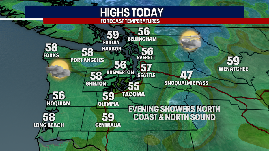
For today, most stay dry. You can expect any fog this morning to lift. Mostly cloudy skies are in the forecast with highs in the mid to upper 50s. There is a slight chance that a little wildfire haze mixed with clouds this morning, but air quality only dropped to "moderate" readings for places like Everett and Seattle. Air quality should be good for everybody later today as westerly winds usher in clean air from the Pacific.
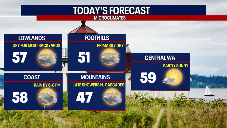
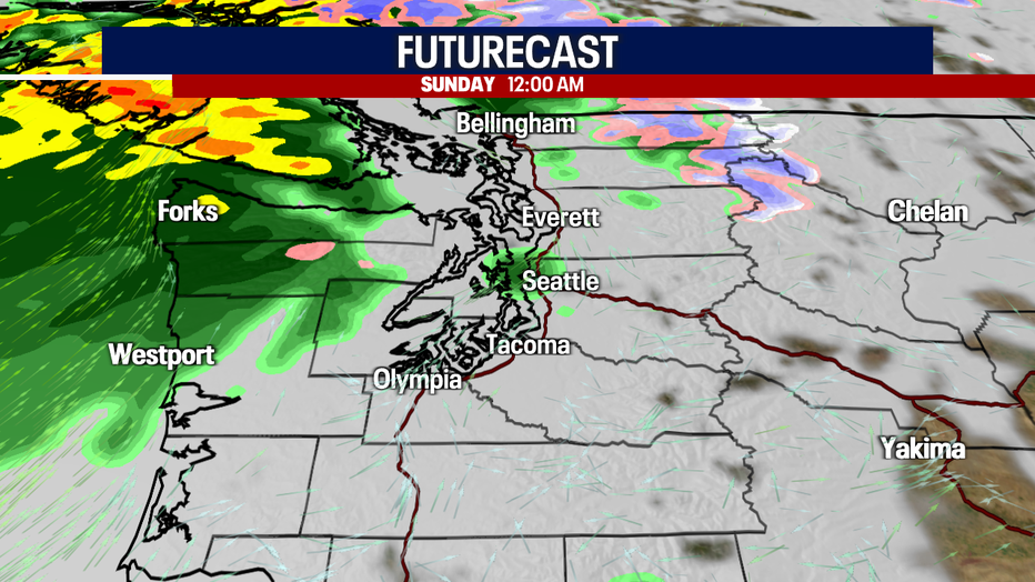
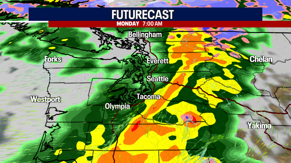
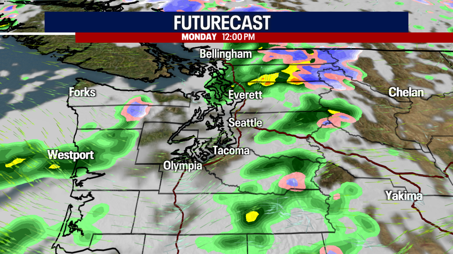
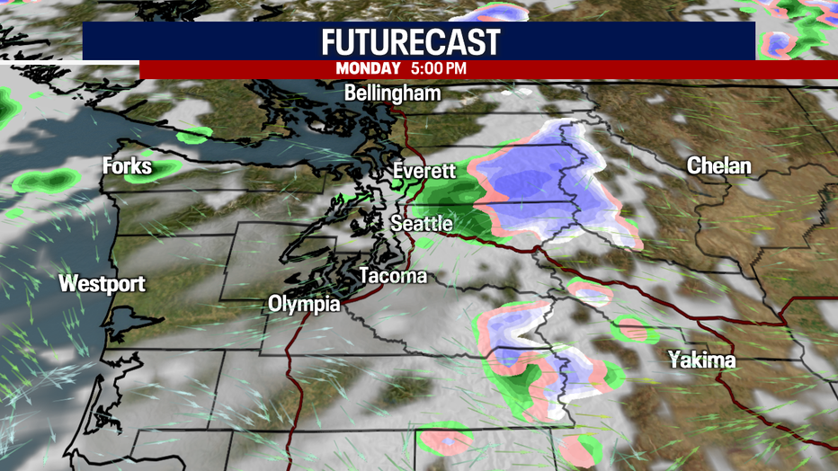
Rain starts knocking on our door later tonight. The North Coast, Strait and North Sound could see showers by six to nine tonight. Rain becomes widespread Sunday. Drenching rain is on the way for the Cascades and the Olympics particularly. With snow levels remaining high, we only expect rain, not snow, over the mountain passes Sunday. Snow levels come crashing down to 2,500 feet by Tuesday morning after a cold front sweeps through the region Monday. Snow could continue over the passes Monday night to Wednesday. Right now, this does not look like a major event for the passes. We will let you know if that changes.
River levels will be rising Sunday, but we're not forecasting river flooding at this time. However, we will need to closely watch conditions over recent burn scars for any debris flows or flooding. Stay tuned as we monitor this carefully.
It will be windy on Sunday. In general, gusts will range between 20-30 mph, but some typical spots could have gusts upwards of 40, max 45 mph. We will let you know if any official wind alerts get posted; none are in effect right now. It will still be breezy for the morning of Halloween, but winds will lighten up in the afternoon and evening.
There could be some rough seas along the coast, up to ten to 15 feet in places, according to the National Weather Service.
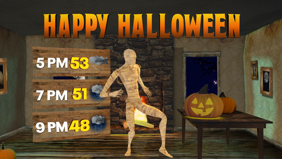
Here is a look at your "evening" forecast for the next three nights. For most in Western Washington, dry weather continues tonight. Rain will be soaking Sunday evening. By Halloween night, showers will be more hit-or-miss. Rain is most likely Halloween night where a convergence zone develops, probably in parts of King, Snohomish and Skagit Counties.
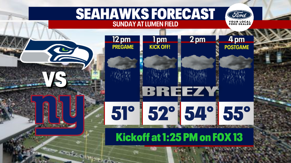
It will be chilly, gusty and rain for the Seahawks tomorrow. If you are going to the game and do not have covered seats, make sure to bring rain pants and a waterproof jacket.
Fewer showers are on the way for Tuesday. Sunbreaks are possible Wednesday along with isolated showers. Thursday will probably wind up mostly dry. Both Wednesday and Thursday mornings look quite chilly. In outlying areas, valleys and the South Sound, temperatures could drop to the freezing mark! On Friday, another front pushes through Western Washington, triggering rain.
Have a fun and safe weekend!
Warmly,
Meteorologist Abby Acone
Follow me on Twitter @abbyacone, Instagram @abbyaconewx, TikTok @abbyaconetv and Facebook (Meteorologist Abby Acone)