

Soggy Saturday with a drier workweek ahead
It is a cozy, soggy Saturday across Western Washington! We are tracking lowland rain and mountain snow today. Drier weather takes hold by Monday.
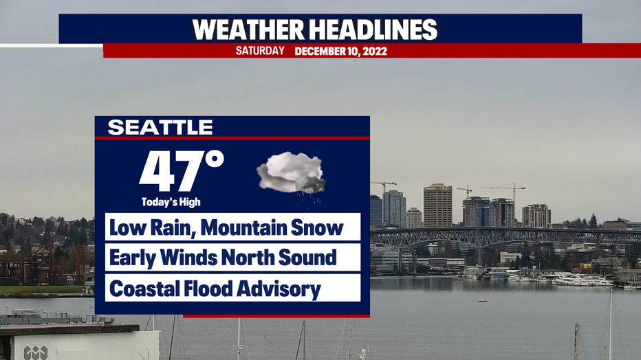
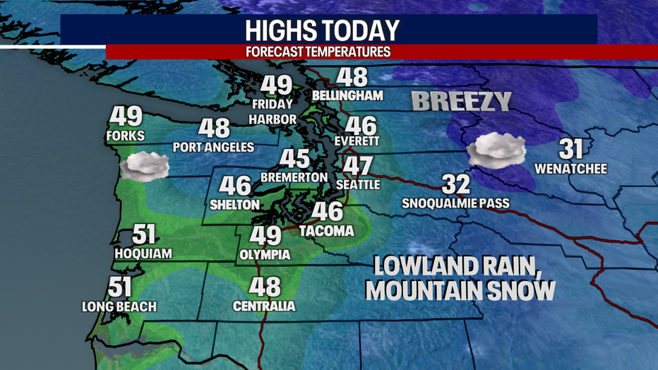
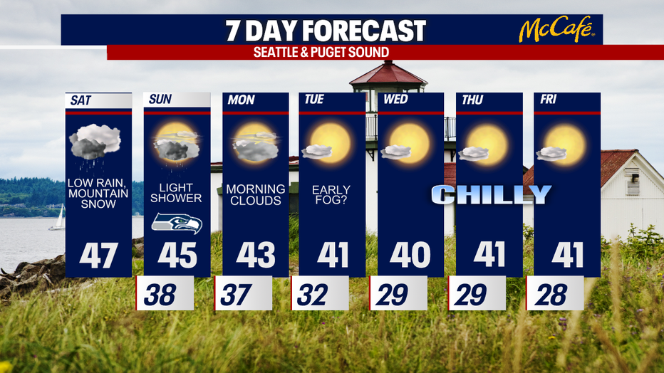
Highs today will stay chilly in the mid to upper 40s. It wll feel even cooler with cloudy skies and scattered rain.
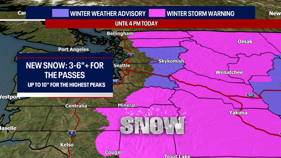
A Winter Weather Advisory and Winter Storm Warning remains in effect for the mountains until 4 p.m. today. There could be an extra two to five (plus) inches of snow over the passes; that is on top of what has fallen so far! This is great news for skiers and snowboards and poor news for pass travelers. Check WSDOT conditions before you drive over the mountains and make sure your car is ready for the conditions.
Early this morning, gusty winds ripped through parts of the Strait, North Sound and inland waters. Winds are gradually easing. Minor tidal overflow was forecast parts of Puget Sound this morning.
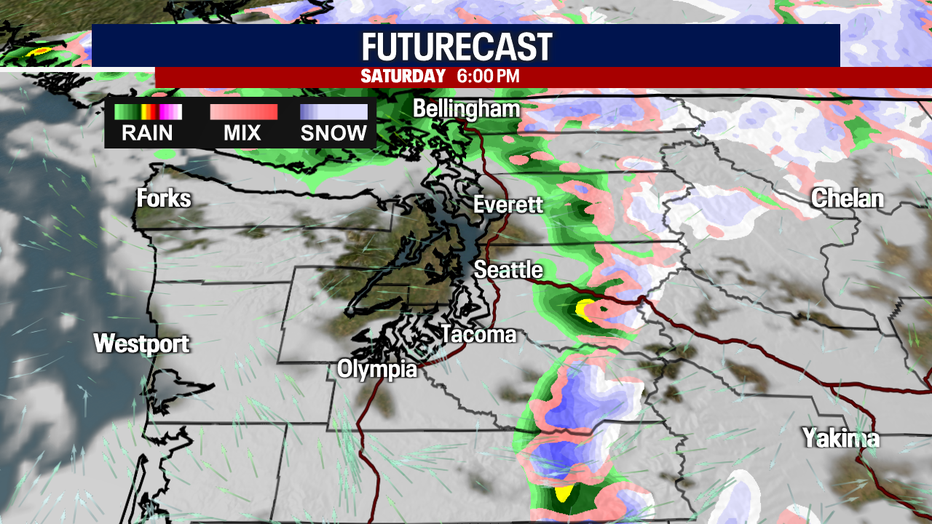
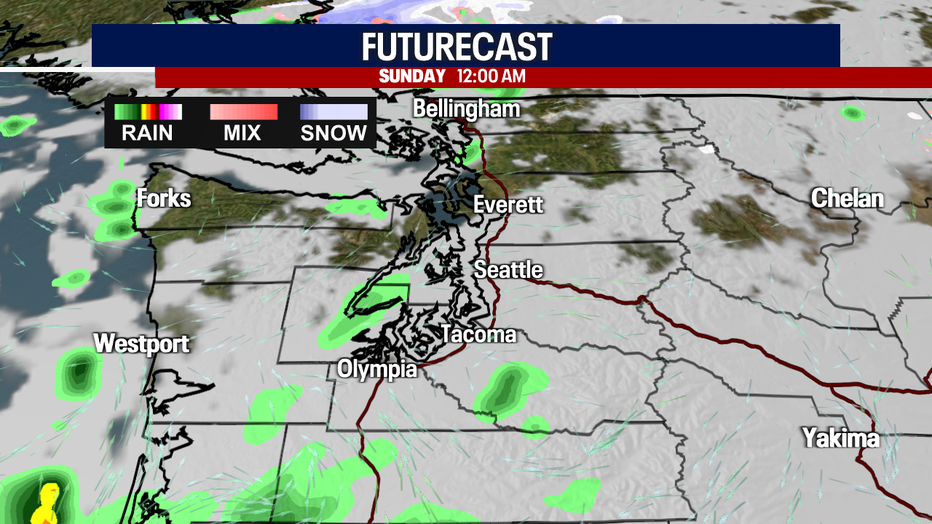
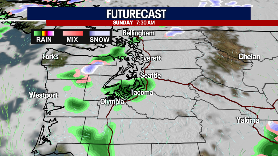
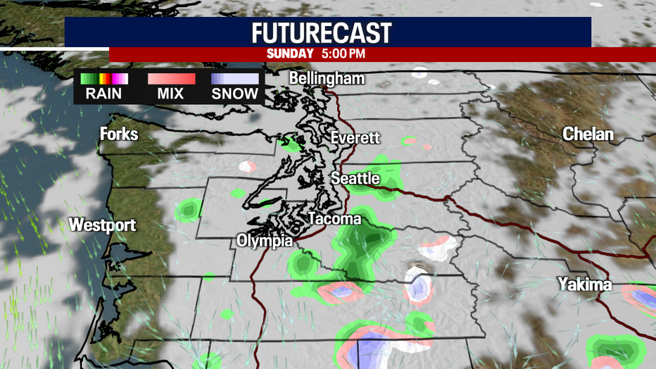
Here is a look at the timing of our showers today and tomorrow. For Sunday, there may be a brief, light passing shower. Otherwise, tomorrow will wind up mostly shower-free.
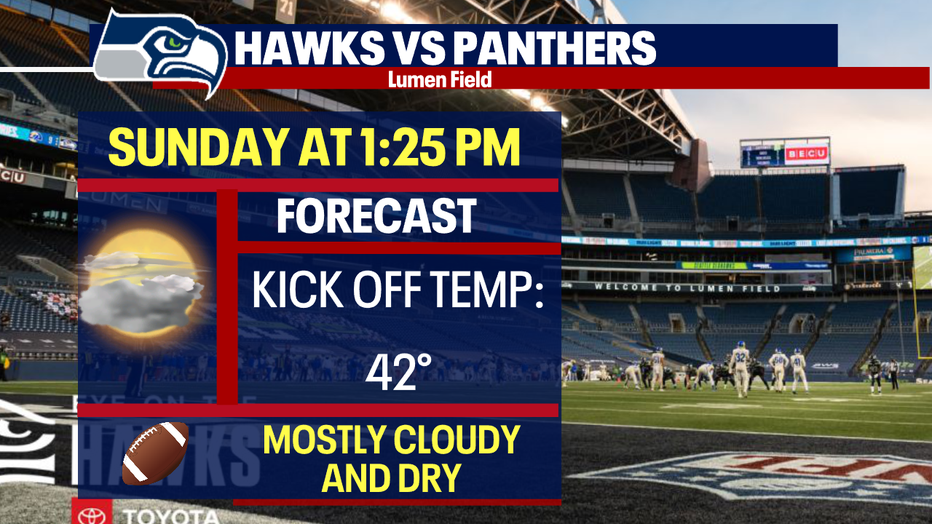
If you are going to the Seahawks game tomorrow, bring a rain jacket in case a light shower pops up. Otherwise, dress in warm layers. It will feel cool!
Monday will start cloudy with afternoon sunbreaks. Enjoy the drier weather! We will have to watch for fog or freezing fog early Tuesday. Throughout the rest of the workweek, we are forecasting frigid overnight lows and below-normal highs. There will be tons of sunshine. Enjoy!
Thanks so much for choosing FOX 13!
Warmly,
Meteorologist Abby Acone
Follow me on Twitter @abbyacone, Instagram @abbyaconewx, TikTok @abbyaconetv and Facebook (Meteorologist Abby Acone)