

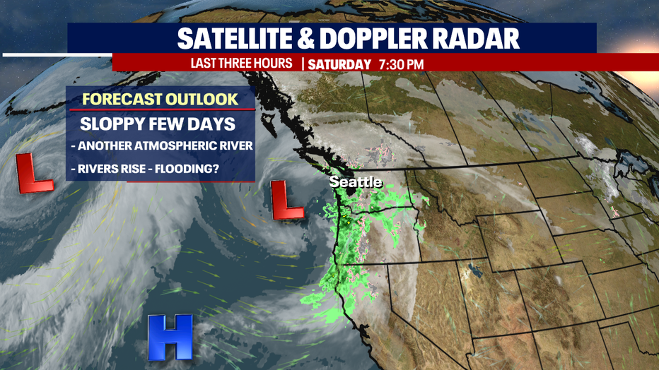
Flood, landslide threat rising with another Northwest atmospheric river
SEATTLE - Sloppy weather will continue through the first part of the work week as a couple of systems, including another atmospheric river, drop heavy rain and mountain snow at times.
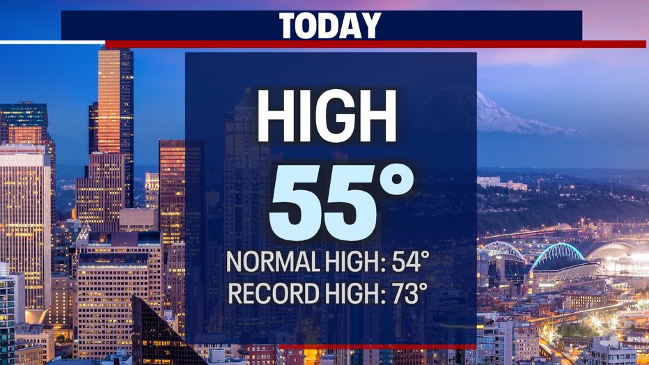
Saturday saw highs warmer than average for many. SeaTac hit 55 while Seattle climbed to 58 at the National Weather Service office off Sandpoint Way.
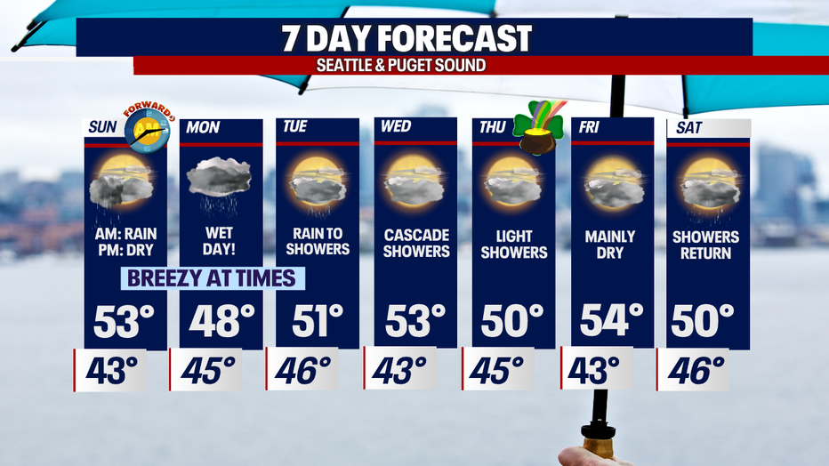
Rain will become heavy at times as system number one continues to spread inland overnight into early Sunday. Winds will become breezy at times too. By midday look for brief drying ahead of an approaching AR.
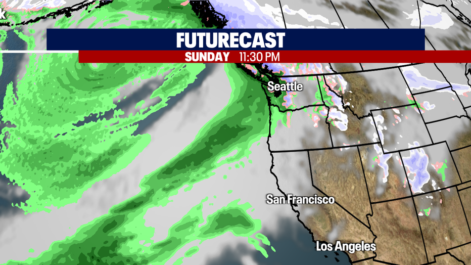
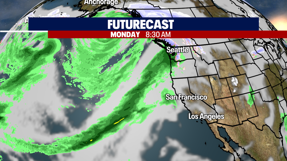
The quick dry break is short-lived as a river in the sky, stretching SW in the Pacific slams the Northwest by late Sunday night. Expect steady rain as this system takes over the region.
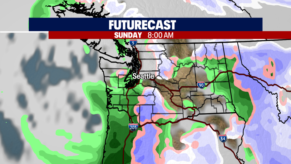
We have become used to this scenario setting up deep in the Pacific and blasting the Northwest Coast. This will cause our morning commute Monday to become very sloppy. Allow for extra time while traveling as water will pond on roadways.
Not only will Seattle see a soggy few days, so will our friends to the south in Portland. As the AR moves inland the bulk of the storm will start to fall to the SE pushing over the WA and OR Cascades before falling apart.
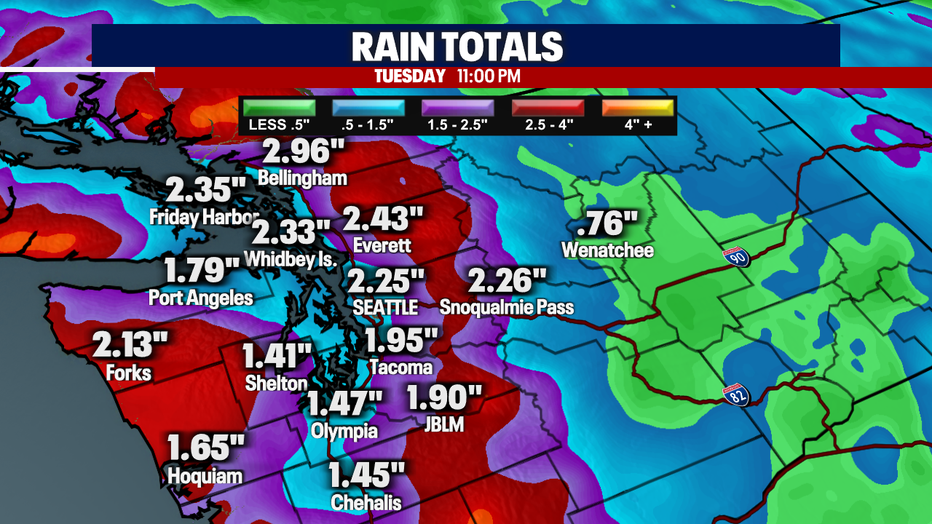
So how much rain will we receive during this rain event? We'll, here are some projected totals across Western WA through Tuesday night. With this much rain falling we're keeping a close eye on several areas for river flooding Sunday–Wednesday. Counties on alert: Mason, Snohomish, King, Pierce, and Lewis.
With soils very saturated the threat of landslides increases this next week too.
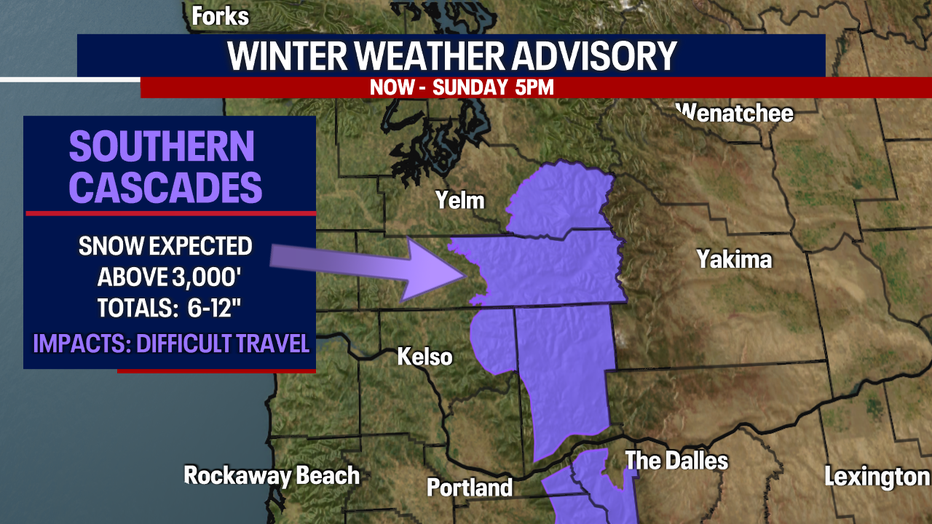
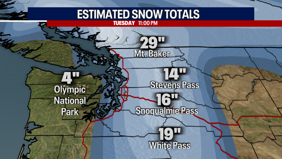
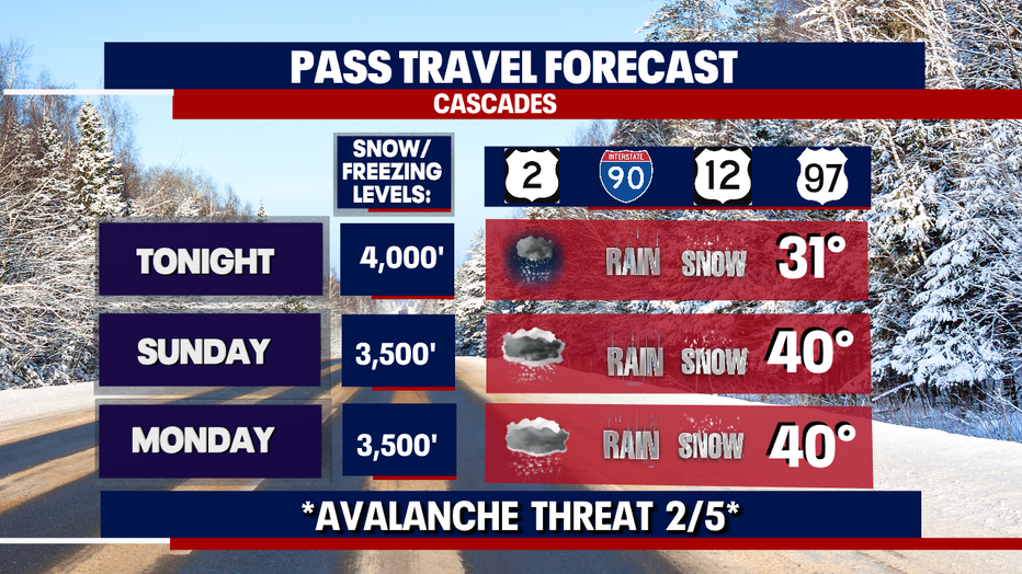
Mountain snow will also be a factor and something to consider when traveling over the mountains Sunday–Tuesday. Right now, we're expecting the bulk of the snow to pile up in the Southern Cascades in Pierce and Lewis counties. This is why a "Winter Weather Advisory" is in effect through Sunday afternoon for half a foot to a foot of snow. Travel will be difficult at times. Make sure to know the roads before you go.
Dryer conditions come our way midweek with a few more systems setting up for the weekend. Highs land in upper 40s to low 50s. Overnights will remain above normal during this time too.
Hopefully we'll see a few more rainbows this week with St. Patrick's Day Thursday!
Have a great rest of the weekend! ~Erin Mayovsky, FOX 13 Forecaster
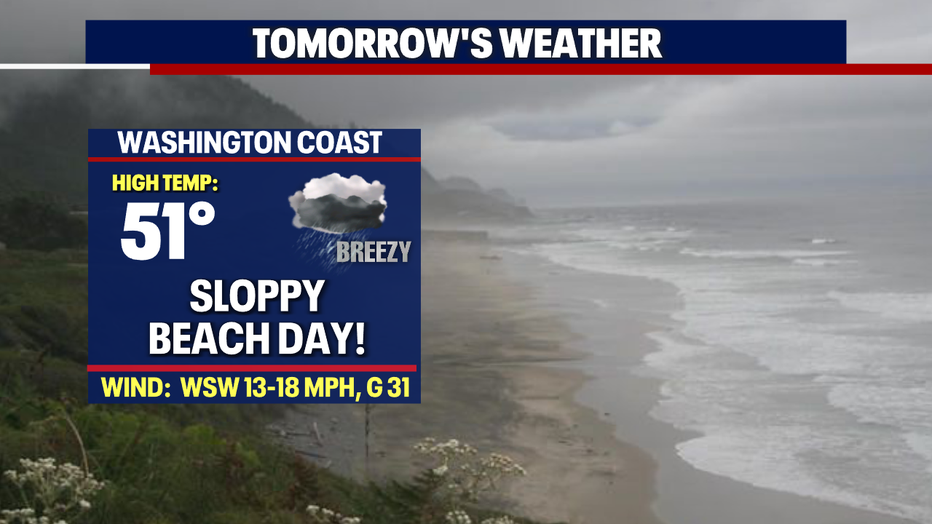
*Beach Forecast
*Mountain Forecast
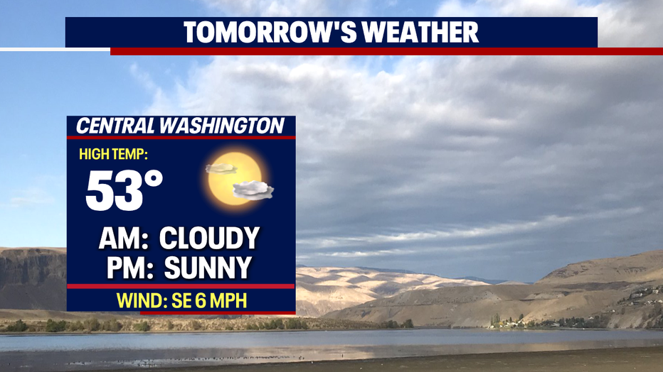
*Central WA Forecast
MORE FROM FOX 13 WEATHER:
DOWNLOAD: FOX 13 Weather and News Apps
WATCH: Forecast and Radar
READ: Closures and Delays
CHECK: Latest Weather Alerts and Live Traffic Map
INTERACT: Submit your Weather Photo
DAILY BRIEF: Sign Up For Our Newsletter
FOLLOW: Lisa Villegas, Erin Mayovsky, Brian MacMillan, Abby Acone and Scott Sistek