

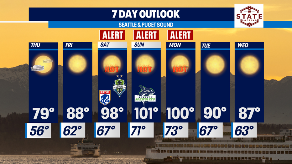
Sizzling summer heat in the PNW this weekend with record breaking temperatures
SEATTLE - Beautiful conditions across Western Washington again today! Highs slightly above normal for SeaTac Wednesday, landing at 75. The average temperature for this time of year is 72 and will jump up a degree tomorrow.
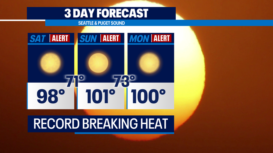
As we roll into the weekend the extreme heat comes our way! Models are forecasting upper 90s to low 100s for Puget Sound--yes triple digits! This is why the Q13 Fox Weather Team is issuing Weather Alert Days for Saturday, Sunday, and extending into Monday.
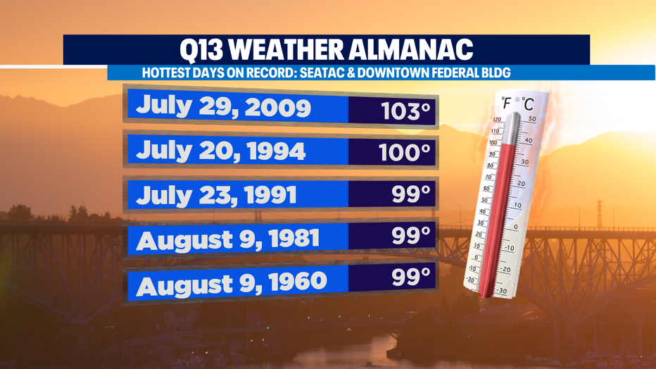
And if you are curious about extreme heat records… here are some of the hottest days on record for SeaTac since 1960! And as far as the hottest temperature we've seen at SeaTac in June is 96! So, hitting 100+ will be a new record for the month!
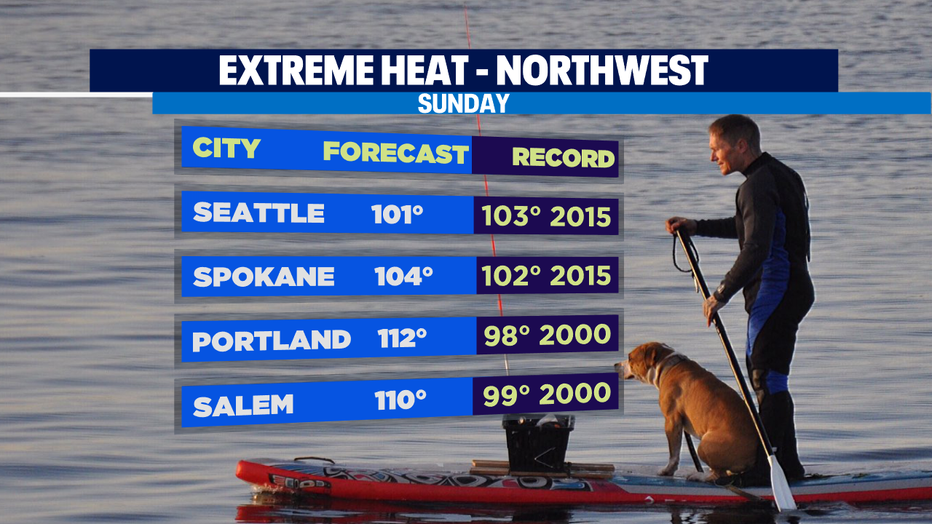
The heat is not limited to Washington, we'll also see records shattered across much of the Northwest. Check out Sunday's forecast for these select cities, including Portland, Oregon!
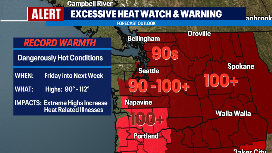
An Excessive Heat Watch and Warning also being issued for Friday through early next week for record-shattering highs in the upper 90s to 100+ across the state.
We finally start to cool down into the low 90s on Tuesday with the upper 80s by Wednesday. Stay cool and don't forget to hydrate!
Have a great night!
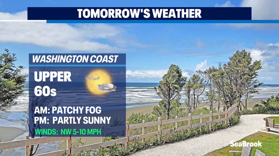
*Beach Forecast
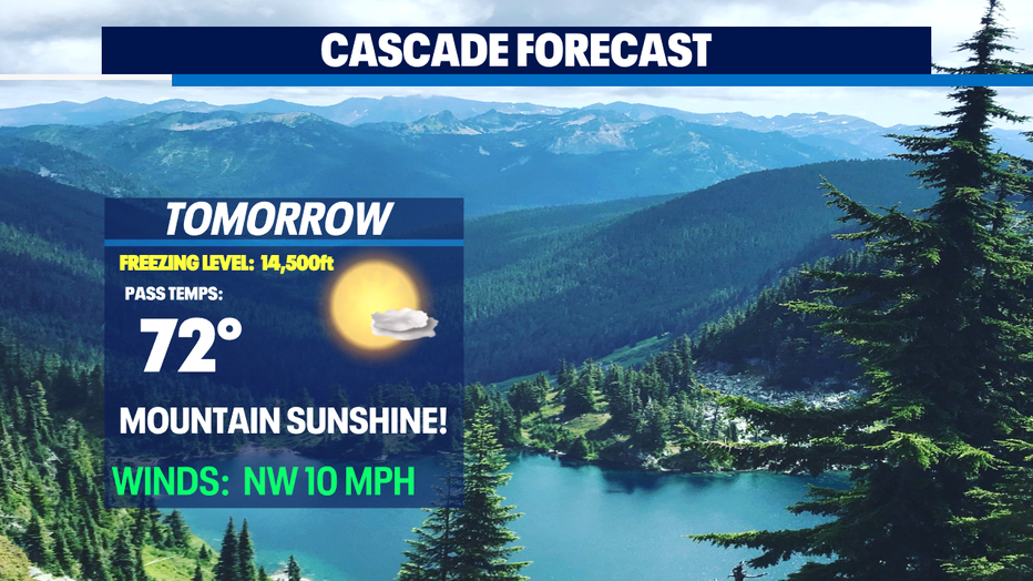
*Mountain Forecast
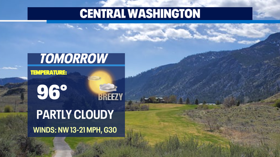
*Eastern WA Forecast
Q13 FOX WEATHER RESOURCES:
DOWNLOAD: Q13 Weather and News Apps
WATCH: Forecast and Radar
READ: Closures and Delays
CHECK: Latest Weather Alerts and Live Traffic Map
INTERACT: Submit your Weather Photo
FOLLOW: Lisa Villegas, MJ McDermott, Tim Joyce, Erin Mayovsky, Grace Lim and Scott Sistek