

Significantly cooler weather, lowland snow possible
Thunderstorms today, mountain snow tonight | FOX 13 Seattle
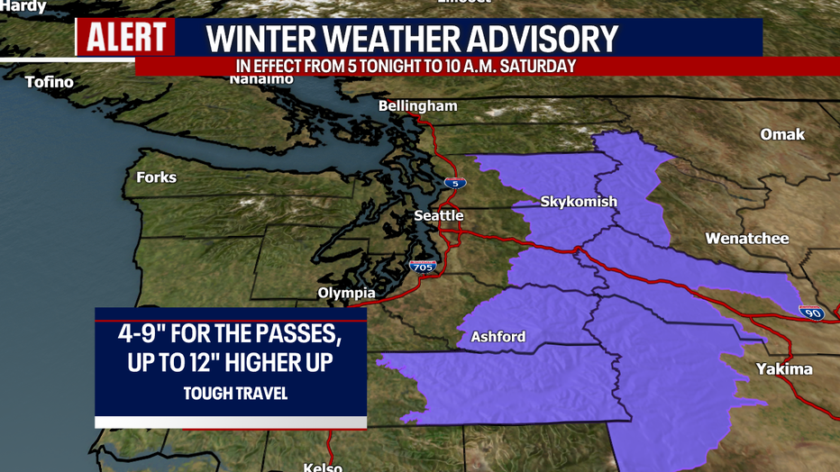
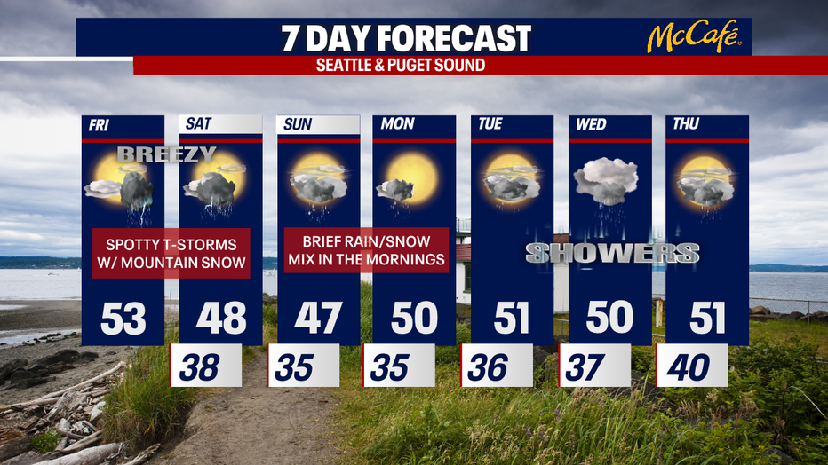
There will be isolated thunderstorms today. Unless something changes, I'm not expecting those storms to be "severe" (meaning: no large hail and damaging winds). Instead, heavy rain, small hail and lightning are possible. Later tonight through early Saturday morning, moderate-to-heavy mountain snow could create problems over the passes.
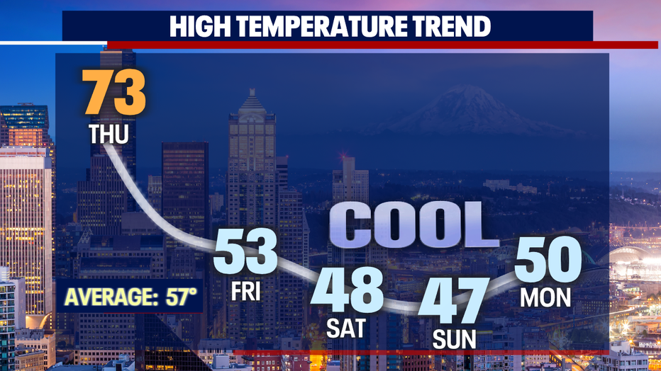
After enjoying a high of 73 in Seattle Thursday, we're tracking significantly cooler weather ahead. Sunday and Monday mornings, there could even be a few spots of lowland flurries. Any snow looks super minor and brief.
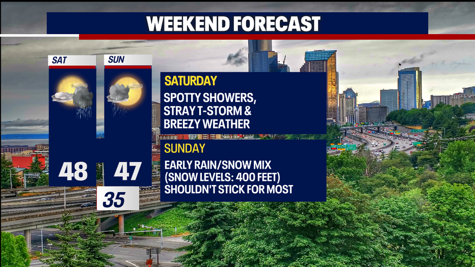
Today and Saturday will be noticeably cooler with partly sunny skies. It'll be breezy both days, and this will make temps feel even chillier.
Garden-variety showers and stray thunderstorms are in the forecast today and tomorrow. Storms aren't expected to be severe. Any isolated thunderstorms today would give us heavy rain, lightning and small hail.
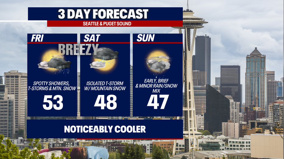
Tonight to early Saturday, moderate-to-heavy mountain snow could create problems over the passes. Right now, I'm forecasting between four and nine inches (or more) over the passes. Check WSDOT conditions before you travel, and if you can - I recommend postponing travel until once the Winter Weather Advisory is over.
Sunday and Monday mornings, there's a small chance for a rain/snow mix in the lowlands. Both days, snow levels should drop to about 400-500 feet if not lower (that includes communities like the Sammamish Plateau, Queen Anne in Seattle, North Bend and Enumclaw). Accumulations are unlikely, but if anything did stick, it would melt quickly.
Next week looks cool and slightly unsettled. Each day will offer at least a small chance for showers.
Hope you have a wonderful weekend!
Warmly,
Meteorologist Abby Acone
Follow me on Twitter @abbyacone, Instagram @abbyaconewx, TikTok @abbyaconetv and Facebook (Meteorologist Abby Acone)