

Seattle weather: Showers turn to heavy rain as we officially kick off spring
SEATTLE - Get ready for more rain, heavy at times as we welcome in Spring 2022!
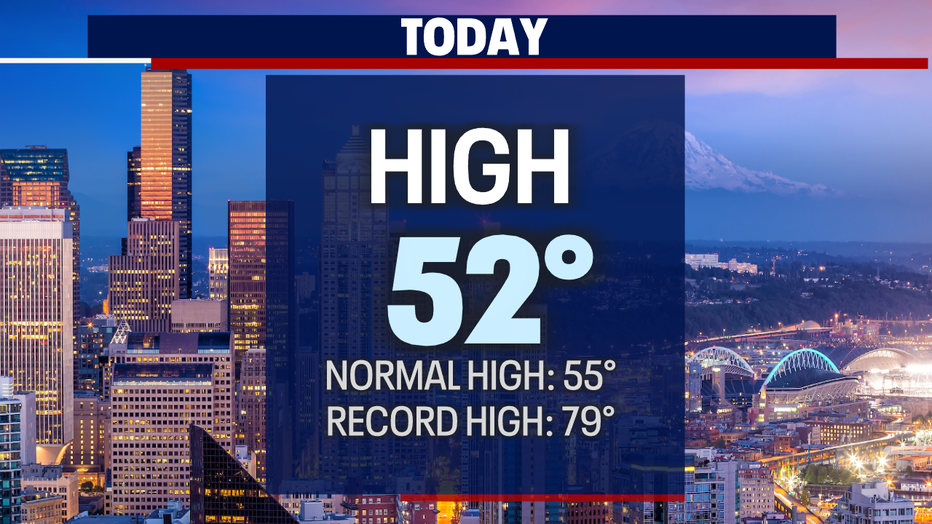
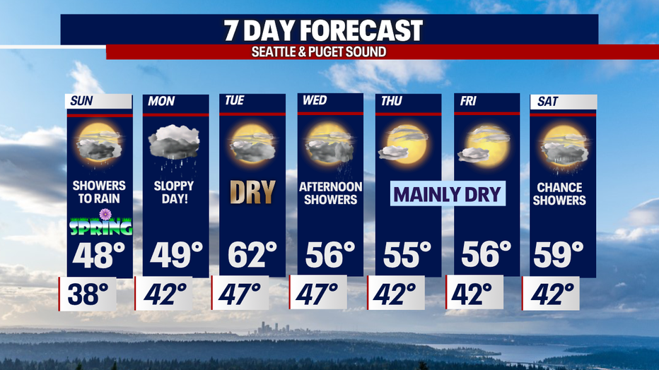
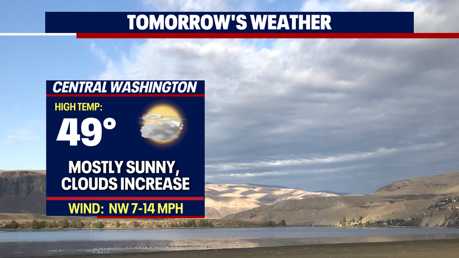
Sunday starts out mainly dry with a few areas seeing spotty showers. Highs will run cooler than average, landing in the upper 40s after hitting 52 Saturday.
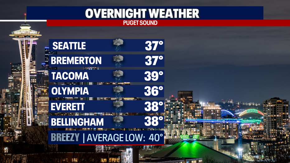
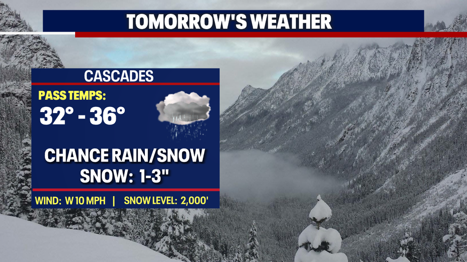
Temperatures will run cool overnight too with lows dipping down into the mid to upper 30s as showers decrease. Most precipitation with fall over the Cascades before wrapping up.
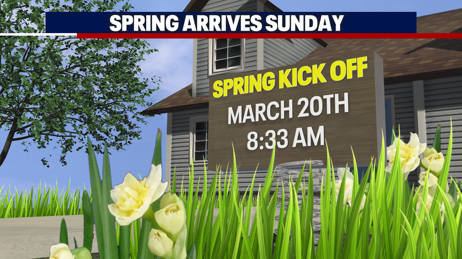
We welcome in Spring officially at 8:33 a.m. tomorrow. Skies look mostly cloudy with a few scattered showers around the region ahead of our next front late Sunday into Monday.
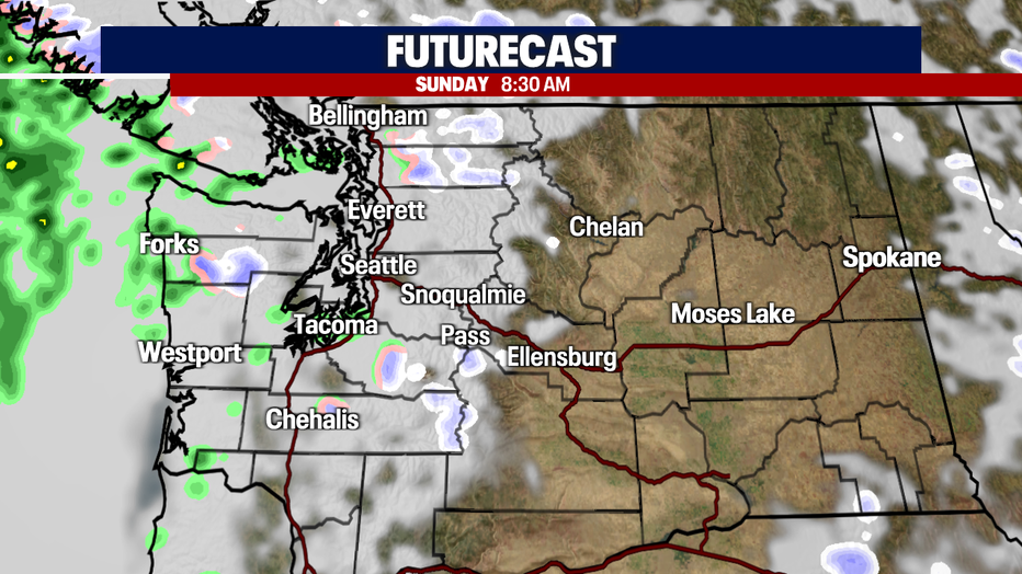
Here's a look at 8:30 a.m. Sunday just as we transition into a new season. Most shower activity sits over the mountains and the coast as the upper atmosphere remains unstable.
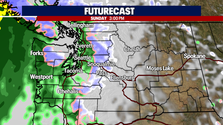
By 3 p.m. Sunday we expect widespread light showers around Puget Sound with the bulk of the system offshore.
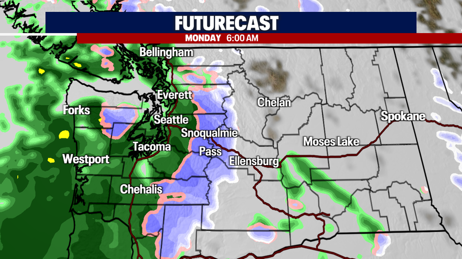
As the system continues to ride inland overnight showers will turn to heavy rain across the lowlands with another round of mountain snow over the Cascades. Expect a soggy start for the Monday morning commute. Allow for extra time as excessive water may create some problems over roadways.
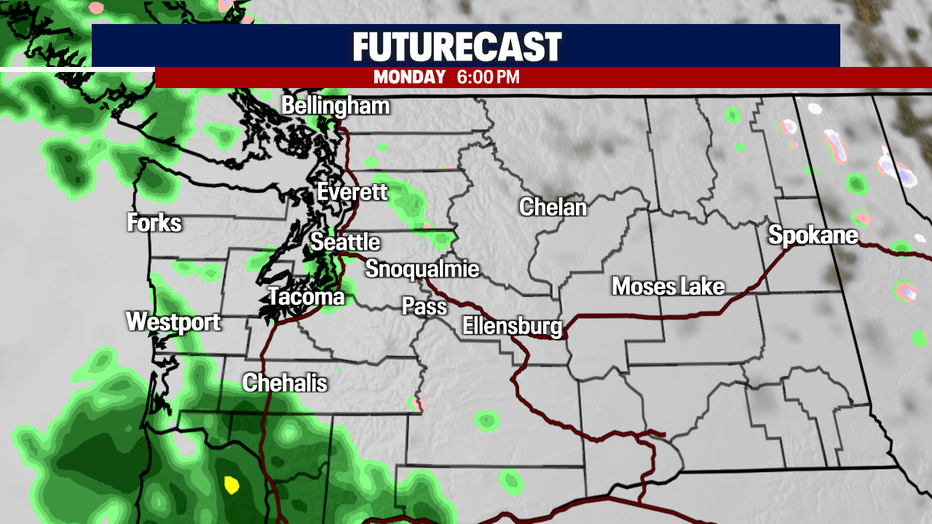
Showers will start to decrease and fall off to the south by our evening commute Monday, leaving us with just pockets of light showers around the region.
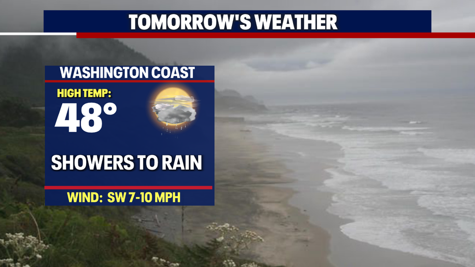
Rain totals Saturday through Monday vary from just under two inches at the NW Coast to 0.35" for Seattle to .62" in Tacoma. Normal rainfall for the month of March is 4.17" and as of Saturday, March 19t at 6 p.m. we have 2.57" in the bucket at SeaTac.
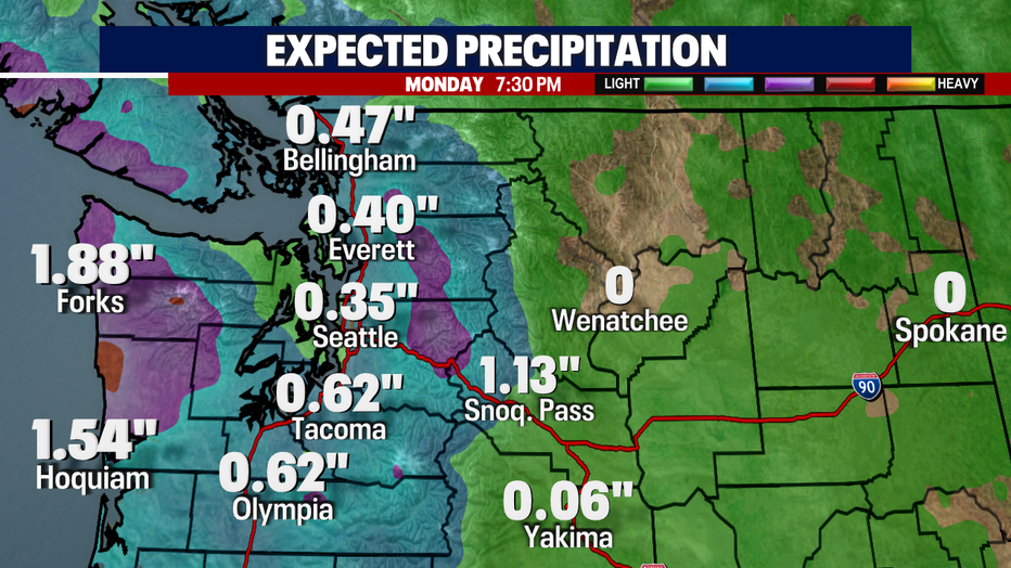
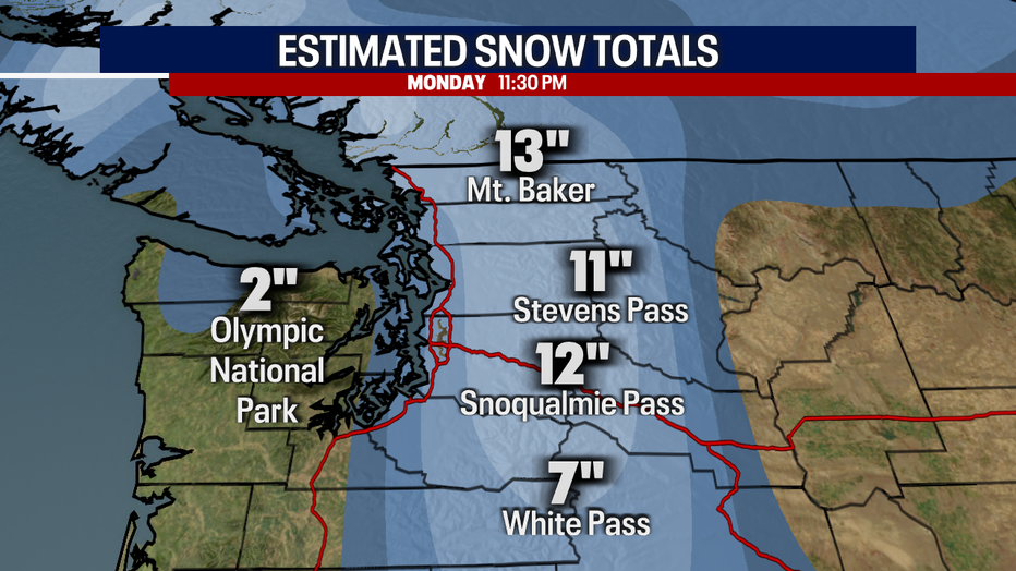
Snow totals through late Monday night over the Cascades range between 7" at White Pass to 13" at Baker. Know the roads before you go!
We rebound Tuesday with plenty of Spring sunshine for Western WA as an upper level ridge builds off the coast. Highs will soar into the upper 50s to low 60s. Our average seasonal high for this time of year is 55 and jumps up to 56 by March 31.
Wednesday features slightly cooler temps with a chance of late showers carrying over into early Thursday, otherwise look for mostly dry conditions through Friday.
Saturday brings the next chance for showers, mainly developing at the coast and north Sound. Highs climb into the upper 50s to near 60s. Enjoy!
Have a great first day of Spring all! ~Erin Mayovsky, FOX 13 Forecaster
*Beach Forecast
*Mountain Forecast
*Central WA Forecast
MORE FROM FOX 13 WEATHER:
DOWNLOAD: FOX 13 Weather and News Apps
WATCH: Forecast and Radar
READ: Closures and Delays
CHECK: Latest Weather Alerts and Live Traffic Map
INTERACT: Submit your Weather Photo
DAILY BRIEF: Sign Up For Our Newsletter
FOLLOW: Lisa Villegas, Erin Mayovsky, Brian MacMillan, Abby Acone and Scott Sistek