

Showers mainly south Wednesday, staying cool
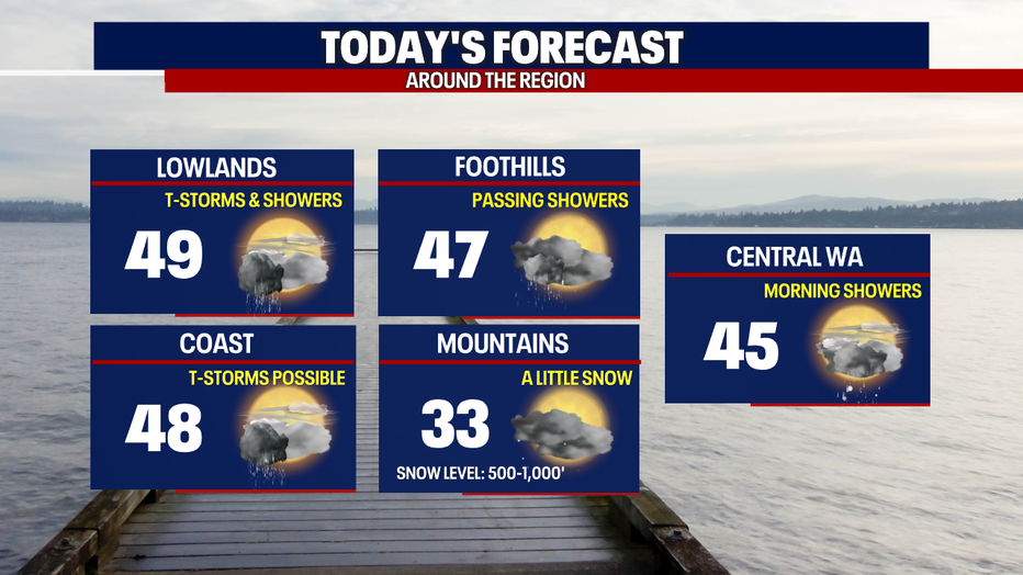
SEATTLE - A low pressure system off the Oregon Coast will continue to spin showers into the south Puget Sound area today, with very cool temps.
It was another winter-like morning in the south Puget Sound area and in the higher elevations of Lewis County. Some spots saw 1-3 inches of snow to start the day. Thurston County had mainly a rain/snow mix. Going forward the rest of the day, the south sound will see more action than the central and north sound. Expect showers on and off with highs only making it into the upper 40s.
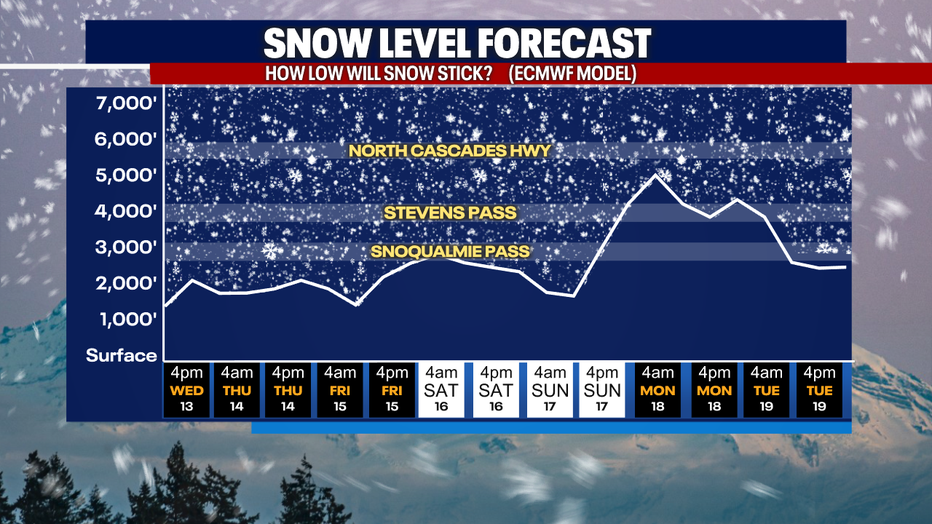
In the mountains, snow levels will stay below the passes through most of next weekend. While I don't see any major snow storms through Sunday, some weak disturbances will bring a few inches to the Cascades, so be prepared for winter driving this week if you're heading over the passes.
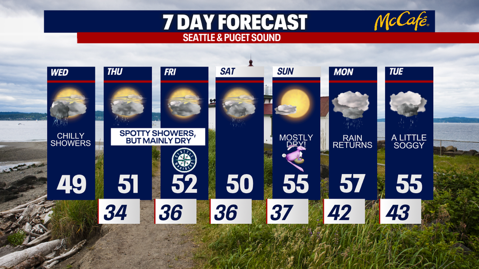
Thursday and Friday look similar to today, but showers will become a lot more spotty and temperatures will slowly warm. If you're heading to the Mariners home opener on Friday night, it should be a great but chilly evening for baseball.
Easter weekend looks more dry than wet with showers on Saturday and sunshine for Sunday. Widespread rain returns late Sunday night.
MORE FROM FOX 13 WEATHER:
DOWNLOAD: FOX 13 Weather and News Apps
WATCH: Forecast and Radar
READ: Closures and Delays
CHECK: Latest Weather Alerts and Live Traffic Map
INTERACT: Submit your Weather Photo
DAILY BRIEF: Sign Up For Our Newsletter
FOLLOW: Lisa Villegas, Erin Mayovsky, Brian MacMillan, Abby Acone and Scott Sistek